27 m away
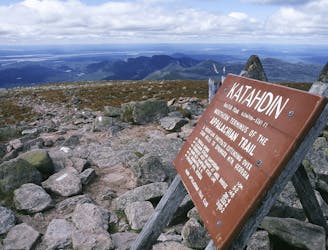
Mount Katahdin Eastern Approach Loop
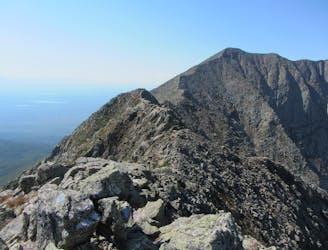
An incredibly challenging and dangerous loop reserved only for the adventurous..
Severe Hiking
- Distance
- 15 km
- Ascent
- 1.2 km
- Descent
- 1.2 km
A loop clockwise from Roaringbrook campground
Hiking Difficult

This is a popular hiking route which is generally considered to be difficult. It's remote, it features high exposure and is typically done between June and October. From a low point of 456 m to the maximum altitude of 1.6 km, the route covers 16 km, 1356 vertical metres of ascent and 1356 vertical metres of descent.
A loop clockwise from Roaringbrook campground
Difficult
Hiking trails where obstacles such as rocks or roots are prevalent. Some obstacles can require care to step over or around. At times, the trail can be worn and eroded. The grade of the trail is generally quite steep, and can often lead to strenuous hiking.

Some trail sections have exposed ledges or steep ascents/descents where falling could cause serious injury.

Away from help but easily accessed.
27 m away
An incredibly challenging and dangerous loop reserved only for the adventurous..
Severe Hiking
9.7 km away
The shortest, most direct route to Mount Katahdin.
Extreme Hiking

58 routes · Hiking

10 routes · Hiking