8 m away
Mount Katahdin Eastern Approach Loop
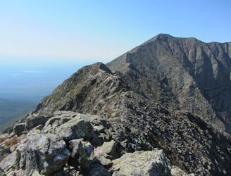
An incredibly challenging and dangerous loop reserved only for the adventurous..
Severe Hiking
- Distance
- 15 km
- Ascent
- 1.2 km
- Descent
- 1.2 km
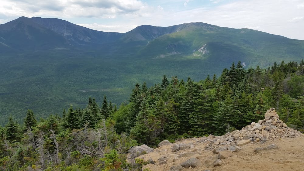
A moderately difficult 3.7 mile RT hike in Baxter State Park in Maine
Hiking Moderate

The trail head for this 3.7 mile RT hike in Baxter State Park is located at the Roaring Brook Campground. The hike begins with a nice walk through the woods with several view points of Sandy Stream Pond, then you pick up elevation as you ascend the mountain. The last part of the hike is boulder scrambling above tree line to reach the peak of South Turner Mountain. Excellent views of the surrounding mountains.
For more info about this hike, please visit my blog: <a href="http://www.ericsturgeon.com/blog/south-turner-mountain-hike-baxter-state-park-maine/">South Turner Mountain Trail Guide - Eric's Maine Life</a>
Moderate
Hiking along trails with some uneven terrain and small hills. Small rocks and roots may be present.

The trail contains some obstacles such as outcroppings and rock which could cause injury.
Away from help but easily accessed.
8 m away
An incredibly challenging and dangerous loop reserved only for the adventurous..
Severe Hiking
9.7 km away
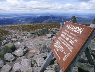
The shortest, most direct route to Mount Katahdin.
Extreme Hiking

58 routes · Hiking

10 routes · Hiking