FATMAP by Strava

Mount Rose Summit

Lake Tahoe

Mount Rose

Strenuous ascent to a big reward atop the highest peak on Lake Tahoe’s Nevada side.

Hiking Difficult

Distance
16 km
Ascent
693 m
Descent
693 m
Duration
4-5 hrs
Low Point
2.7 km
High Point
3.3 km
Gradient
10˚
Mount Rose Summit Map

Mount Rose, at 10,779 feet above sea level, is the highest peak in the Carson Range, the mountains on the east side of Lake Tahoe. It is the second highest peak in the entire Tahoe Basin, after Freel Peak. Despite its imposing height and intimidating slide-path slopes, the ascent of Mount Rose is actually quite accessible to moderately fit hikers, and makes a very popular challenge for locals and visitors alike. The trail follows a less-steep weakness up the mountain’s southwest flank with incredible scenery the whole way.

Description

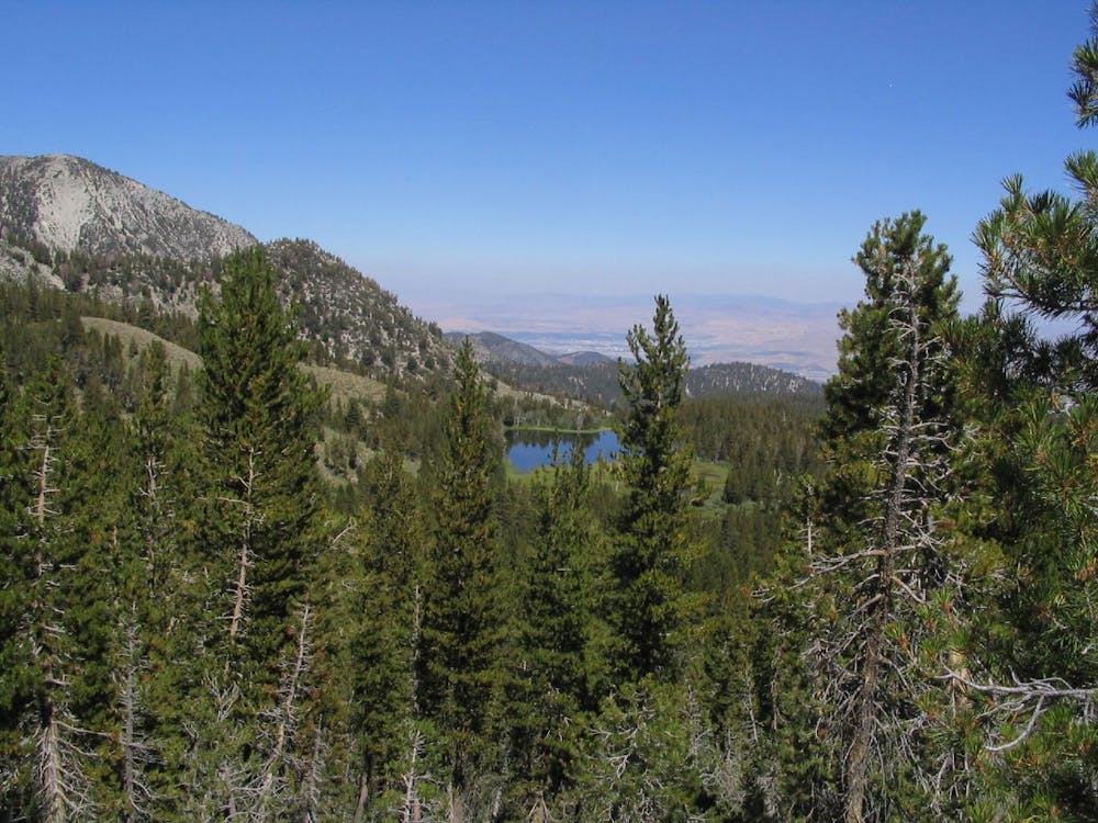
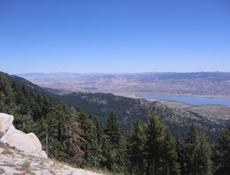
This hike begins at the Mount Rose Summit parking area on NV-431, and starts out on the Tahoe Rim Trail heading west. The first few miles traverse rock-strewn hillside through sunny stands of spruce and fir. Through gaps in the trees, you’ll see Mount Rose looming not so far in the distance.

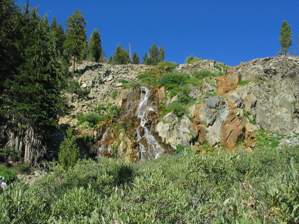
It all gets much more interesting at an intersection where a sign points out the trail to Mount Rose Summit (the actual summit, not the trailhead). Follow this downhill to cross a creek, pause for an excellent view of Galena Creek Falls, then promptly begin the climb up the mountain.

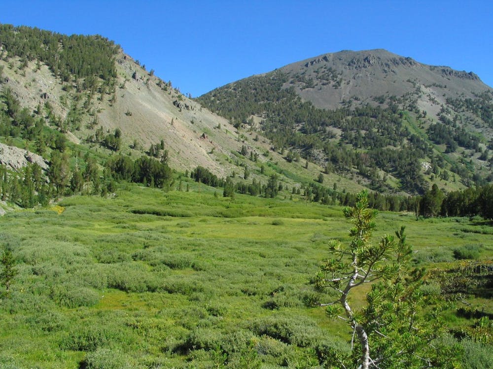
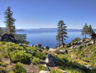
It begins as a mellow ascent through flowery mountainside meadows with an excellent vantage over the valley. The views remain, but the gentle gradient does not, as the trail goes on. Soon it begins a leg-burning ascent along a scree-filled gully, then gains a ridgeline for a brief respite before a set of switchbacks that punch above treeline. This is when the views get truly spectacular, and you gain the summit ridge with views spilling away in all directions.

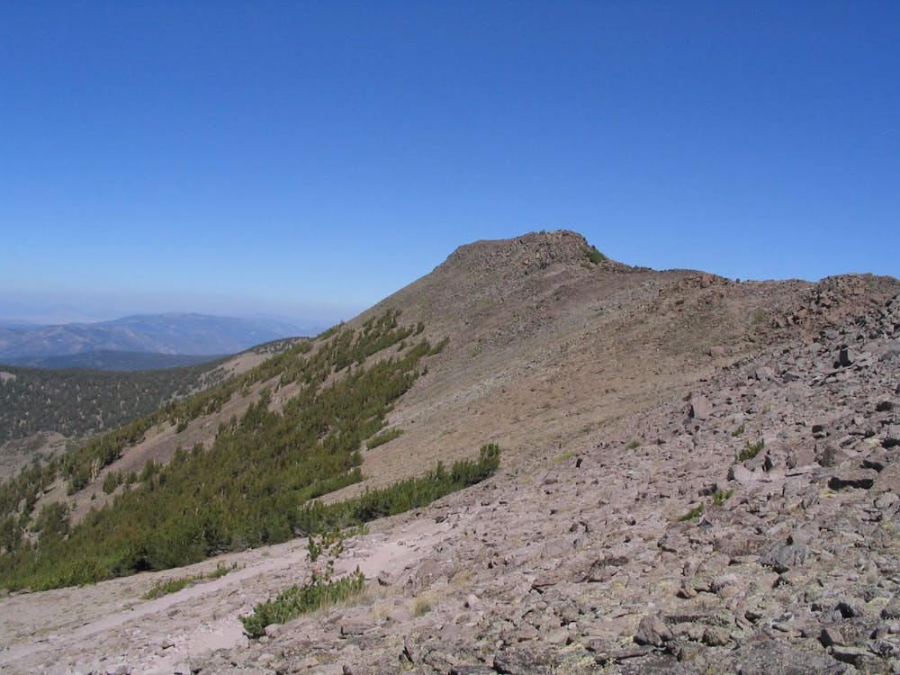
Continue across the exposed ridgeline of broken volcanic rock to the summit, where a stone windbreak stands for good reason. If you’re lucky enough to have a calm day, linger and enjoy your hard-earned command over the Carson Range.

Sources: https://www.fs.usda.gov/recarea/ltbmu/recarea/?recid=11768 https://tahoerimtrail.org/wp-content/uploads/2017/04/MapBrochBStoMtR-TM.pdf https://www.summitpost.org/mount-rose-nevada/150662

Difficulty

Difficult

Hiking trails where obstacles such as rocks or roots are prevalent. Some obstacles can require care to step over or around. At times, the trail can be worn and eroded. The grade of the trail is generally quite steep, and can often lead to strenuous hiking.

Medium Exposure

2 out of 4

The trail contains some obstacles such as outcroppings and rock which could cause injury.

Remoteness

2 out of 4

Away from help but easily accessed.

Best time to visit

between July and September

Features

  • Alpine
  • Wildlife
  • Picturesque
  • Summit Hike
  • Dog friendly
  • Wild flowers
  • Water features
  • Forestry or heavy vegetation

Similar routes nearby

Guidebooks in this area