23 m away
Taos Vortex Ride
If you're looking for a beat down without even leaving the foothills of Taos, look no further than the so-called Taos Vortex Ride.
Severe Mountain Biking
- Distance
- 24 km
- Ascent
- 678 m
- Descent
- 678 m
A steep, technical test piece of a trail.
Mountain Biking Severe

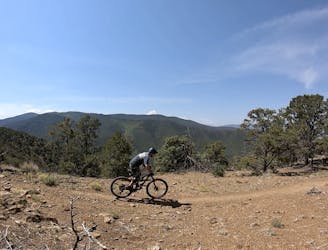
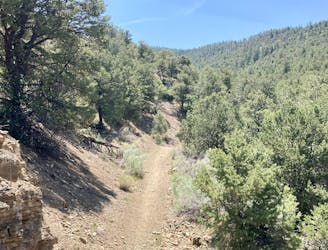
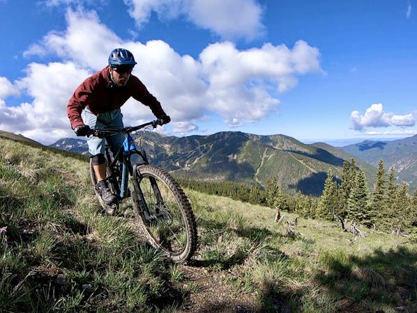
The Devisadero Peak Loop is a technical test piece of a trail. This short but steep loop ride begins from the ever-popular El Nogal Trailhead and heads straight up the Devisadero trail. After ascending the short stem of this lollipop loop, the recommended direction of travel for mountain bikes is clockwise.
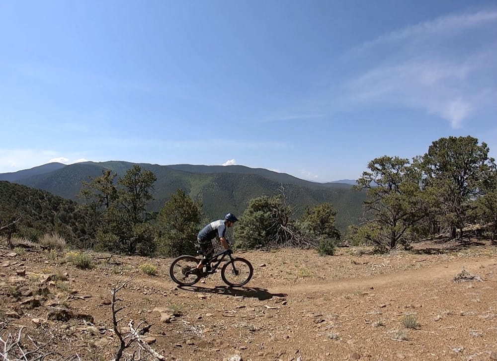
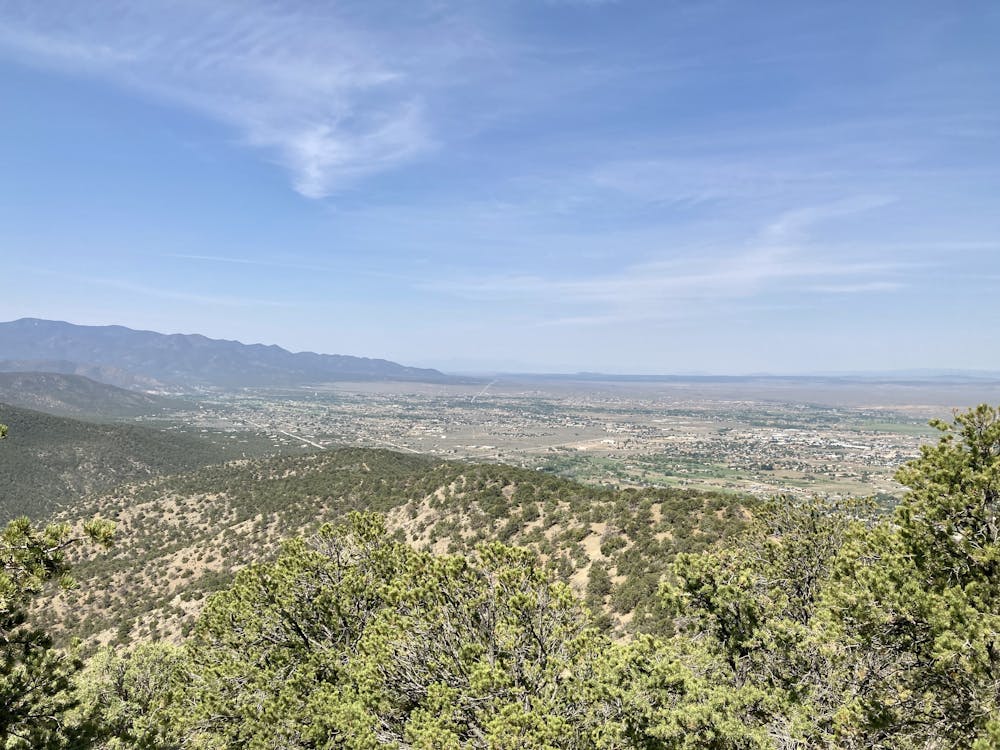
The climb up the mountain in the clockwise direction is steep and challenging, and you'll definitely hike-a-bike several sections. Nevertheless, there are several AREAS where the trail levels out or descends just barely to give you a break from the huffing and puffing. Higher up, the views really open up, providing stunning vistas of Taos and the valley below.
After rounding the corner and taking the hard right to pass the junction with North Boundary, there's just a bit of climbing left before you top out on the summit of Devisadero Peak. Take a break and grab a snack—you've earned it!
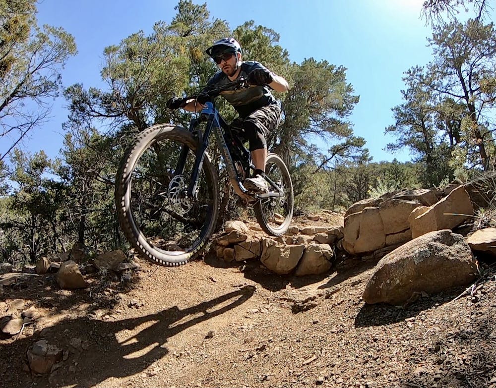
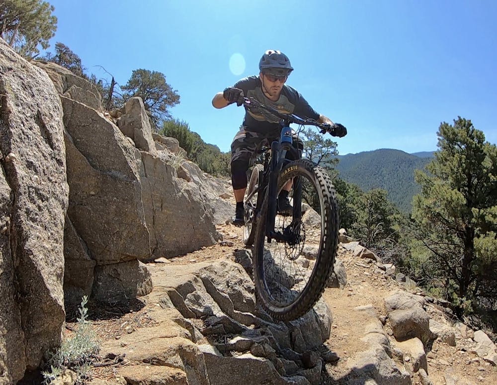
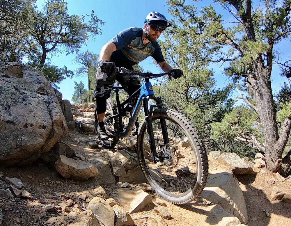
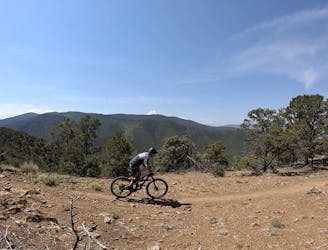
Now comes the fun part. The descent as mapped is all rideable in the downhill direction, but some sections will still test even advanced mountain bikers. There are some respectable ledge drops, brutal rock gardens, slab rock rolls, loose rolling rocks, and plenty of sharp switchbacked corners. The sightlines are quite good into most of the features, allowing riders who are unfamiliar with the area to rail through even the biggest features. Still, if some features seem non-obvious, you can always hike back up and spend some time sessioning. For the amount of work that you put into the climb, it's best to savor the descent, as it's unfortunately over all too quickly.
This trail is also very popular with hikers, so be sure to ride heads-up. That said, enjoy the rip down the mountain—you've earned it!
Severe
Widely variable, narrow trail tread with steeper grades and unavoidable obstacles of 15in/38cm tall or less. Obstacles may include unavoidable bridges 24in/61cm wide or less, large rocks, gravel, difficult root sections, and more. Ideal for advanced-level riders.

Some trail sections have exposed ledges or steep ascents/descents where falling could cause serious injury.

Close to help in case of emergency.
23 m away
If you're looking for a beat down without even leaving the foothills of Taos, look no further than the so-called Taos Vortex Ride.
Severe Mountain Biking
32 m away
Pedal to the top of South Boundary's final rowdy descent.
Severe Mountain Biking
6.8 km away
A little-ridden point-to-point shuttle combining old dirt roads and rugged singletrack.
Severe Mountain Biking
9 routes · Mountain Biking