1.6 km away
Appalachian Trail: Bear Mountain Bridge to NY-22
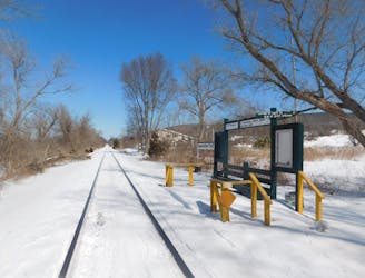
This section passes Anthony's Nose, Canopus Lake, Nuclear Lake, and Cat Rocks ending at the Appalachian Trail Station .
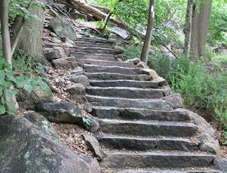
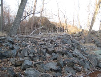
Difficult Hiking
- Distance
- 68 km
- Ascent
- 2.6 km
- Descent
- 2.5 km
14 miles - 3 peaks - Train from NYC
Hiking Difficult

This is a popular hiking route which is generally considered to be difficult. It's remote, it features low exposure and is typically done all year round. From a low point of -1 m to the maximum altitude of 394 m, the route covers 29 km, 1403 vertical metres of ascent and 1403 vertical metres of descent.
3 Hills - 1 Swim Hole
Difficult
Hiking trails where obstacles such as rocks or roots are prevalent. Some obstacles can require care to step over or around. At times, the trail can be worn and eroded. The grade of the trail is generally quite steep, and can often lead to strenuous hiking.

The path is on completely flat land and potential injury is limited to falling over.

Away from help but easily accessed.
1.6 km away
This section passes Anthony's Nose, Canopus Lake, Nuclear Lake, and Cat Rocks ending at the Appalachian Trail Station .
Difficult Hiking
2.9 km away
A picturesque and challenging, albeit short, hike to the the summit of Bear Mountain.
Difficult Hiking
5.8 km away
A historic loop connecting some of Bear Mountain's finest views.
Difficult Hiking
8 km away

A relaxing hike connecting moss-covered ponds to two defined summits.
Moderate Hiking

8 routes · Hiking

58 routes · Hiking