1.9 km away
Lookout Mountain Loop
A scenic, yet demanding, loop highlighting some of the best views in Montreat.
Difficult Hiking
- Distance
- 6.4 km
- Ascent
- 381 m
- Descent
- 381 m
A must-do summit hike not far from Asheville.
Hiking Difficult

Just a short drive from Asheville, this summit hike is a must-do for any adventurer. On the way up, the trail passes Graybeard Falls, Walden's Rock, and Walker's Knob—all excellent destinations for those looking for a shorter hike.
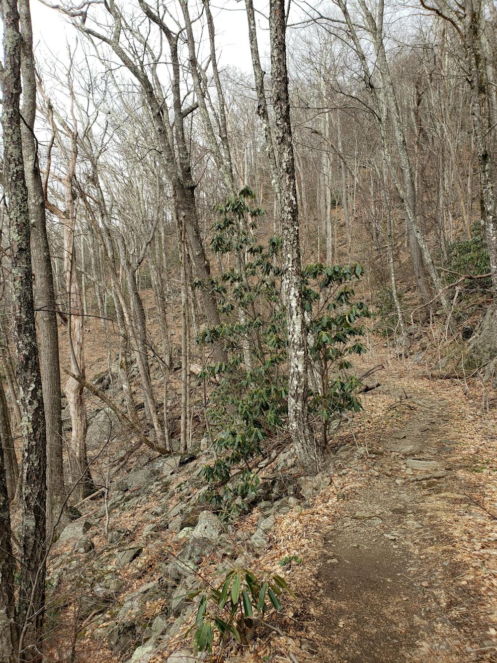
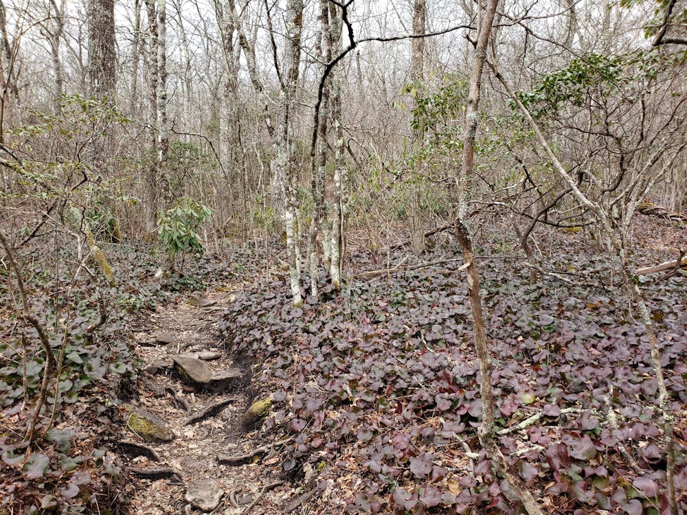
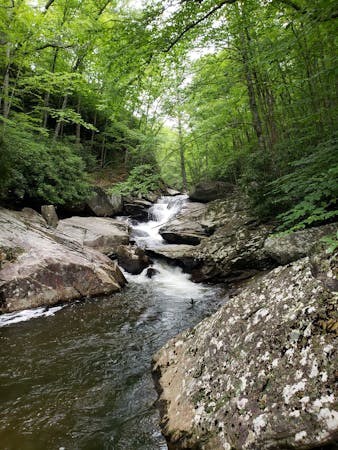
Tucked away in behind Montreat College is a small trailhead along Graybeard Mountain Road with parking for a dozen cars at most. Look for the kiosk at the trailhead and follow the blue diamond blazes across the wooden bridge to begin your hike. The first mile is very challenging, with plenty of rocks and roots defining the way. Know that after rain, there are multiple points where you could get your feet wet.
For a short hike, pair the Graybeard Mountain Trail with the Harry Bryan and Julia Woodward Trails. Less than 1.5 miles, this is an excellent opportunity for a family-friendly afternoon hike.
Continuing your way to the summit of Graybeard Mountain, keep left at the junction with the unmarked doubletrack. Following the blue blazes left at the intersection, the Graybeard Mountain Trail merges onto a former railroad grade that leads uphill for the next couple of miles.
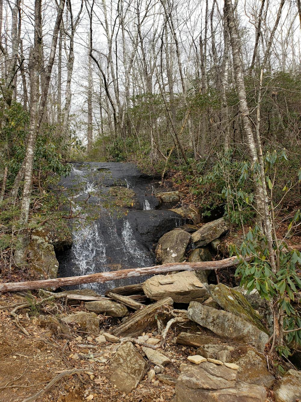
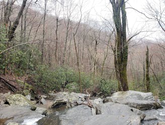
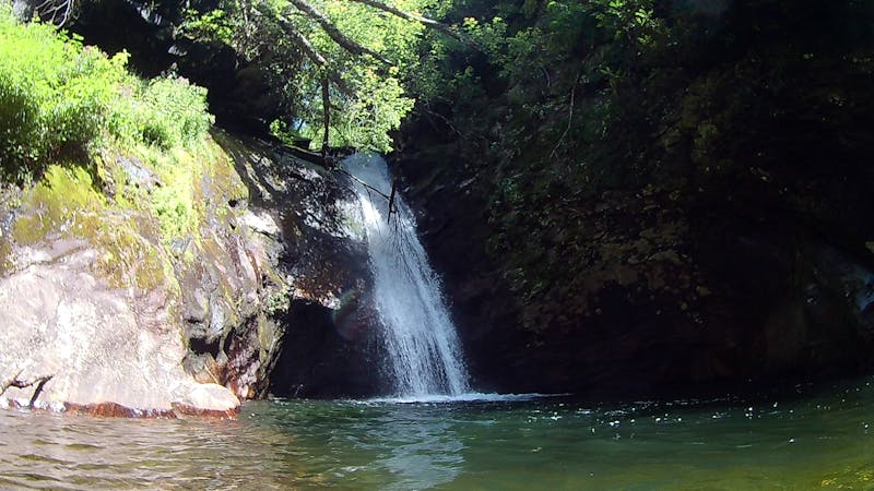
This segment is considerably easier than the first mile and offers some partial views to the valley below. Along the grade, look for a spur trail leading to the quaint Graybeard Falls. On a hot summer day, take the opportunity to cool off in this year-round waterfall.
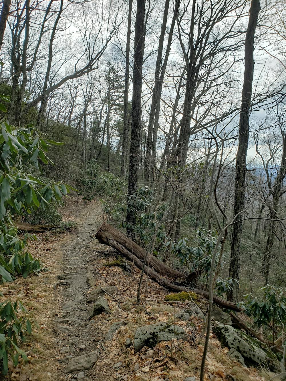
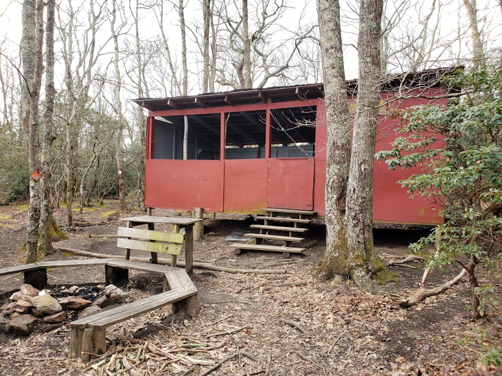
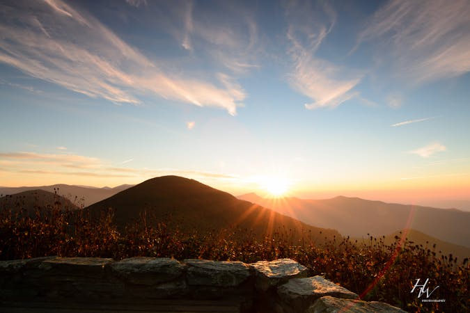
Ahead on the trail, you'll trade in the old railroad grade for rugged singletrack as you approach Walker's Knob Shelter. A short spur leads to a phenomenal overlook as well the only option for overnight camping on this loop.
Continuing your climb, a final trail intersection separates you from the summit. The West Ridge Trail leads south and warns that the path is not a shortcut back to the parking lot. Despite its distance, this trail is extremely rugged, challenging, and reserved for the most adventurous hikers.
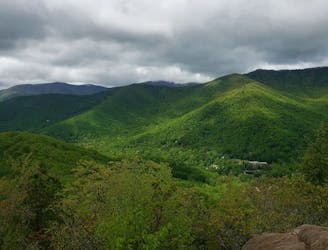
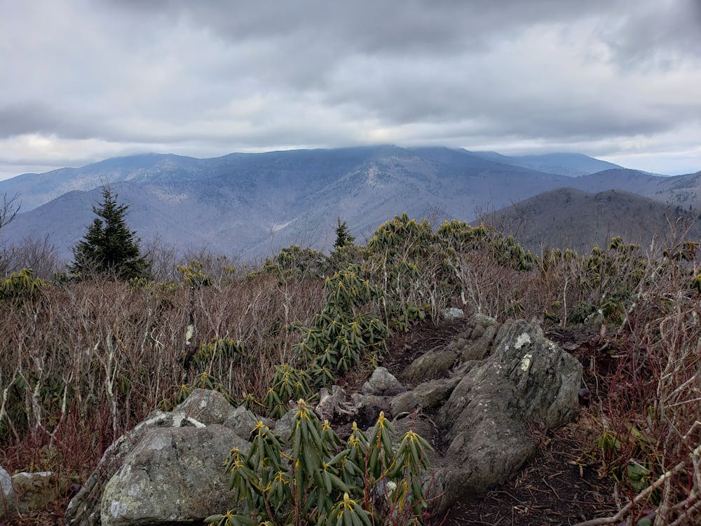
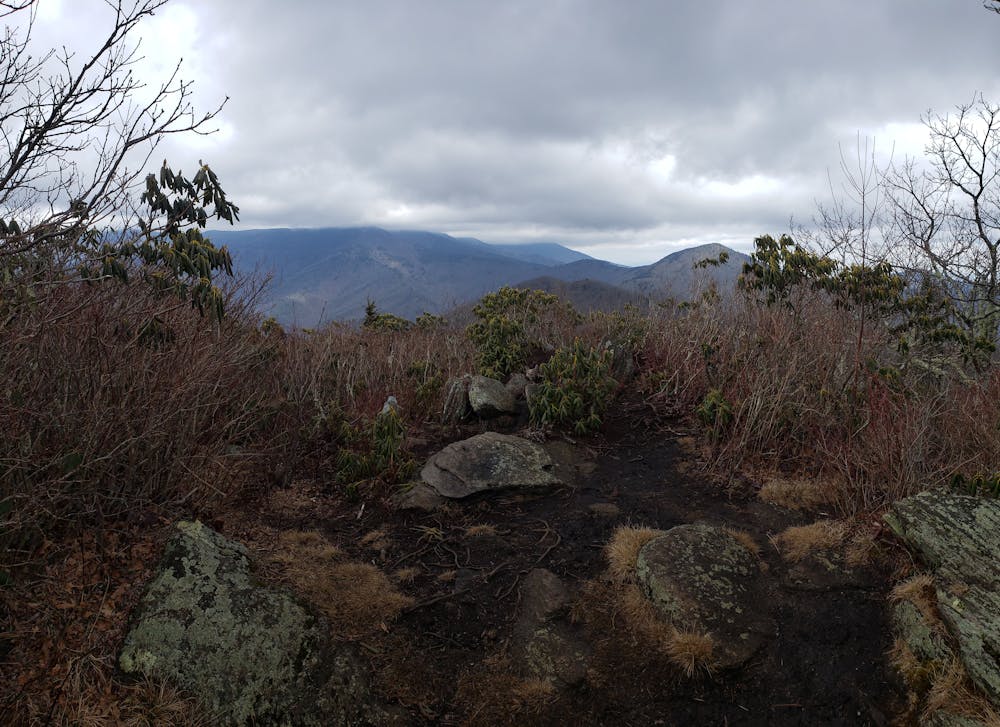
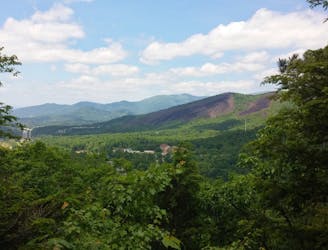
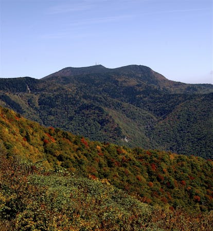
Up the Graybeard Mountain Trail, you'll be welcomed with a challenging and rocky final approach. The summit, a clearing no bigger than a small room, rewards you with some incredible views of Mount Mitchell. Even on a foggy or cloudy day, the surrounding Blue Ridge Mountains offer a phenomenal, picturesque backdrop.
Difficult
Hiking trails where obstacles such as rocks or roots are prevalent. Some obstacles can require care to step over or around. At times, the trail can be worn and eroded. The grade of the trail is generally quite steep, and can often lead to strenuous hiking.

The trail contains some obstacles such as outcroppings and rock which could cause injury.

Little chance of being seen or helped in case of an accident.
1.9 km away
A scenic, yet demanding, loop highlighting some of the best views in Montreat.
Difficult Hiking
7.4 km away
A local classic with epic views and easy access from town.
Difficult Hiking
7.8 km away
A family-friendly hike to one of North Carolina's best waterfalls.
Moderate Hiking
8.6 km away
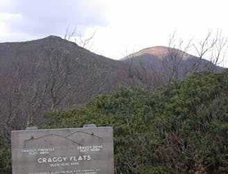
A short hike in the Great Craggy Mountains with sweeping 360-degree views.
Moderate Hiking
9.7 km away
A classic hike to the summit of Mount Mitchell, the highest point east of the Mississippi River.
Difficult Hiking
7 routes · Hiking
6 routes · Hiking

10 routes · Hiking

16 routes · Hiking
8 routes · Hiking · Trail Running
8 routes · Hiking