378 m away
Brutus
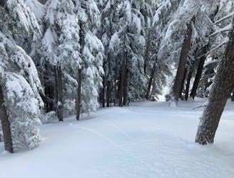
Arguably one of the two best glades on Mt. Ashland.
Difficult Freeride Skiing
- Distance
- 576 m
- Ascent
- 0 m
- Descent
- 218 m
Connecting cross trail.
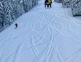
Freeride Skiing Easy

This is a popular freeride skiing route which is generally considered to be easy. It's an unknown remoteness, it features unknown exposure and is typically done between December and April. From a low point of 2 km to the maximum altitude of 2 km, the route covers 209 m, 0 vertical metres of ascent and 39 vertical metres of descent.
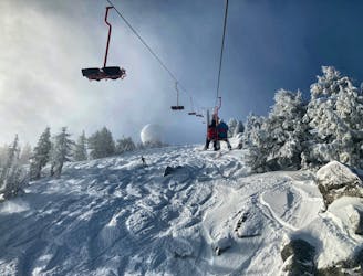
All's Well is a crosstrail connector that provides egress from Ariel Chairline and Ariel Trees to get out and around to Pistol, and down to the bottom of the Ariel chair. The section of the mountain right above the Ariel trail is closed to skier traffic, hence the detour around.
Easy
Wide gentle slopes at around 20 degrees or less.
378 m away
Arguably one of the two best glades on Mt. Ashland.
Difficult Freeride Skiing
413 m away

A sunny glade off of Dream.
Moderate Freeride Skiing
417 m away
An obvious Hollywood line.
Moderate Freeride Skiing
438 m away

An often-overlooked glade.
Moderate Freeride Skiing
448 m away
One of the two best glades on Mt. Ashland.
Moderate Freeride Skiing
552 m away

A wide but short glade.
Moderate Freeride Skiing
596 m away
Combine with Ariel Chairline for a few great laps on the mountain.
Moderate Freeride Skiing
596 m away
Home to some of the best hits on the mountain.
Difficult Freeride Skiing
653 m away

Mt. Ashland's most remote glade.
Moderate Freeride Skiing

52 routes · Mountain Biking · Freeride Skiing · Gravel Biking · Hiking · Road Biking

7 routes · Freeride Skiing