ATCA Shuttle
A backcountry point-to-point ride of epic proportions.
Difficult Mountain Biking
- Distance
- 43 km
- Ascent
- 1.5 km
- Descent
- 2.3 km
Known as the "crown jewel" of Oakridge, the Alpine Trail easily ranks among the best shuttle routes in the world.
Mountain Biking Difficult
While "Alpine Trail" may sound like a generic name, once you begin associating that name with this epic point-to-point enduro-style shuttle route outside of Oakridge, Oregon, it becomes anything but ordinary!
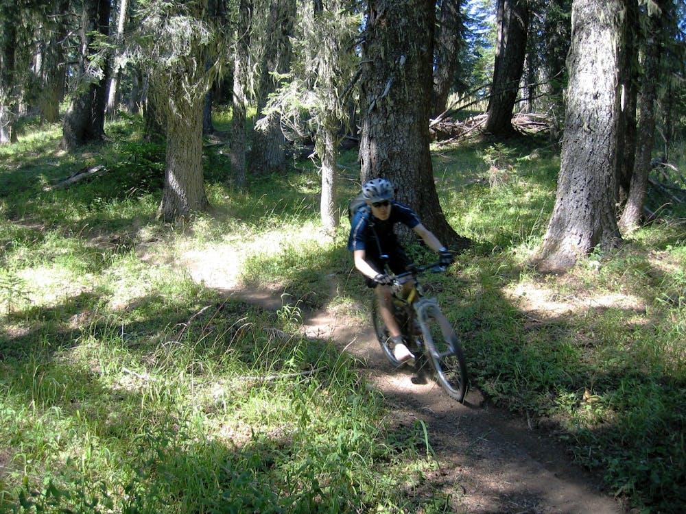
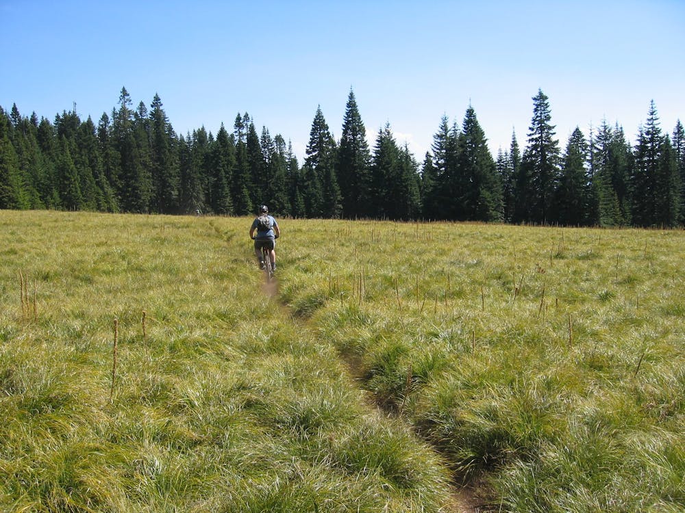
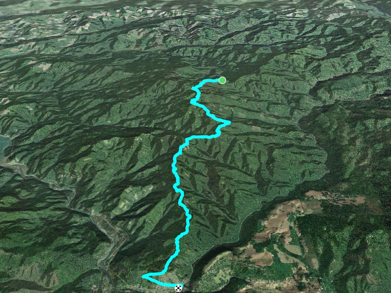
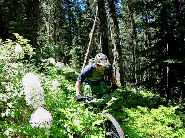
The route begins high in the mountains above Oakridge after a long shuttle up a dirt road. A mellow climb greets riders departing the trailhead, with the singletrack snaking beneath towering trees.
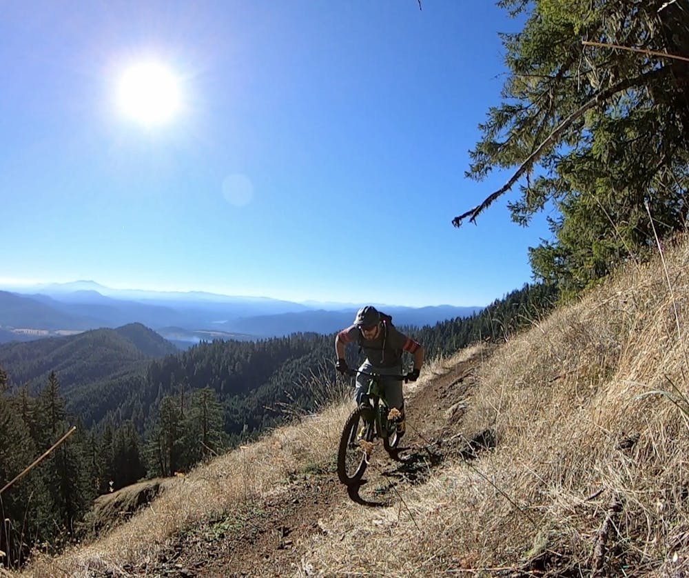
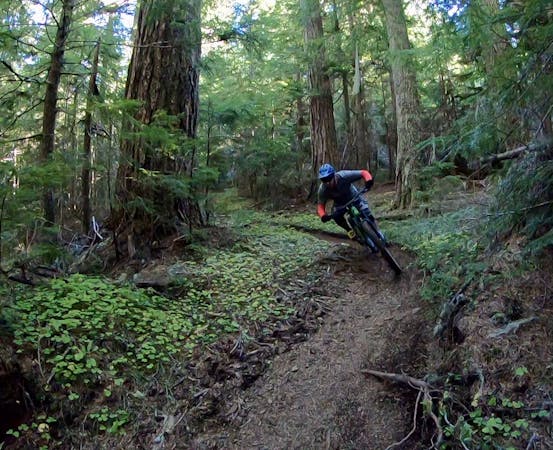
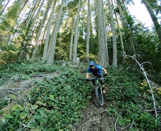
Once the trail starts heading down, it descends with a vengeance! While the grade isn't super steep, the flow of the trail and relatively straight sight lines allow riders to amp up the speed, the massive Douglas Firs whizzing past in a blur of brown and green.
Thanks to the lush Pacific Northwest vegetation, the trail tread is filled with dark dirt that provides traction for days, only helping riders max out the speed. As you'd expect, tangles of tree roots cross the trail.
Some sections of the Alpine Trail are surprisingly rocky, and while the chunder will put your suspension to work, there aren't many significant rock features aside from a barrage of chunk.
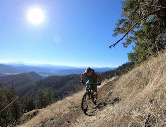
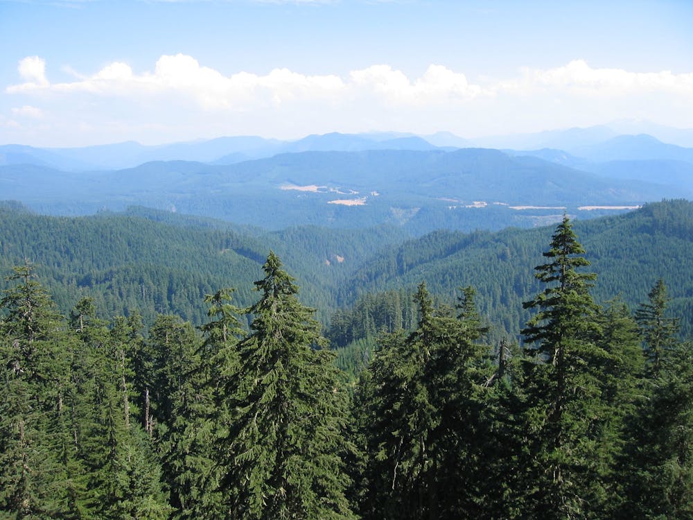
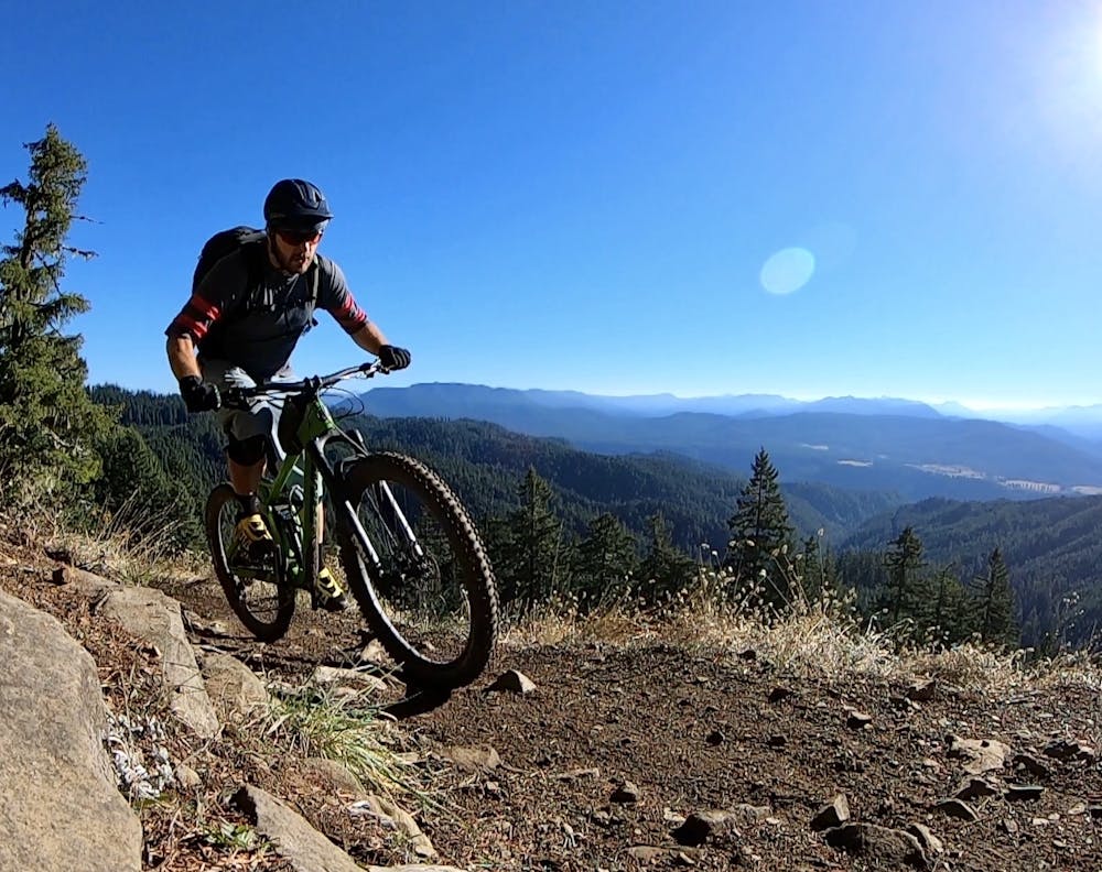
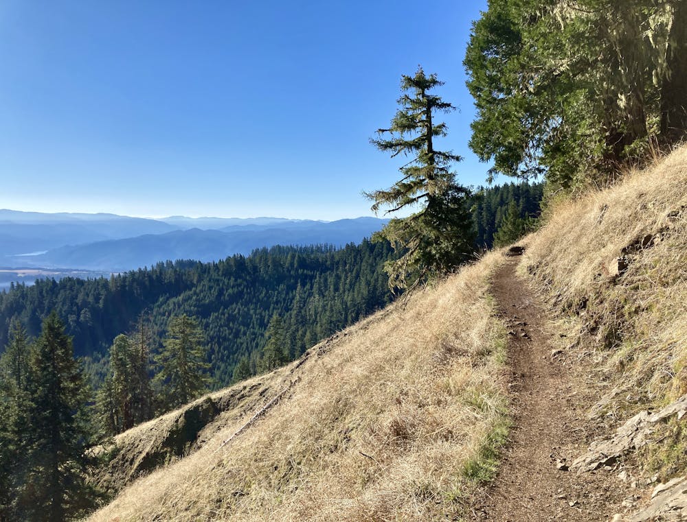
One of the iconic spots on the Alpine Trail is in the final leg, where the singletrack breaks out onto a beautiful bench cut and riders can see down toward Oakridge and the small town of Westfir where the ride concludes. From here, the singletrack sidehills along the bench cut, with some mild exposure, ending with a high-speed rush to the finish.
If you only have time for one trail in Oakridge, ride the Alpine Trail!
Difficult
Mostly stable trail tread with some variability featuring larger and more unavoidable obstacles that may include, but not be limited to: bigger stones, roots, steps, and narrow curves. Compared to lower intermediate, technical difficulty is more advanced and grades of slopes are steeper. Ideal for upper intermediate riders.

The trail contains some obstacles such as outcroppings and rock which could cause injury.

Little chance of being seen or helped in case of an accident.
A backcountry point-to-point ride of epic proportions.
Difficult Mountain Biking

25 routes · Mountain Biking

16 routes · Mountain Biking

10 routes · Mountain Biking
5 routes · Mountain Biking
10 routes · Mountain Biking
6 routes · Mountain Biking

15 routes · Mountain Biking