MERA: Sasquatch Figure-8
A MERA loop variant with more climbing and flow-filled descending.
Moderate Mountain Biking
- Distance
- 14 km
- Ascent
- 441 m
- Descent
- 441 m
Ride from the low point to the high point—and back!—of the MERA trail system.
Mountain Biking Difficult

This loop climbs from the lowest MERA trailhead on Igo Lane all the way up to the top of North Knob, the highest point in the MERA trail system! In just 14.8 miles round-trip, you’ll climb and descend a whopping 2,800 vertical feet. Logging almost 200 vertical feet per mile on a loop ride is no joke, so be sure to bring your climbing legs for this one!
The MERA Trail System is a convoluted network of singletrack, and this route weaves one of the best paths through the maze. Consequently, I won’t dive into all of the turns in detail—it’s best to just follow the map. However, one key option is to dive off of the Caffeine Trail onto Doing Time, and then doubling back to the Caffeine Trail after Doing Time’s jumps and drops end. This variant is known as the Tom G Special and is mapped separately.
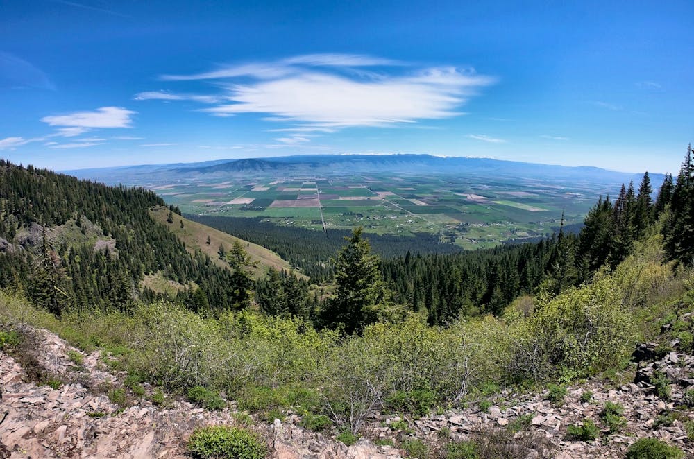
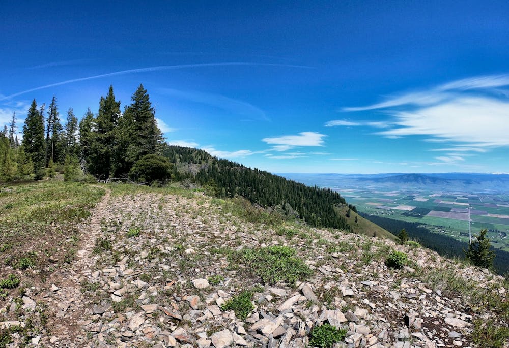
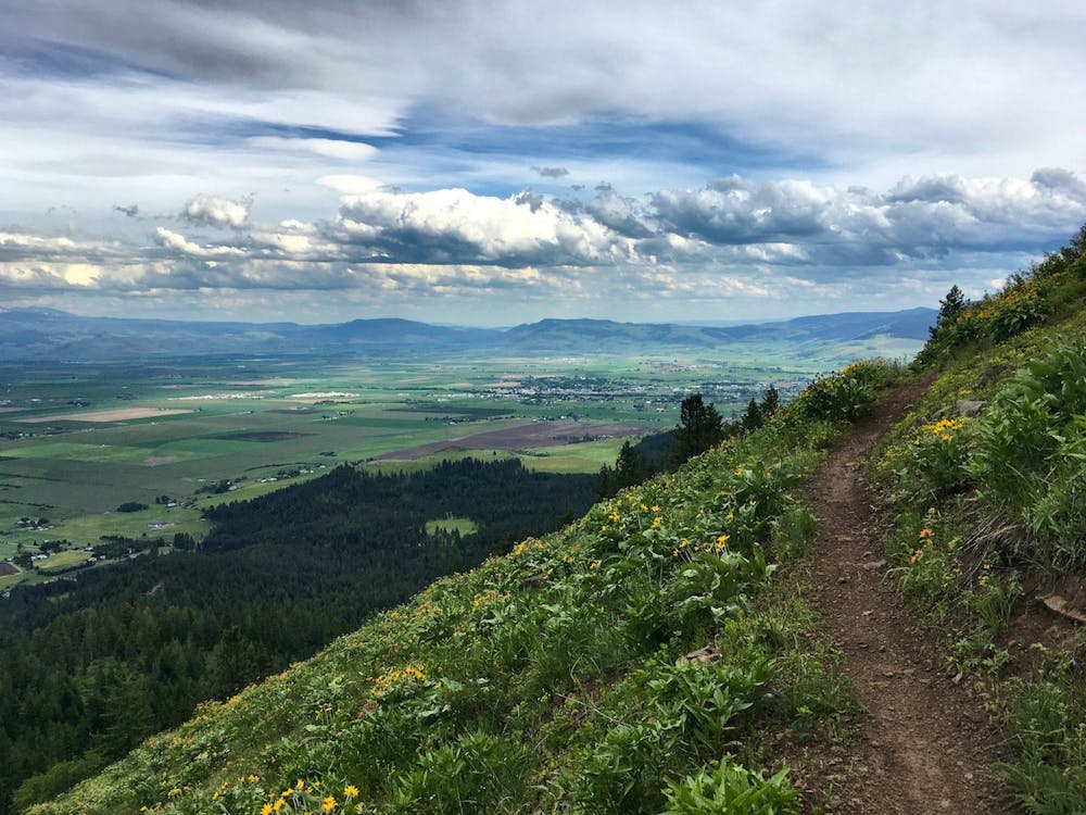
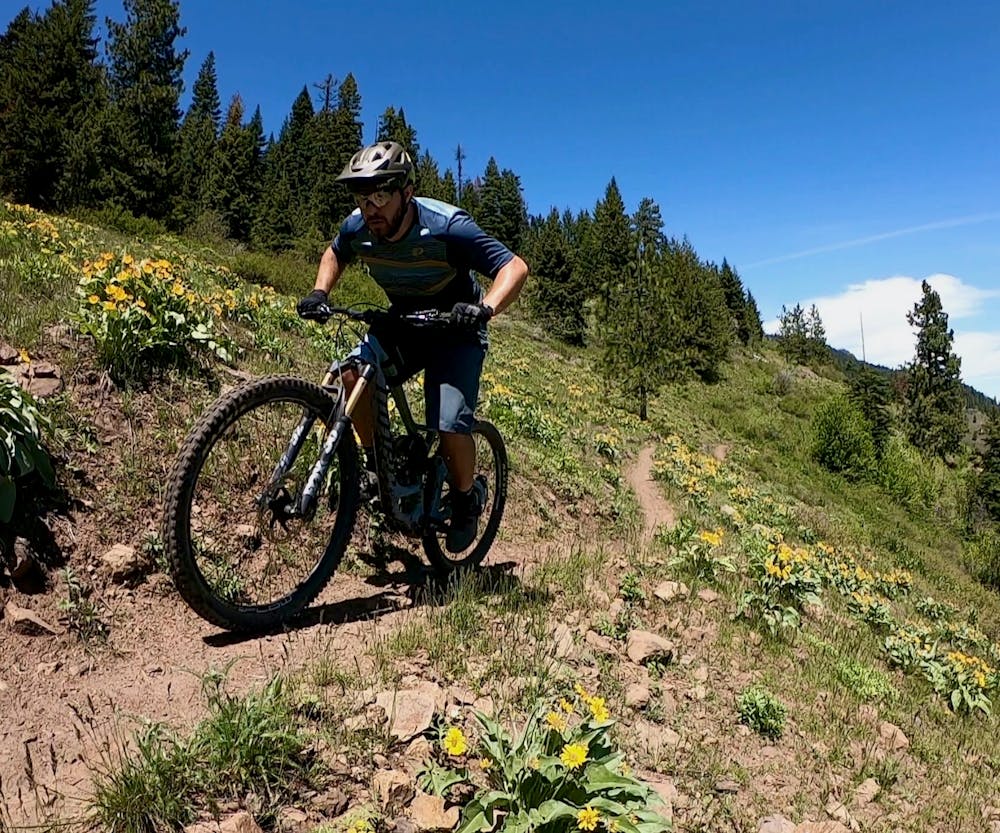
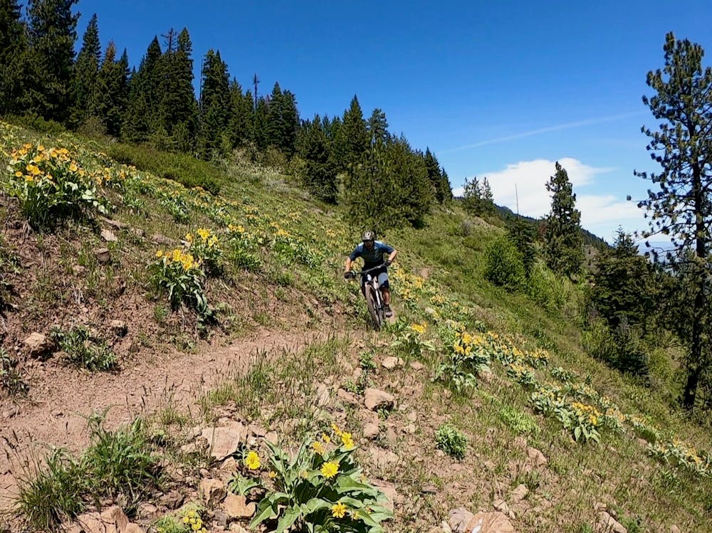
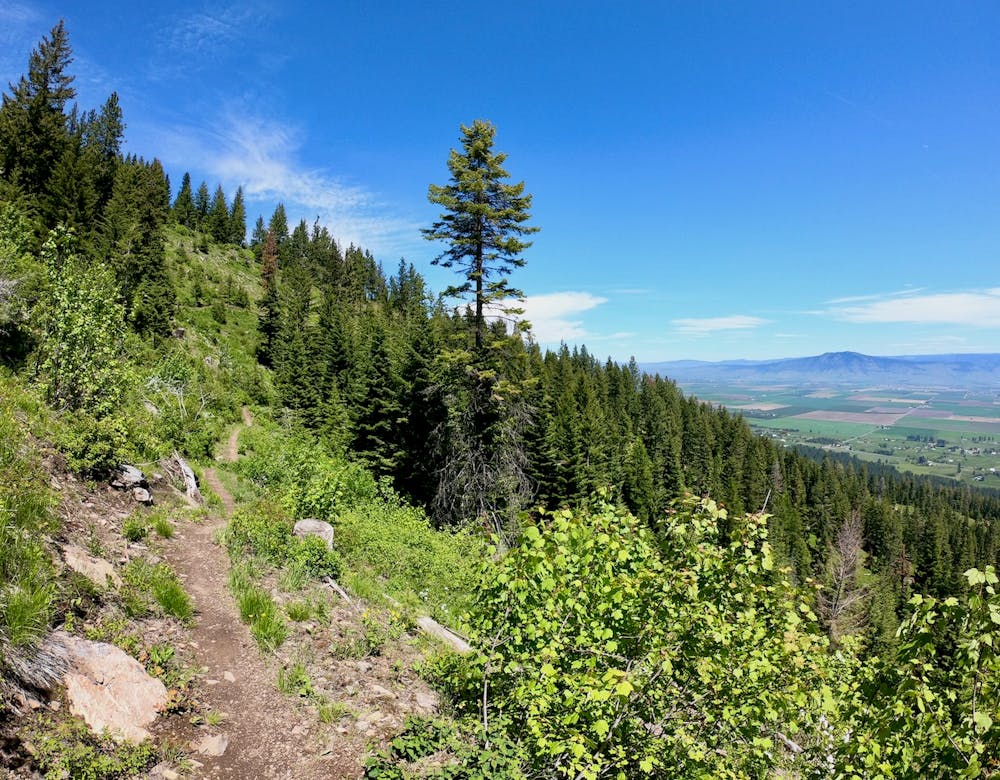
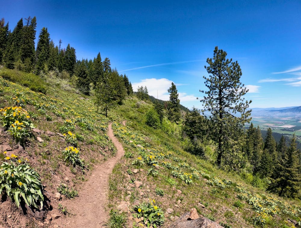
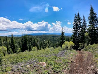
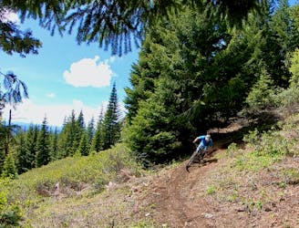
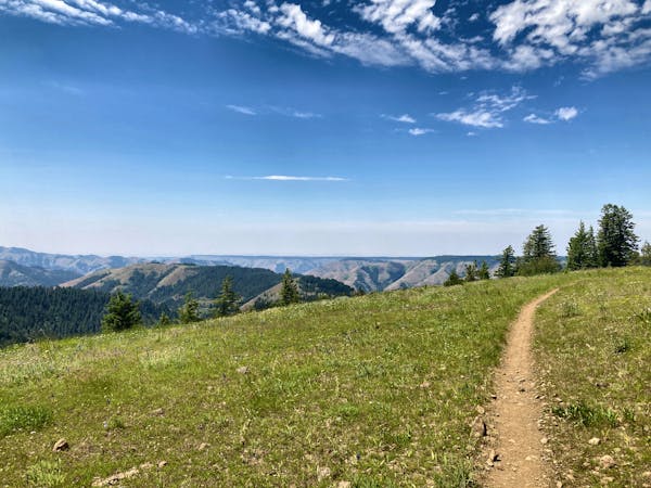
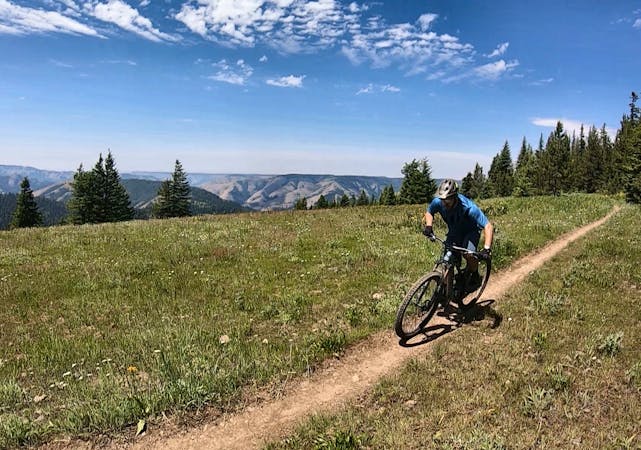
Aside from the vast amount of descending, one of the highlights of this ride is the opportunity to enjoy incredible views from the upper reaches of Mount Emily. The higher you climb, the more incredible the views get, until you reach the Ridgeline trail and get to see the entire expanse of the valley spread out below you, and the Wallowa Mountains dominating the far horizon. The vistas from Ridgeline are truly jaw-dropping—be sure to savor them for a few minutes before you drop back into the trees.
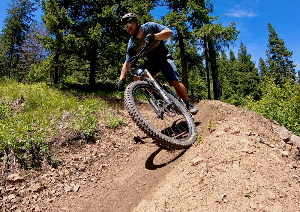
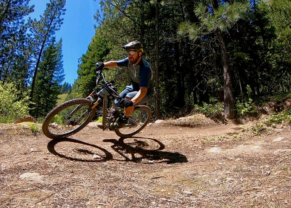
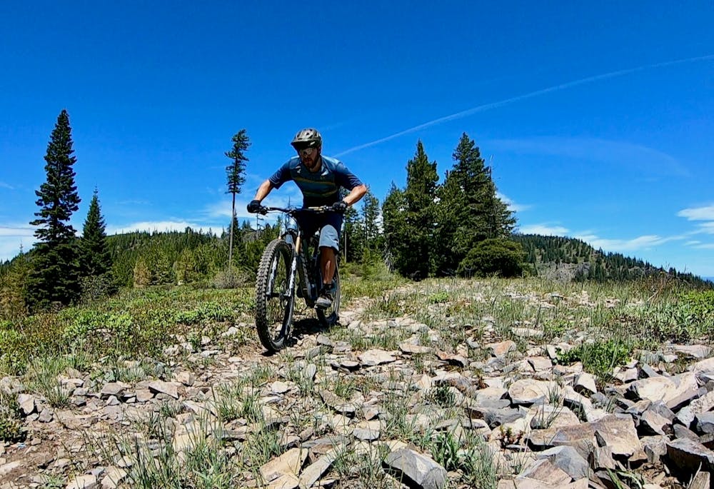
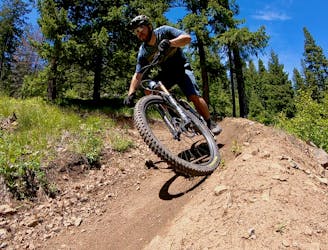
North Knob and Upper Doing Time are a bit more technical than most of the rest of MERA, although they still aren’t much to write home about in the gnar department. However, you will get to enjoy some high-speed descents a few chunky bits before you drop back into the tight twisties of Caffeine’s berms.
For an even longer ride, you could consider dropping down the moto trails on the opposite side of the mountain, then climbing back up and completing this ride as mapped. But if you drop down the opposite side, be ultra-certain that you can climb back up and over to get back to your original starting location!
Difficult
Mostly stable trail tread with some variability featuring larger and more unavoidable obstacles that may include, but not be limited to: bigger stones, roots, steps, and narrow curves. Compared to lower intermediate, technical difficulty is more advanced and grades of slopes are steeper. Ideal for upper intermediate riders.

The trail contains some obstacles such as outcroppings and rock which could cause injury.

Little chance of being seen or helped in case of an accident.
A MERA loop variant with more climbing and flow-filled descending.
Moderate Mountain Biking
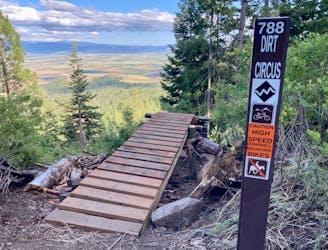
The first downhill mountain biking-only trail at MERA!
Severe Mountain Biking
1 m away
One of the best routes to maximize the descending at MERA.
Difficult Mountain Biking
1.2 km away
The eponymous trail connecting the larger MERA trail system together.
Moderate Mountain Biking
3.7 km away
A ripping loop on the moto side of the mountain.
Difficult Mountain Biking
3.7 km away
Singletrack gems on the moto legal side of MERA.
Difficult Mountain Biking

11 routes · Mountain Biking
18 routes · Mountain Biking · Gravel Biking · Hiking · Stand Up Paddle
5 routes · Mountain Biking

20 routes · Mountain Biking

15 routes · Mountain Biking