2.1 km away
Rainbow Falls
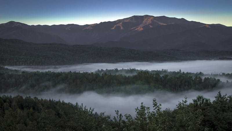
The Rainbow Falls Trail is a challenging, yet rewarding hike to the highest waterfall in the Smokies!
Difficult Hiking
- Distance
- 8.5 km
- Ascent
- 543 m
- Descent
- 543 m
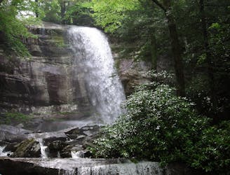
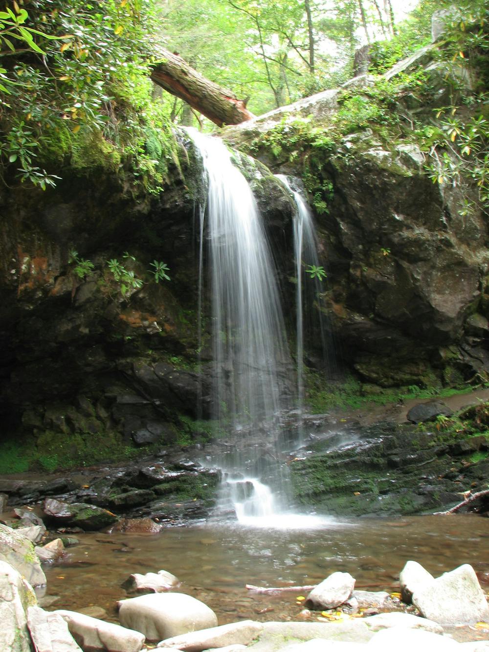
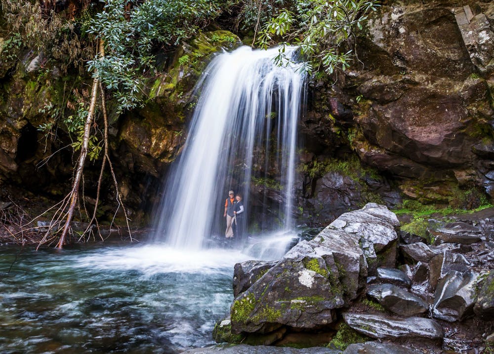
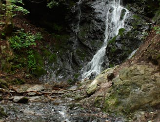
A short hike to a picturesque 25' waterfall that you can walk behind!
Hiking Moderate

Located near Gatlinburg, Grotto Falls is a 2.6-mile round trip hike to a stunning 25' waterfall that you can walk behind! According to the NPS, "the cool, moist environment near the falls is ideal for salamanders," and it makes an excellent summer hike for the entire family!
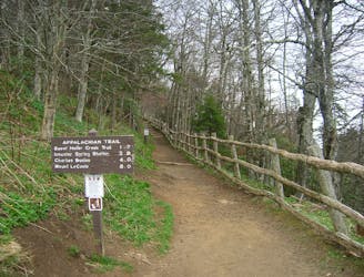
This out-and-back hike begins at stop #5 on the Roaring Fork Motor Nature Trail. There is a large parking area, though buses, RVs, trailers, and larger vehicles are prohibited on the road. It's also closed during the winter months, so plan this adventure during the summer heat so that you can cool off its refreshing water.
From the trailhead, look for the spur that leads to Trillium Gap Trail. At the junction, keep left, following the trail in a southeasterly direction. The trail actually runs behind the waterfall, making it difficult to get lost.
If you're planning a longer backpacking trip up to Mount LeConte, this is an excellent alternative to the popular Alum Cave Trail. After camping at the summit, you can return via Rainbow Falls Trail, another trail aptly named for the beautiful waterfall you'll visit along the way.
Source: https://www.nps.gov/grsm/planyourvisit/grotto-falls.htm
Moderate
Hiking along trails with some uneven terrain and small hills. Small rocks and roots may be present.

The trail contains some obstacles such as outcroppings and rock which could cause injury.
Away from help but easily accessed.
2.1 km away
The Rainbow Falls Trail is a challenging, yet rewarding hike to the highest waterfall in the Smokies!
Difficult Hiking
5 km away
Steep climb to a popular viewpoint near a craggy summit.
Difficult Hiking
5.7 km away
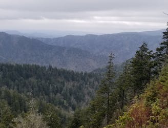
A popular route to the summit of Mount LeConte.
Difficult Hiking
6.9 km away
A quick family-friendly waterfall hike behind the Sugarlands Visitor Center.
Moderate Hiking
8.4 km away
The second half of the Great Smoky Mountains National Park.
Difficult Hiking

58 routes · Hiking
10 routes · Hiking

10 routes · Hiking

6 routes · Hiking