0 m away
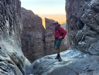
Emory Peak via Chisos Basin Loop
A epic undertaking to the summit of Emory Peak, the tallest peak in the Chisos Mountains.
Difficult Hiking
- Distance
- 20 km
- Ascent
- 918 m
- Descent
- 918 m
An epic multi-day journey through Big Bend National Park
Hiking Severe

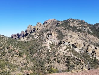
This loop through Big Bend National Park is one of the more epic ways to experience the region's beauty. Affectionately referred to as the "Outer Mountain Loop," the 35-mile route takes hikers through remote, rugged terrain, summiting Emory peak on the way.
The NPS suggests dividing this route into three days, though two days is still attainable for an experienced hiker. One of the most important aspects of the route is that you must cache water near Homer Wilson/Blue Creek Ranch. Take the Ross Maxwell Scenic Drive until shortly before the Sotol Vista Overlook. Hike 0.25 miles in, leave water in the storage box, and "ensure your name and date are written on your bottles."
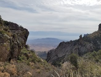
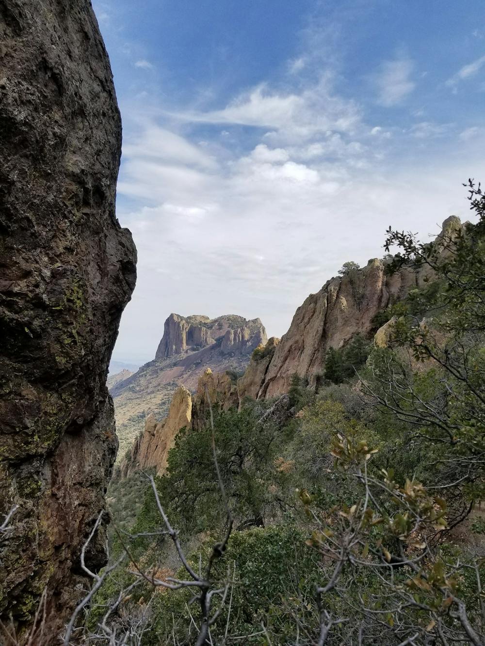
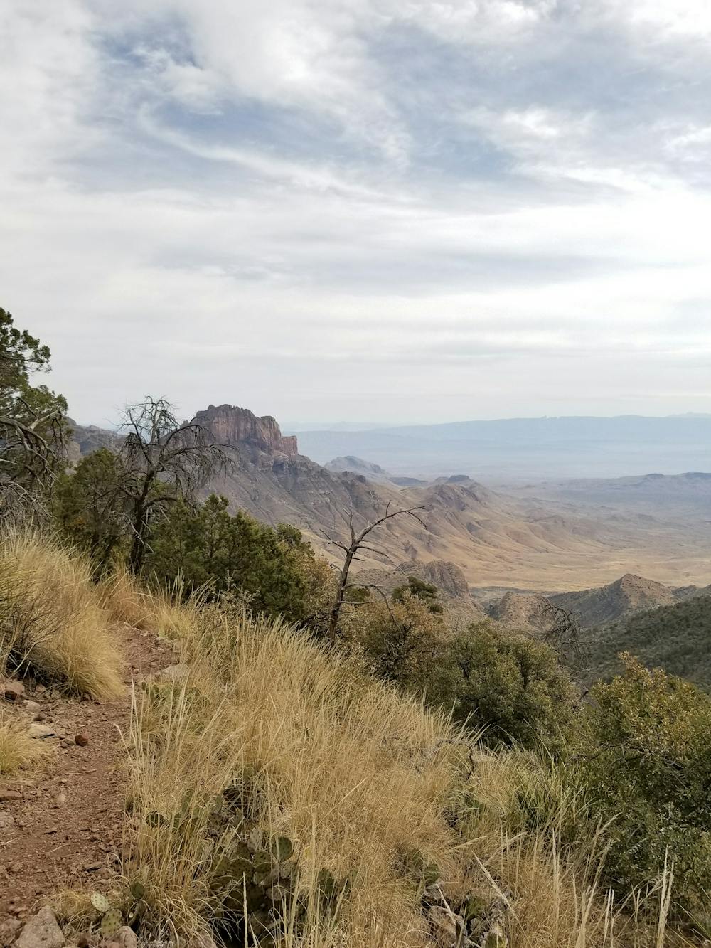
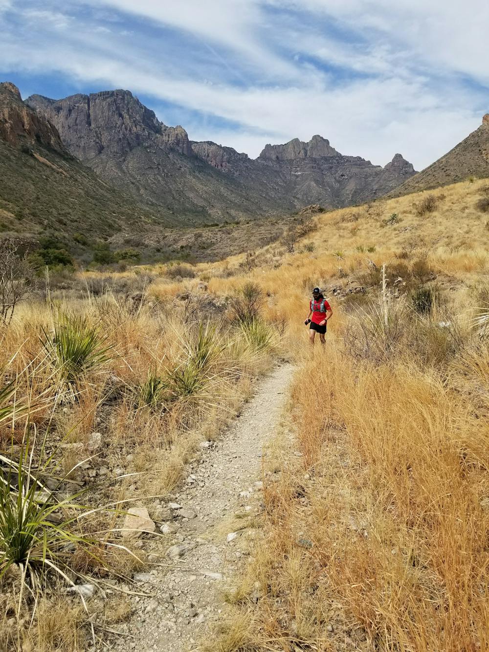
Divided into three days, the first portion of the hike connects the Chisos Basin Visitor Center to Emory Peak. A popular destination among day hikers, the summit is the tallest in the Chisos Mountains and an excellent addition to an Outer Mountain Loop hike. At ~7,800', you'll experience some incredible panoramic views of the vast, barren desert below. At this point, you will be well over one mile above the Rio Grande Village in the park.
The loop continues by following the Juniper Canyon Trail out of the mountains heading towards the desert floor. Most hikers choose to camp where Juniper Canyon Trail ends and Dodson Trail begins.
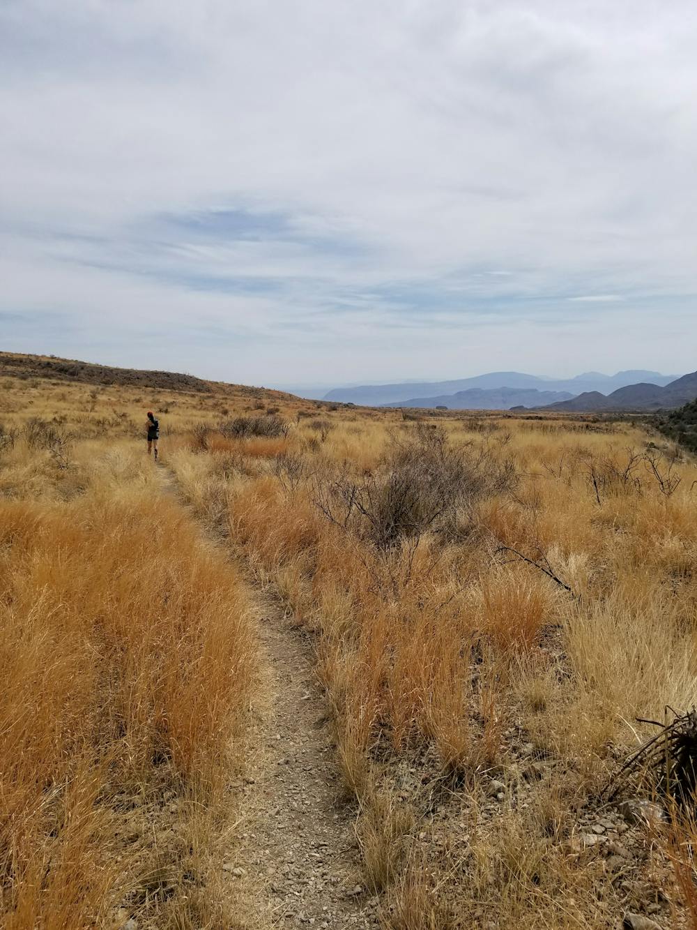
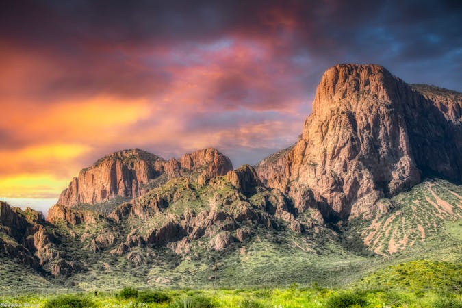
The second portion of the hike leads hikers west along the Dodson Trail. This segment of the trail is extremely exposed as the trail undulates through several drainages on the desert floor. Pay close attention to rock cairns that mark the way.
Between the 4- and 5-mile marks, the trail crosses the Fresno Creek drainage, the only notable water source until reaching your cache at Homer Wilson Ranch. Per the NPS, "any water collected should be treated before drinking. Please do not contaminate this water source as it is vital to wildlife in the desert."
Ahead, the route circles around Carousel Mountain, where you'll reach your water cache at Homer Wilson Ranch. Camp nearby, but at least 0.5 miles from the road.
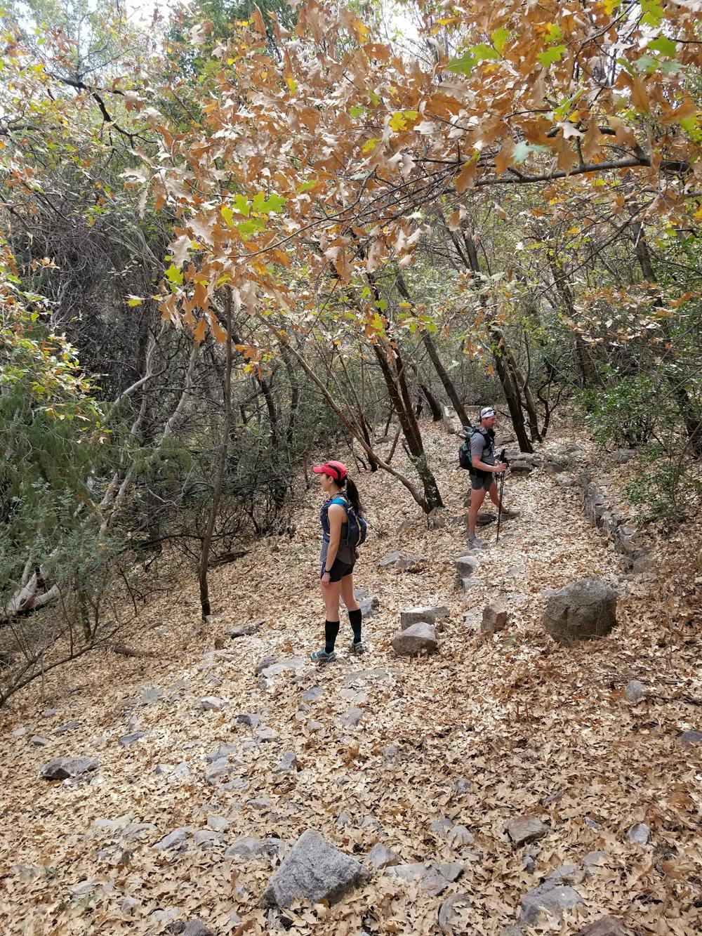
The final portion of the hike follows Blue Creek Trail for a steady 2,500-foot climb back into the Chisos Mountains. Along the way, you'll encounter picturesque red rock formations and ascend back into the woodlands. As the trail levels, you will pass through the high point of the Laguna Meadow Trail and begin the final descent back to the trailhead in the Chisos Basin.
Sources: https://www.nps.gov/bibe/planyourvisit/oml-itinerary.htm
Severe
Hiking challenging trails where simple scrambling, with the occasional use of the hands, is a distinct possibility. The trails are often filled with all manner of obstacles both small and large, and the hills are very steep. Obstacles and challenges are often unexpected and can be unpredictable.

Some trail sections have exposed ledges or steep ascents/descents where falling could cause serious injury.

In the high mountains or remote conditions, all individuals must be completely autonomous in every situation.
0 m away
A epic undertaking to the summit of Emory Peak, the tallest peak in the Chisos Mountains.
Difficult Hiking
15 m away
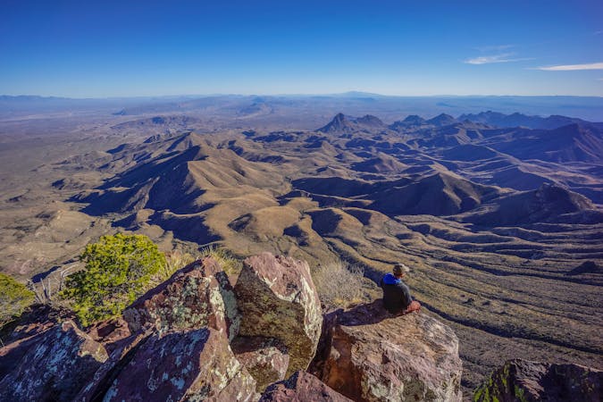
Gain stunning views off of Big Bend's elevated South Rim.
Difficult Hiking
15 m away
An incredible loop hike to Big Bend's dramatic South Rim.
Difficult Hiking
549 m away
The most popular trail in the Chisos Basin.
Difficult Hiking
1.5 km away
A popular hike in Big Bend National Park with endless views of the Chisos Mountains.
Difficult Hiking
12 routes · Hiking

10 routes · Hiking
14 routes · Hiking

63 routes · Alpine Climbing · Hiking