280 m away
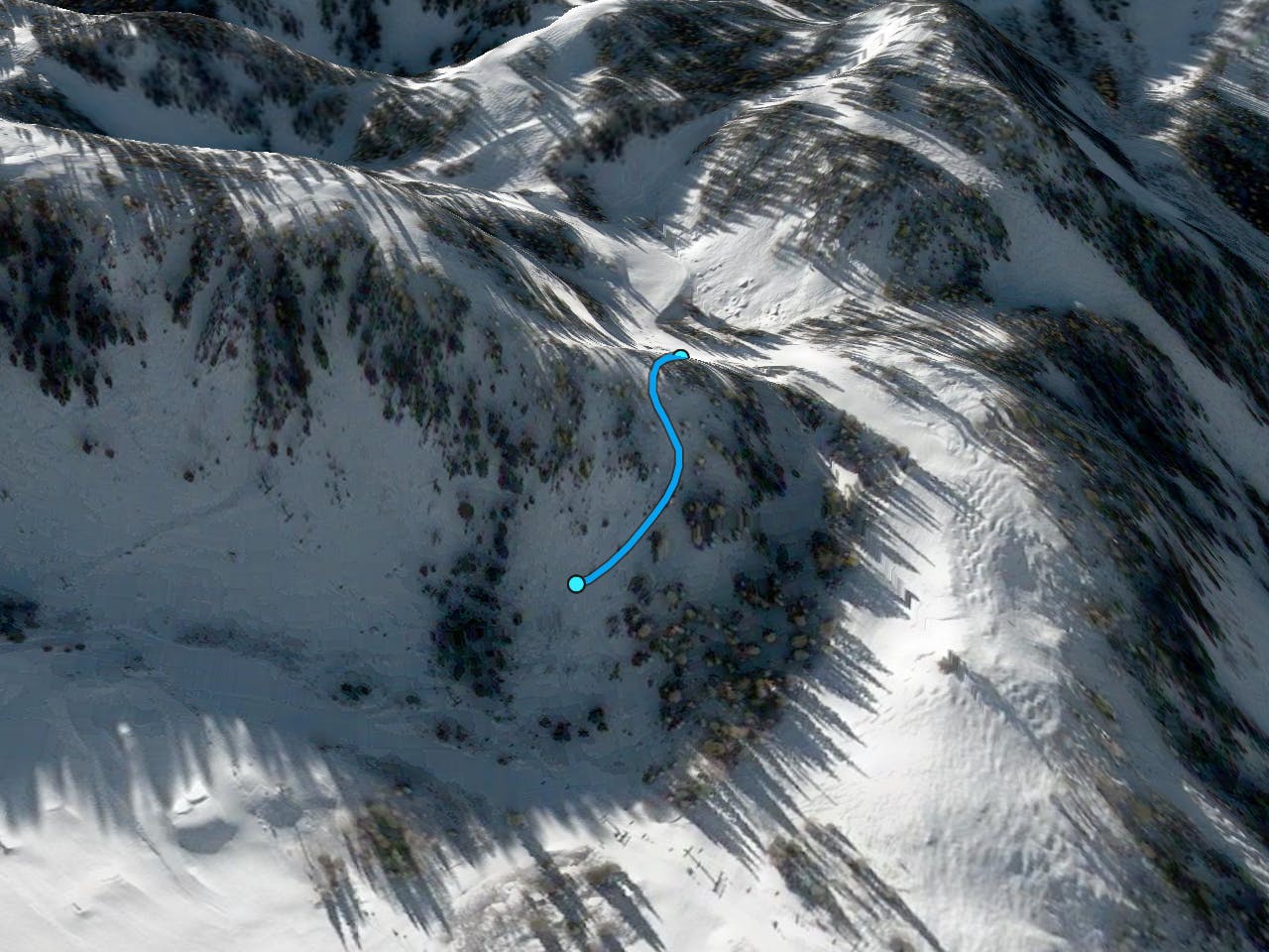
Carbonate Cliffs

Steep technical skiing in the Carbonate Cliffs.
Severe Freeride Skiing
- Distance
- 218 m
- Ascent
- 0 m
- Descent
- 144 m
Amazing unmarked trees
Freeride Skiing Difficult
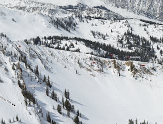
At the bottom of Gad 2 you'll see a sign that reads something like lower carbonate which is the gate to this tree run. You'll take a short traverse over until you get to the top of this area. It starts with a 2 - 3 foot drop in which is easy in soft snow conditions but shouldn't be too difficult otherwise. Once in you can either ski down the fall line or go right which will give you access to some cliffs and other paths. Once you ski that you'll be connected back to the Gad Valley road green. The difficult rating comes from the exposure of this area. It's quite steep and has a few cliffs scattered about so ski with caution.
Difficult
Serious gradient of 30-38 degrees where a real risk of slipping exists.

As well as the slope itself, there are some obstacles (such as rock outcrops) which could aggravate injury.

Close to help in case of emergency.
280 m away
Steep technical skiing in the Carbonate Cliffs.
Severe Freeride Skiing
815 m away

A secret bowl with trees near the top
Moderate Freeride Skiing
1.1 km away

A steep, wide open chute
Difficult Freeride Skiing
1.1 km away

A steep slot though the trees
Difficult Freeride Skiing
1.1 km away

A nice long powder stash
Difficult Freeride Skiing
1.2 km away

Very steep technical tree skiing
Difficult Freeride Skiing
1.2 km away

Secret gate that takes you just other side of rope line
Difficult Freeride Skiing
1.3 km away

Steep technical skiing in the Forbidden Zone.
Extreme Freeride Skiing
1.3 km away

A short, tight straight line
Extreme Freeride Skiing
1.3 km away
A cliff drop to straight line
Extreme Freeride Skiing