1.7 km away
Oompa Loompa Land

A wooded adventure just off the groomers
Moderate Freeride Skiing
- Distance
- 315 m
- Ascent
- 0 m
- Descent
- 84 m
Wooded gully skiers right of Rattler
Freeride Skiing Difficult
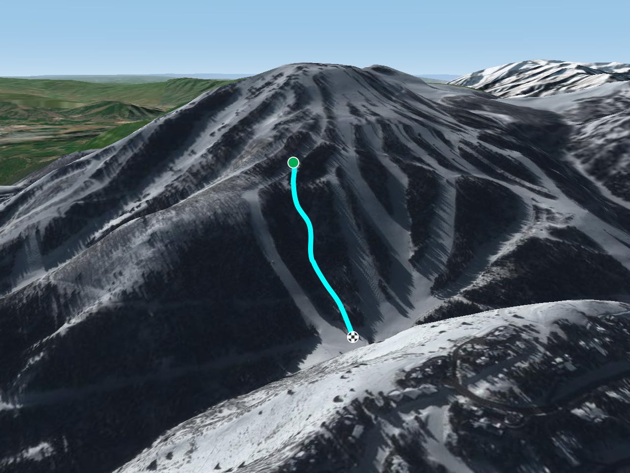
This is a popular freeride skiing route which is generally considered to be difficult. It's remote, it features medium exposure (e2) and is typically done between January and March. From a low point of 2.4 km to the maximum altitude of 2.6 km, the route covers 569 m, 0 vertical metres of ascent and 207 vertical metres of descent. It's graded 2.2 and Labande grade 3.
Coming soon
Difficult
Serious gradient of 30-38 degrees where a real risk of slipping exists.

As well as the slope itself, there are some obstacles (such as rock outcrops) which could aggravate injury.
Away from help but easily accessed.
1.7 km away
A wooded adventure just off the groomers
Moderate Freeride Skiing
2 km away

Lower angle advanced off piste terrain, skiers left of Hawkeye
Moderate Freeride Skiing
2.4 km away

Ungroomed terrain leading from the top of Mountaineer and Jordanelle Express lifts to the lower section of Deer Hollow
Moderate Freeride Skiing
3 km away

Short pitch of often fresh snow after a bit of a hike
Easy Freeride Skiing
3 km away

Gladed evergreens after a short hike
Moderate Freeride Skiing
7 km away

A fun run through open aspen glades
Difficult Freeride Skiing
7.2 km away

Steep, rocky run, through tight trees that finishes in tight little chutes
Severe Freeride Skiing
7.3 km away

A steep run through trees with several different chute options.
Difficult Freeride Skiing
7.3 km away

A partly open, partly tree-d run just outside the resort boundary
Difficult Freeride Skiing
7.3 km away
A classic longer line for skiers willing to make the walk
Difficult Freeride Skiing
3 routes · Freeride Skiing