3.4 km away
Ensign Peak
A short hike to a stunning view of Salt Lake City from the top of Ensign Peak.
Moderate Hiking
- Distance
- 1.7 km
- Ascent
- 114 m
- Descent
- 114 m
One of the most popular sections of the BST.
Hiking Difficult
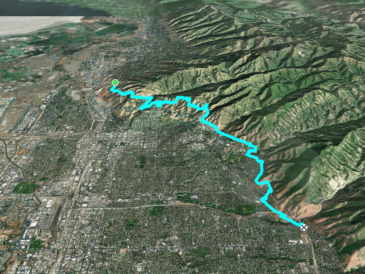
The Bonneville Shoreline Trail (BST) attempts to follow the bench that was formed by the ancient Lake Bonneville. "Lake Bonneville was the largest Late Pleistocene paleolake in the Great Basin of western North America,” according to Wikipedia. The lake covered most of western Utah and extended into Idaho and Nevada. At its largest, Lake Bonneville was more than 980 feet deep and covered over 20,000 square miles.


Today, the Bonneville Shoreline Trail only has 100 miles of trail designated along its planned route, but eventually, the proposed trail will cover a total of 280 miles! This route will eventually stretch from the Idaho border to Nephi, Utah.
The segment of the trail mapped here is a logical combination of completed singletrack trails that form part of the official Farmington to Salt Lake segment, along with the entirety of the official Salt Lake to Parley’s Canyon segment. This section of the BST is one of the most popular, in part because it connects many other trails in the Salt Lake City trail network together, and in part because it’s so easily-accessible.
Still, this segment as mapped is a substantial 19 miles long. Of these 19 miles, one of the most popular sections is the Dry Creek to City Creek section. This portion features rolling hills and respectable grades that will force you to work for it, but simultaneously reward you with beautiful views and relaxing downhills.
The final section as mapped is a mostly pavement connector that will get you from one section of singletrack to another. Just skip this section unless you’re planning a full through-hike of the BST.
Sources: http://www.bonnevilleshorelinetrail.org/ http://www.bonnevilleshorelinetrail.org/saltlaketoparleys/saltlaketoparleys.html https://en.wikipedia.org/wiki/LakeBonneville https://fatmap.com/routeid/181906/DryCreektoCityCreek/@41.2007977,-111.9179115,10979.5589354,-21.0131472,83.7202517,1959.1284340,normal
Difficult
Hiking trails where obstacles such as rocks or roots are prevalent. Some obstacles can require care to step over or around. At times, the trail can be worn and eroded. The grade of the trail is generally quite steep, and can often lead to strenuous hiking.

The trail contains some obstacles such as outcroppings and rock which could cause injury.

Close to help in case of emergency.
3.4 km away
A short hike to a stunning view of Salt Lake City from the top of Ensign Peak.
Moderate Hiking
9.7 km away
Quick suburban hike to a low summit.
Difficult Hiking

10 routes · Alpine Climbing · Hiking