5 m away
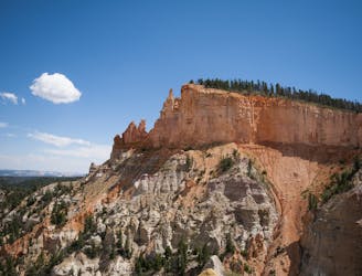
Bryce Rim Trail
Take a short or long walk on the edge of the plateau, gazing over the entire Bryce Amphitheater from above.
Moderate Hiking
- Distance
- 9 km
- Ascent
- 365 m
- Descent
- 200 m
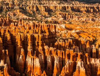
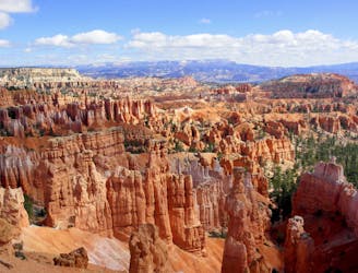
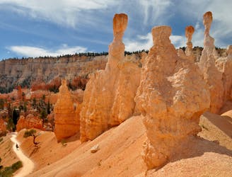
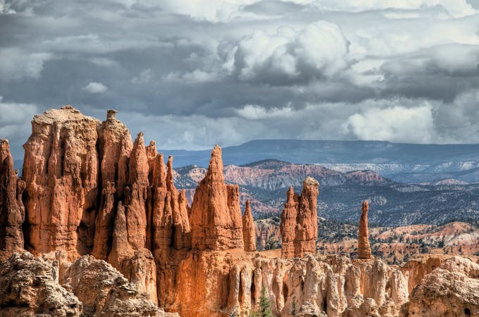
Let your imagination run wild among a maze of fantastically shaped hoodoos and other formations.
Hiking Difficult

The Fairyland Loop is one of the most spectacular trails in Bryce, but it remains less traveled than some others because of its location away from the campgrounds and lodge. Though the loop does link with the busy Sunrise Point, Fairyland Point is the further removed and more relaxed trailhead. You’ll likely have lots of company at the overlook, but crowds quickly disappear once you once you’re into the trail. You can choose to hike along the rim first or down into the canyons first, depending on the direction you take the loop.
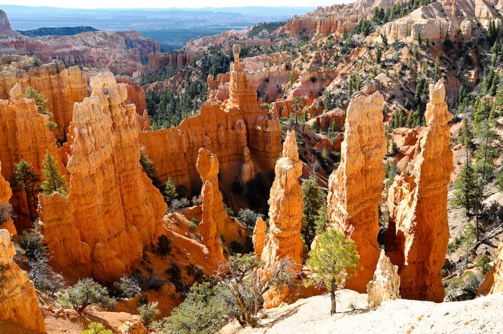
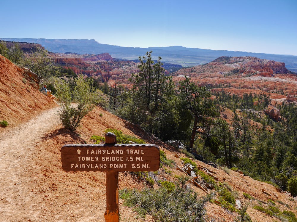
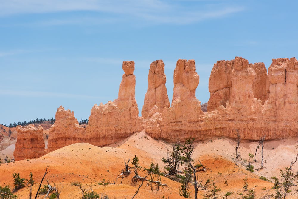
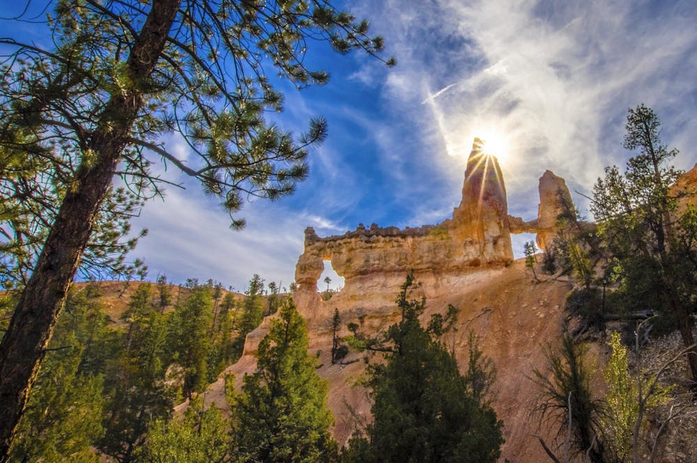
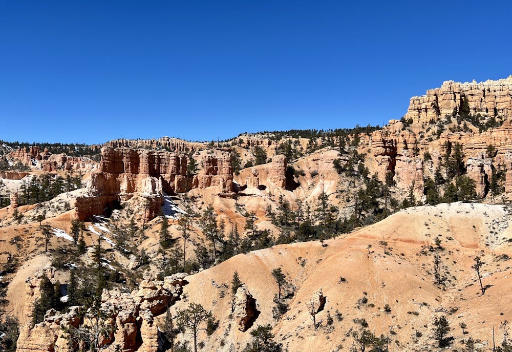
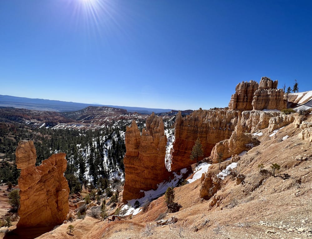
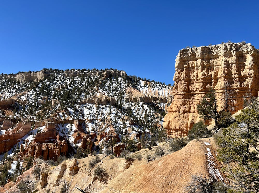
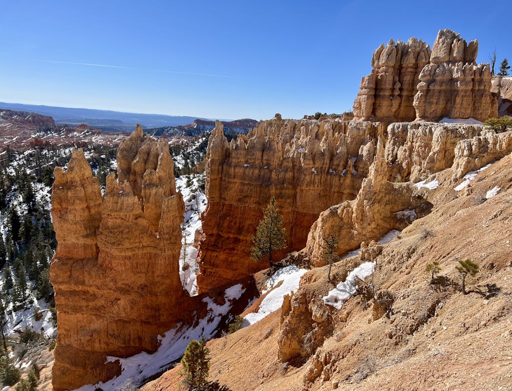
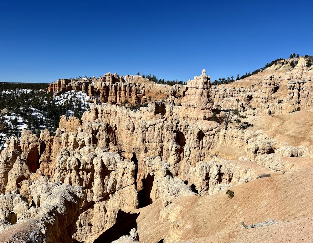
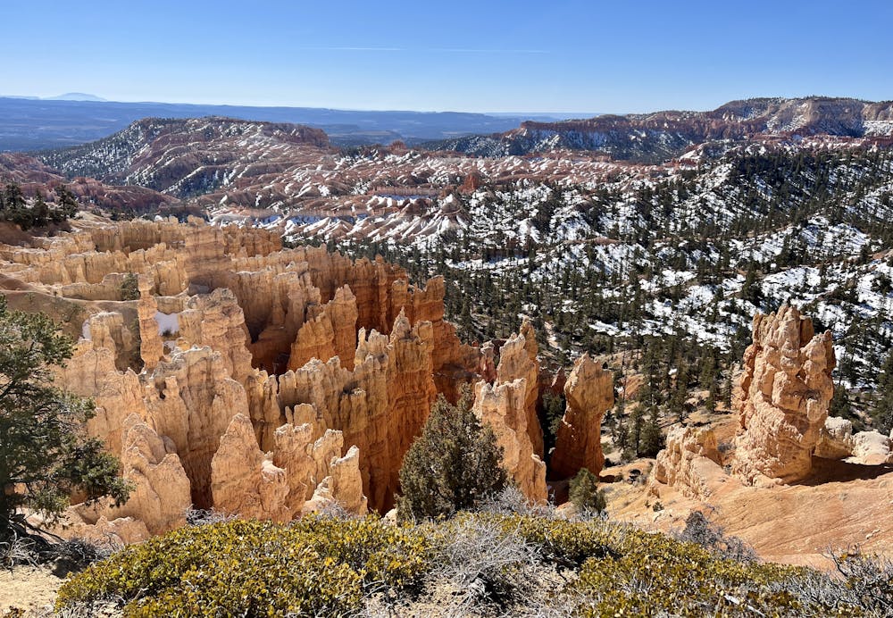
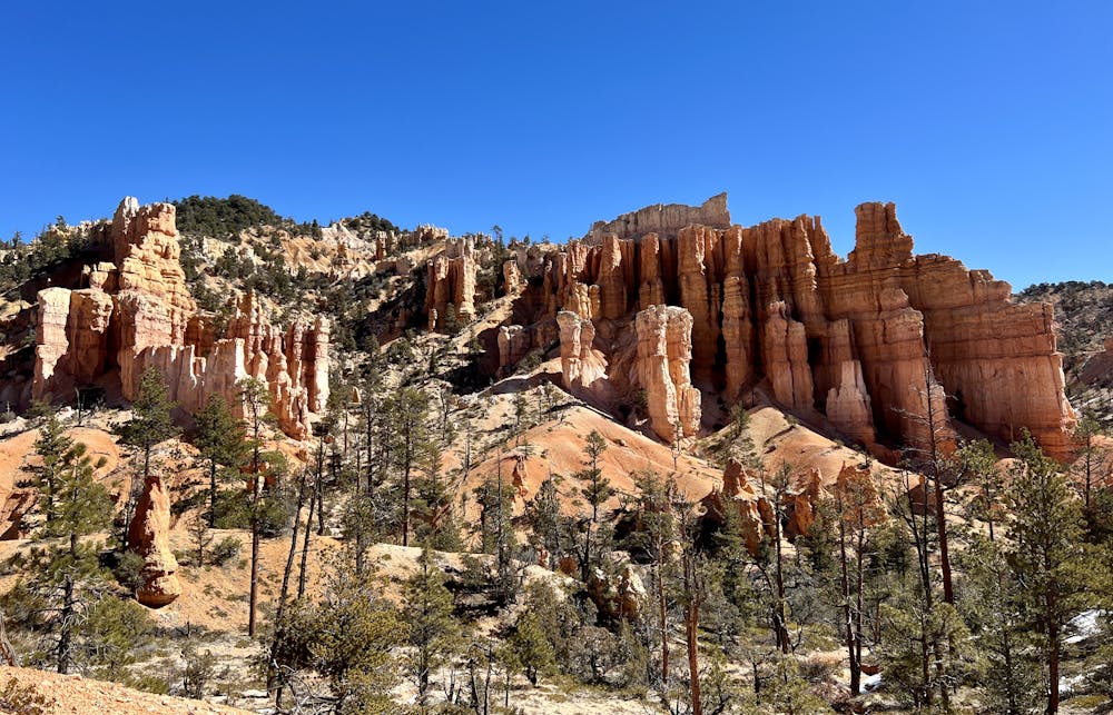
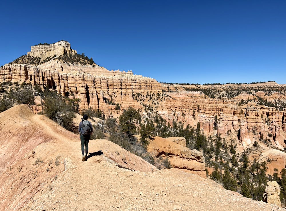
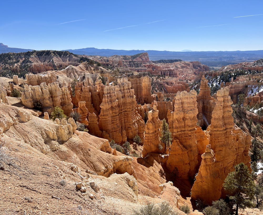
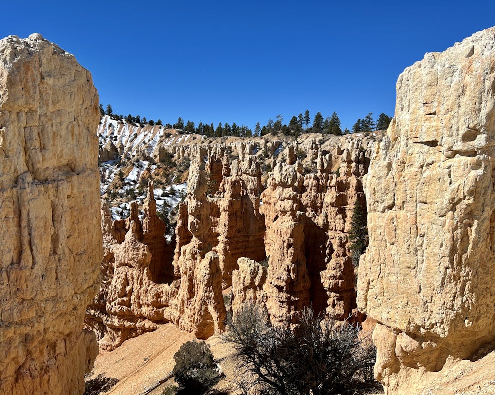
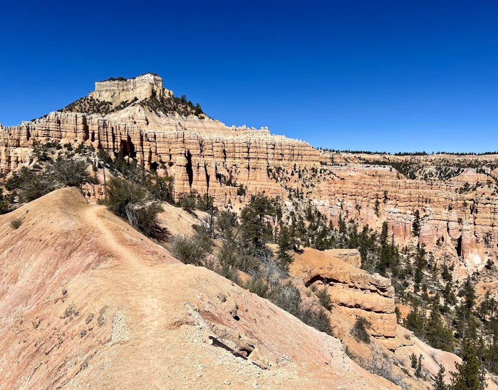
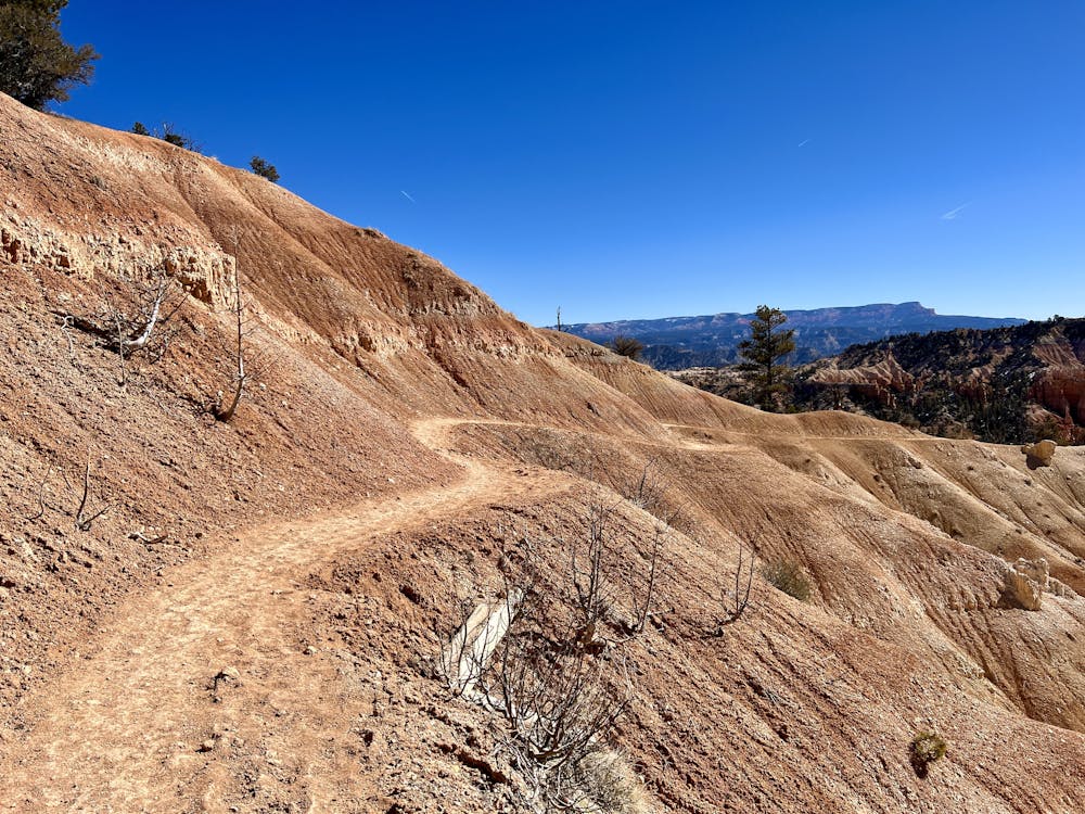
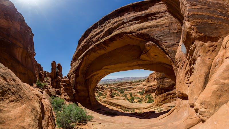
The rim features non-stop views over the amphitheater from above, on gentle ups and downs along a broad path. Beneath the rim, the trail stays wide and easy to follow, but with constant elevation changes and steeper sections as it winds throughout the natural statue garden. You’ll see colorful arches, windows, hoodoos, and pinnacles. Their shapes are so odd that you might imagine them as fairy castles or mythical creatures instead of rock formations. You’ll also weave along slopes and ledges with fantastic views find scenic spots to take breaks. Don’t miss out on the short spur to see Tower Bridge, a giant arch formation that resembles the famous London landmark.
Fairyland Loop remains open in winter, though the road to Fairyland Point may close for snow. In that case, you can usually still begin from Sunrise Point. Spikes and poles are recommended in winter because parts of the trail stay quite icy.
Sources: https://www.nps.gov/brca/planyourvisit/fairylandloop.htm https://utah.com/hiking/bryce-canyon-national-park/fairyland-loop-trail
Difficult
Hiking trails where obstacles such as rocks or roots are prevalent. Some obstacles can require care to step over or around. At times, the trail can be worn and eroded. The grade of the trail is generally quite steep, and can often lead to strenuous hiking.

The trail contains some obstacles such as outcroppings and rock which could cause injury.
Away from help but easily accessed.
5 m away
Take a short or long walk on the edge of the plateau, gazing over the entire Bryce Amphitheater from above.
Moderate Hiking
2.5 km away
The most popular hike in Bryce Canyon National Park.
Easy Hiking
5.1 km away
Bryce Canyon’s premier backcountry trail, far from the crowds and with secluded campsites for backpackers.
Difficult Hiking
5.1 km away
Marvel at a feast of rock formations along this twisting loop through the best of Bryce Canyon.
Difficult Hiking

10 routes · Hiking
6 routes · Hiking

10 routes · Hiking
5 routes · Hiking

63 routes · Alpine Climbing · Hiking