2.5 km away
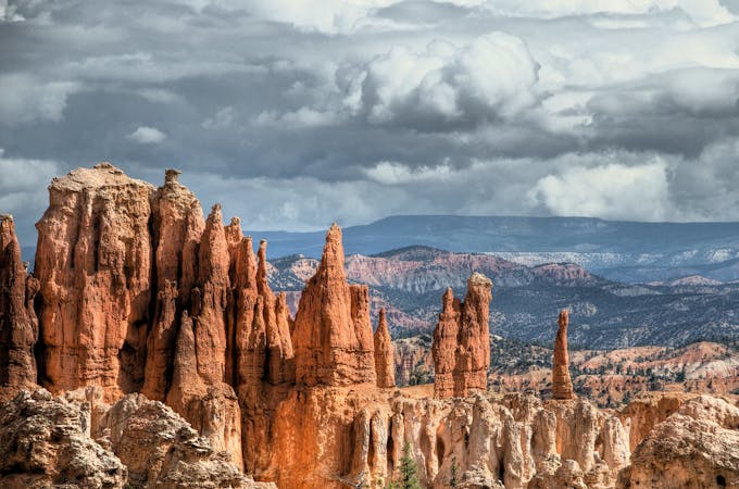
Fairyland Loop
Let your imagination run wild among a maze of fantastically shaped hoodoos and other formations.
Difficult Hiking
- Distance
- 13 km
- Ascent
- 488 m
- Descent
- 488 m
The most popular hike in Bryce Canyon National Park.
Hiking Easy

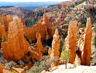
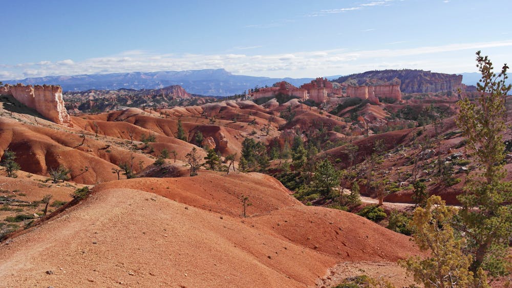
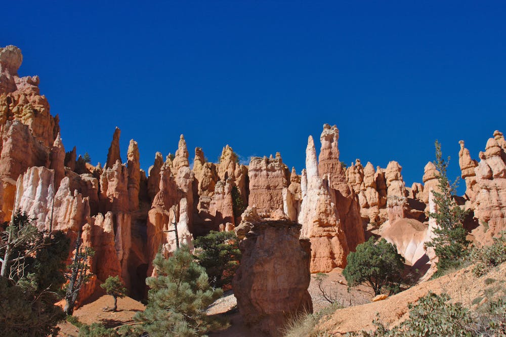
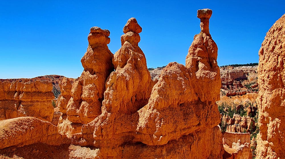
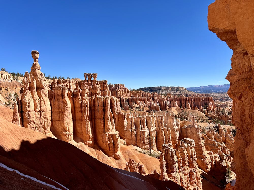
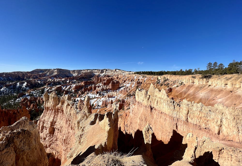
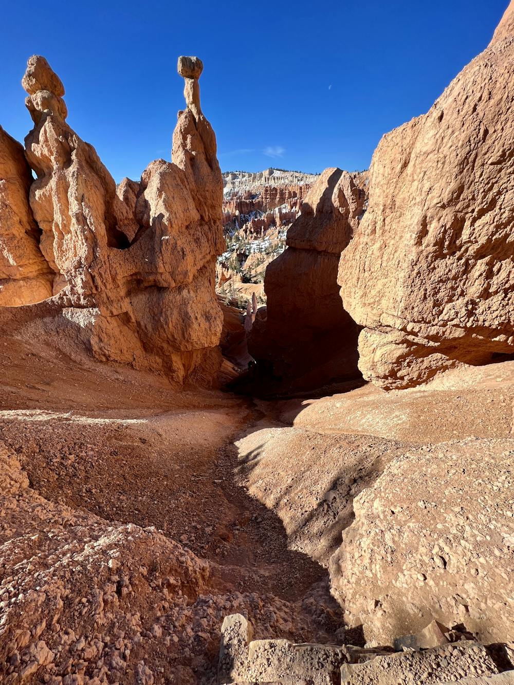
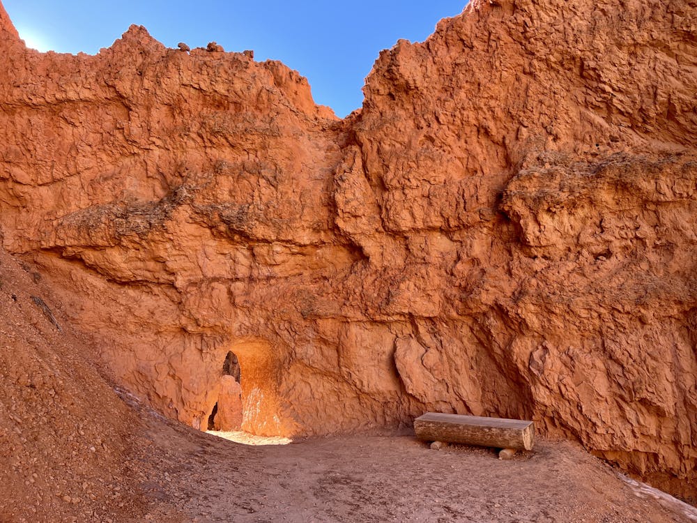
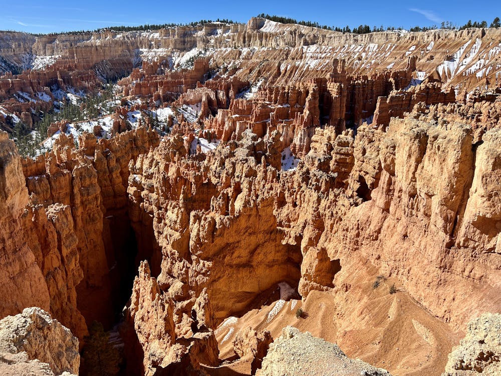
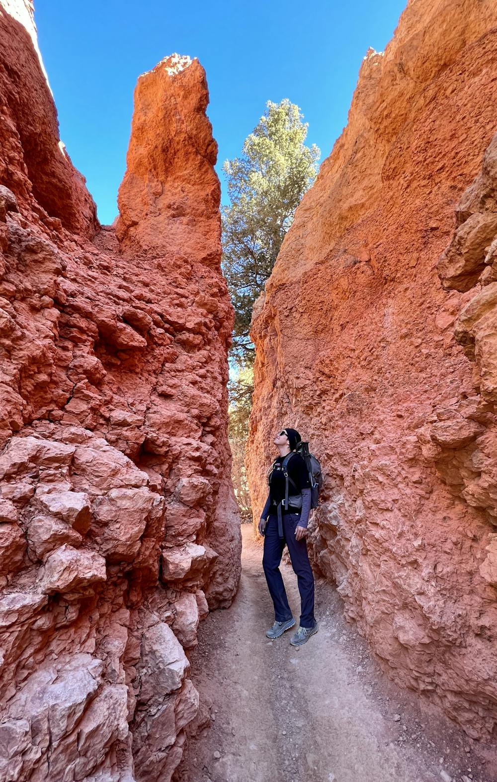
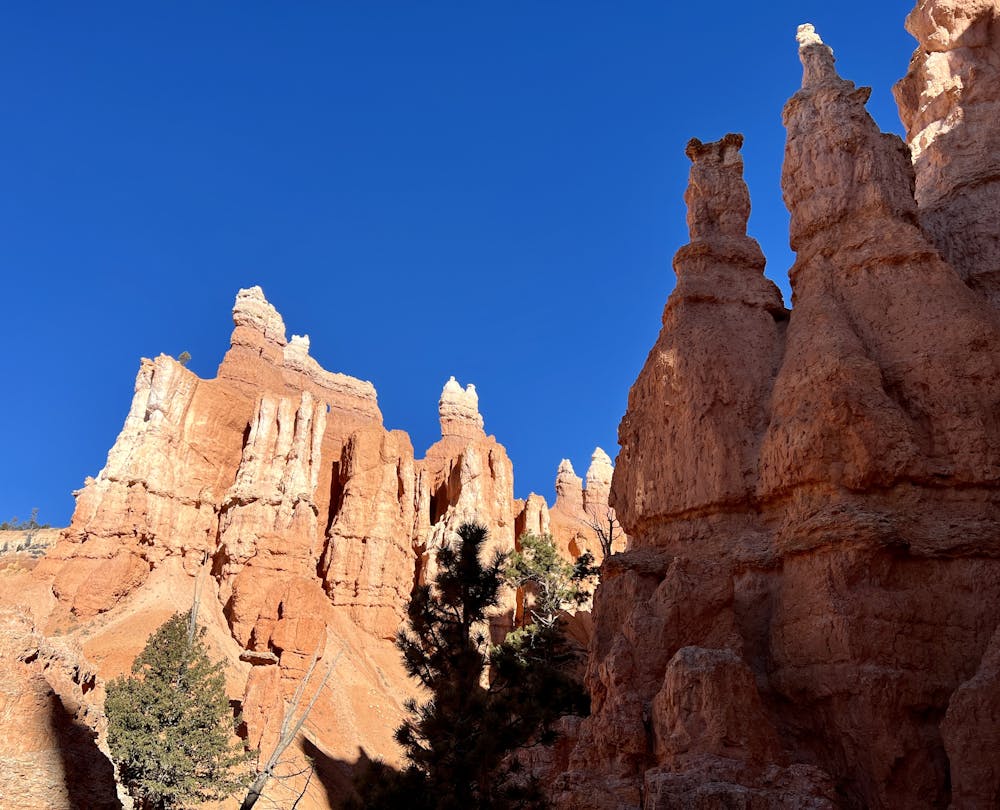
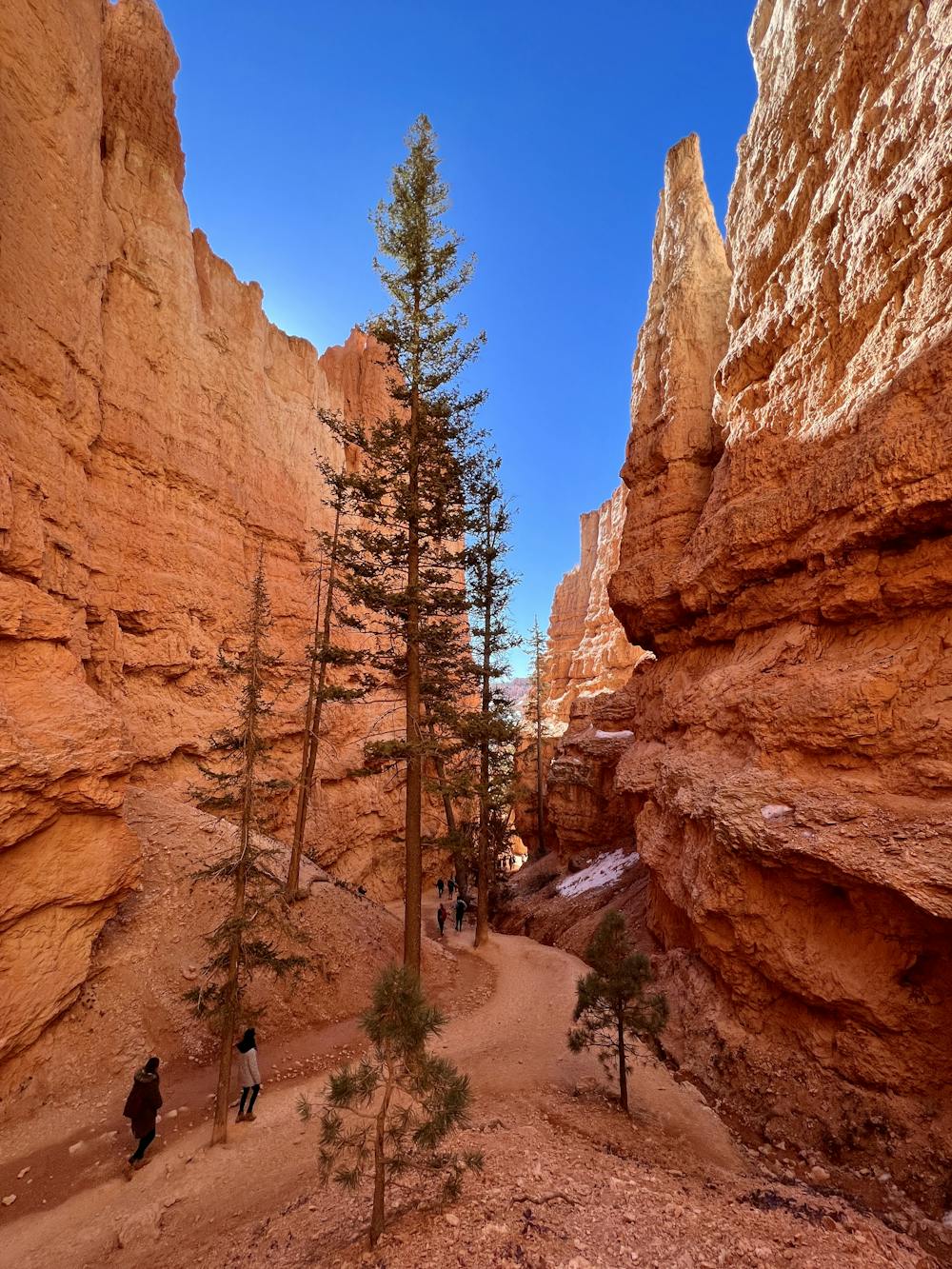
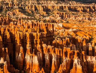
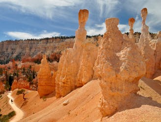
This short 3-mile loop combining the Queens Garden and Navajo trails is one of the most visually-stunning routes in all of Bryce Canyon National Park! The hard, smooth trail runs along "the tops of ridges” and "wind their way through a fairyland forest of towering hoodoos,” according to Lana Law on PlanetWare.com. "Mixed into the scene are a scattering of huge pines, dwarfed by the size of the stone formations that surround them,” she continues.
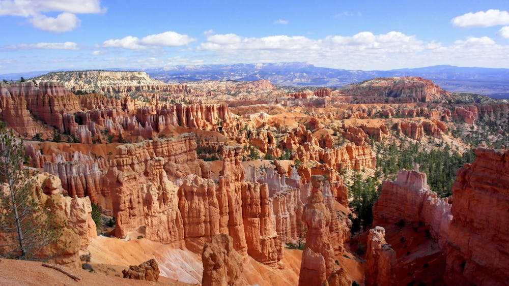
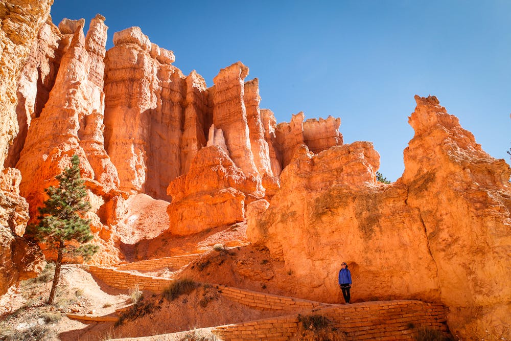
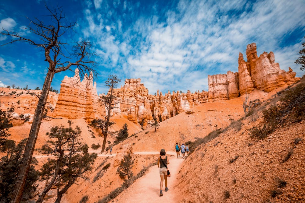
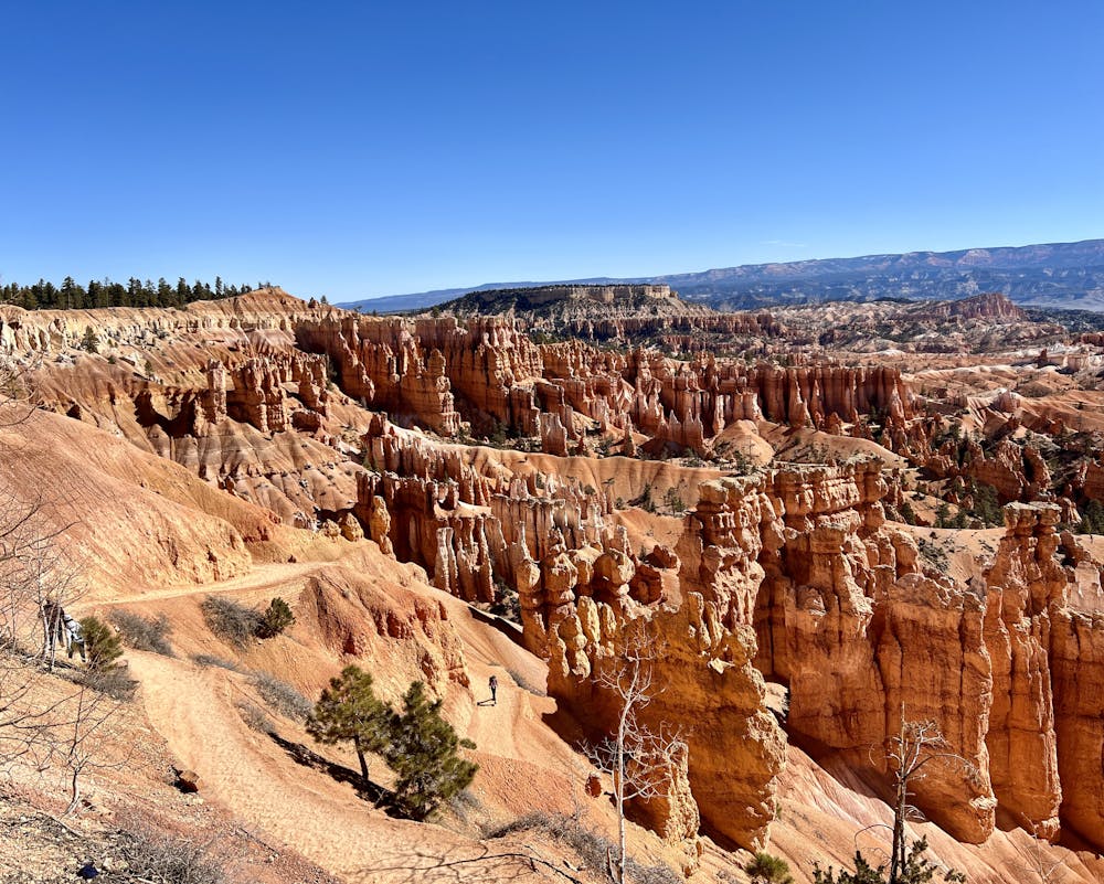
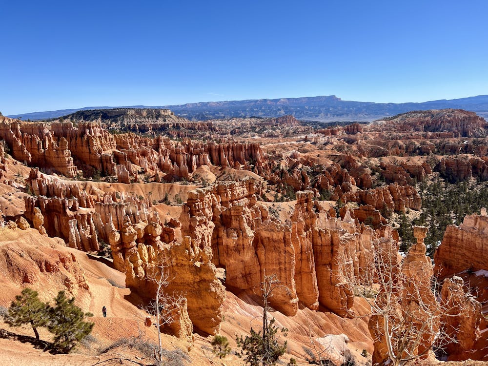
The incredible beauty of this hike makes it the most popular route in the national park. While you’ll share the hike with plenty of other tourists, you still have to complete this route and get up close and personal with Bryce’s incredible beauty.
Overall the trail is very smooth and easy to hike along. You won’t encounter any obstacles—instead, this is more of a sightseeing walk than an arduous hike. Consequently, we’ve assigned it the FATMAP rating of “Easy.” However, do note that the trail does climb and descend 620 vertical feet over the course of the three miles, meaning that you’ll still need a little fitness to complete the entire loop. And since the loop begins and ends at the high point, dropping to the low point in the middle, you should be certain that you can hike back out of the canyon before you descend into it.
If you want an even easier hike, consider simply walking out-and-back to either Sunrise or Sunset Point, both of which are passed if you complete the entire loop as mapped here. From the points, you’ll enjoy views of “burnt orange and cream banded hoodoos that rise up from the floor and walls of the canyon, and in the background, rolling hills that give way to distant mountains,” according to Law.
However you choose to tackle this route, be sure to pack your camera and savor the scenery—it’s not a race!
Source: https://www.planetware.com/utah/top-rated-hikes-in-bryce-canyon-national-park-us-ut-155.htm
Easy
Walking along a well-kept trail that’s mostly flat. No obstacles are present.

The path is on completely flat land and potential injury is limited to falling over.

Away from help but easily accessed.
2.5 km away
Let your imagination run wild among a maze of fantastically shaped hoodoos and other formations.
Difficult Hiking
2.5 km away
Take a short or long walk on the edge of the plateau, gazing over the entire Bryce Amphitheater from above.
Moderate Hiking
3 km away
Bryce Canyon’s premier backcountry trail, far from the crowds and with secluded campsites for backpackers.
Difficult Hiking
3 km away
Marvel at a feast of rock formations along this twisting loop through the best of Bryce Canyon.
Difficult Hiking

10 routes · Hiking
6 routes · Hiking

10 routes · Hiking
5 routes · Hiking

63 routes · Alpine Climbing · Hiking