7 m away
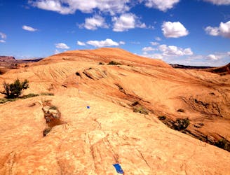
Slickrock Trail
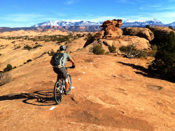
One of the original world-famous mountain bike trails, the unique slickrock slabs provide an otherworldly ride experience
Severe Mountain Biking
- Distance
- 16 km
- Ascent
- 388 m
- Descent
- 388 m
A fantastic change of pace from the classic Slickrock loop.
Mountain Biking Severe

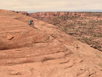
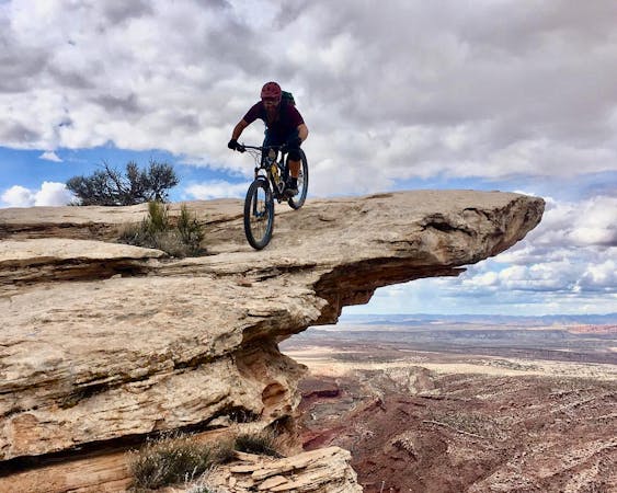
Above Abyss is an alternative route option in Moab's world-famous Slickrock. The OG Slickrock ride is one of the original internationally-famous mountain bike rides that helped launch one of the most popular destinations into the limelight. In this unique area, the endless slabs of slickrock sandstone provide an otherworldly ride experience, allowing you to power up near-vertical rock faces and rocket down the other side. On this ride, you'll follow a string of painted dots around a lunar-esque landscape, enjoying a mountain bike ride experience that you can only find here in Moab!
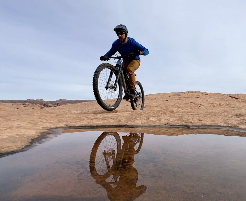
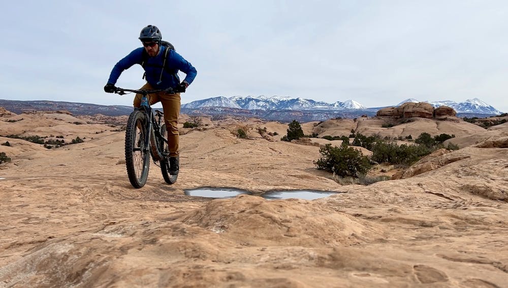
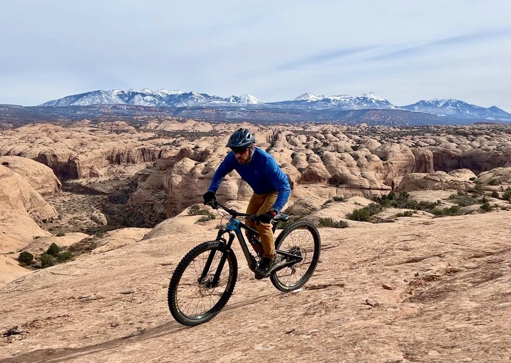
Going straight up and straight down the rock domes does get arduous and grueling after a while, so a trail called "Above Abyss" was added to the area. This non-motorized addition features a much more modern route design, with long sections of traversing around the domes instead of powering straight up and straight down.
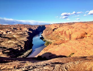
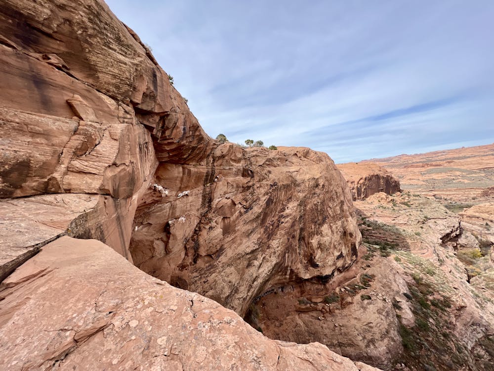
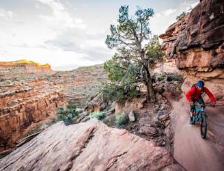
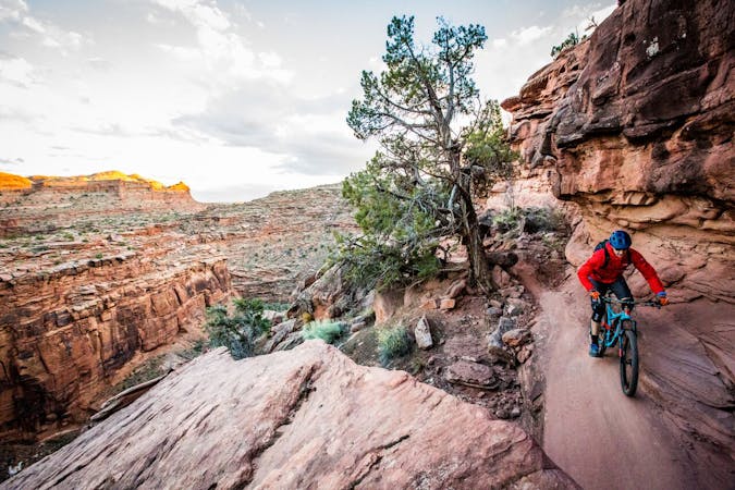
The trail gets its name from a canyon that it passes near, known as "Abyss Canyon." This dramatic cleft in the rock is a wondrous sight to behold, and traversing along the rocky rim hundreds of feet above the canyon floor is a surreal experience! In some places, you might wish that the route was actually closer to the rim than it is, so if you want to investigate, feel free to ride closer to the Abyss to take in the view. However, if you depart from the dotted line, be sure to stay on the rock and not crush any cryptobiotic soil and vegetation, and most importantly: don't fall off the edge!
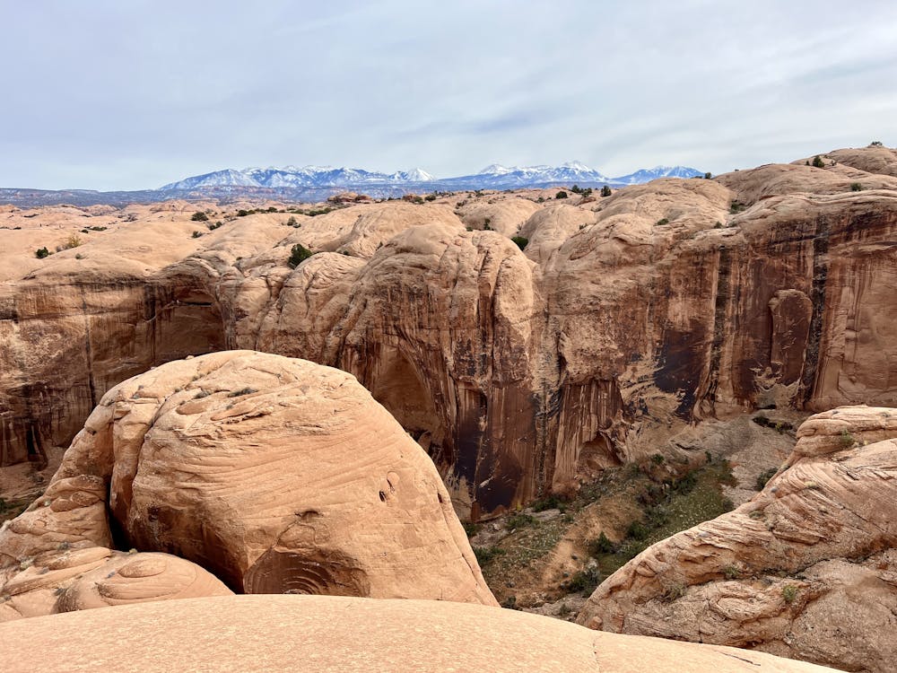
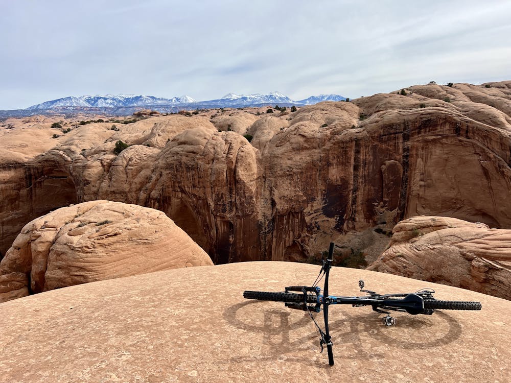
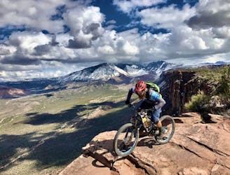
One of the most stunning sections of the trail traverses high above the famous Grandstaff Canyon, providing sweeping views of the La Sals in the background with the canyon down below in the foreground.
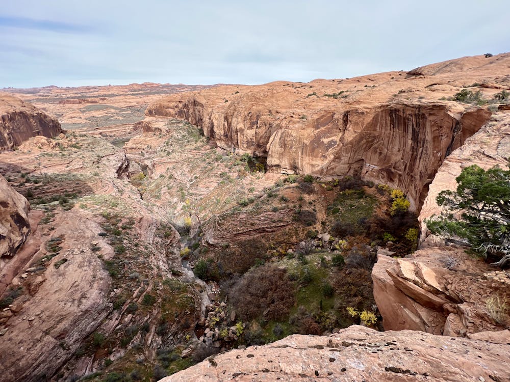
Finally, before exiting the trail, be sure to take the short dog leg to the viewpoint above Icebox Canyon. This small canyon is stunningly beautiful, and you might experience a dramatic sense of vertigo as you peek your head over the top of the cliff and realize that it's hundreds of feet straight down!
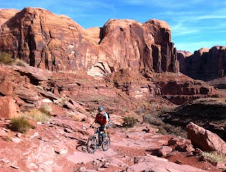
The route rejoins the Slickrock loop and then continues following the classic loop all the way around and back to the trailhead.
If you still feel like a glutton for punishment, consider adding two bonus spurs off of the main Slickrock Loop: Panorama Viewpoint and Portal Viewpoint. Portal Viewpoint is fairly short and easy to follow and reach, but Panorama Viewpoint requires substantial navigational skills to not get cliffed out. Neither of these trails is shown in this route line, but you can find the trails in the OSM layer in the map.
Severe
Widely variable, narrow trail tread with steeper grades and unavoidable obstacles of 15in/38cm tall or less. Obstacles may include unavoidable bridges 24in/61cm wide or less, large rocks, gravel, difficult root sections, and more. Ideal for advanced-level riders.

Some trail sections are extremely exposed where falling will almost certainly result in serious injury or death.

Away from help but easily accessed.
7 m away
One of the original world-famous mountain bike trails, the unique slickrock slabs provide an otherworldly ride experience
Severe Mountain Biking
8.9 km away
If death-defying ledge drops, massive boulders, narrow singletrack on top of a thousand-foot cliff, and jaw-dropping views constitute your idea of fun, then Rockstacker to Jackson's is for you!
Extreme Mountain Biking
8.9 km away
An incredible double loop covering several of the best mountain bike trails in the world!
Extreme Mountain Biking
9 km away
Porcupine Rim is a Moab classic in the true sense of the word. Mountain bikers have been braving Porcupine Rim's gnar since at least the 1980s.
Extreme Mountain Biking
9 km away
One of the original gnarly epics, the Amasa Back 4x4 trail still offers some serious gnar on the way down.
Severe Mountain Biking
9 km away
Captain Ahab combines the best new-school singletrack trail building techniques with Moab's famous views and challenging rocks for a classic mountain bike experience.
Extreme Mountain Biking
5 routes · Mountain Biking
20 routes · Mountain Biking

25 routes · Mountain Biking
4 routes · Mountain Biking · Hiking

37 routes · Mountain Biking
4 routes · Mountain Biking

25 routes · Mountain Biking

24 routes · Mountain Biking