4.7 km away
Monitor-Merrimac

A scenic, non-technical introduction to riding Moab's slickrock.
Moderate Mountain Biking
- Distance
- 9.8 km
- Ascent
- 182 m
- Descent
- 182 m
Prepare to have a blast playing on Bartlett's undulating slickrock terrain.
Mountain Biking Difficult

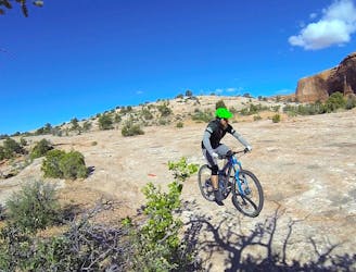
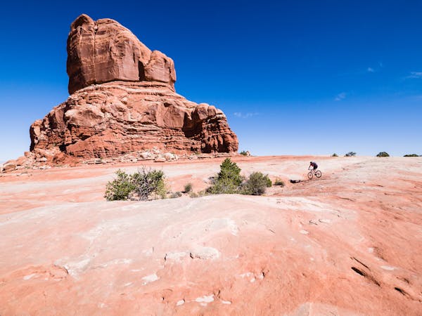
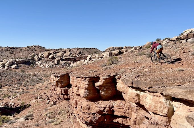
"Bartlett Wash is an Entrada sandstone slickrock ride featuring incredible views and fun undulating waves of great rock,” writes UtahMountainBiking.com. Unlike most other mountain bike rides, Bartlett Wash is actually more of a mountain biking playground than it is a destination-oriented pedal. Instead of covering ground, the goal here is to play!
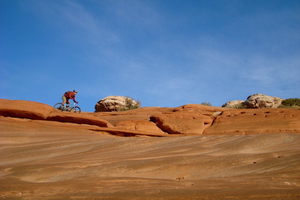
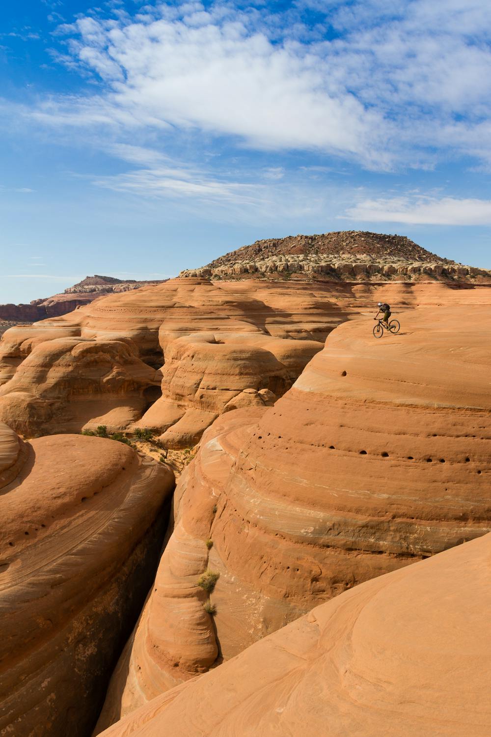
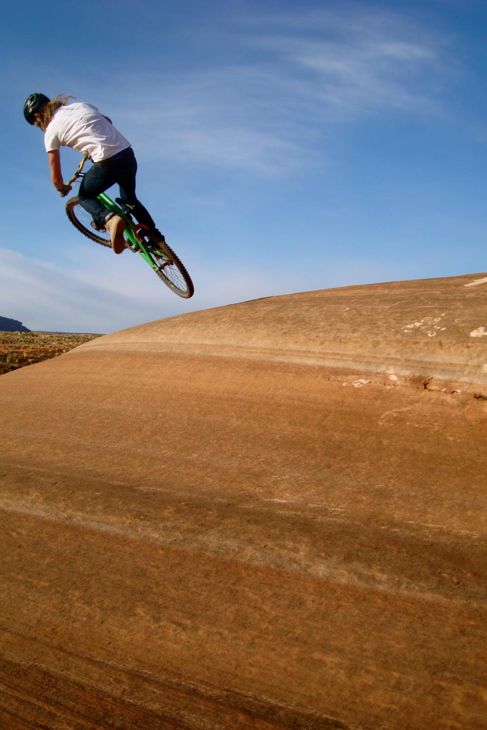
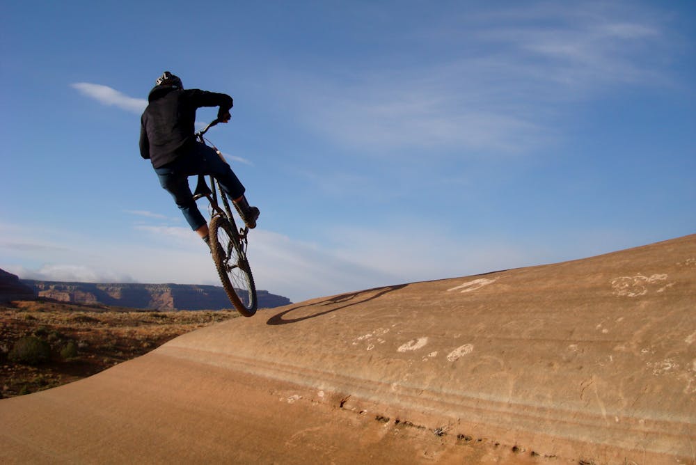
This massive expanse of slickrock is home to bowls, drops, dips, lips, and rock rollers, allowing creative mountain bikers to catch air, rip through bowls like a BMXer in a skatepark, or simply work on improving their bike handling skills on slickrock terrain. You can make your ride on Bartlett Wash as hard or as easy as you’d like, and as long or as short as you’d like.
This unique terrain has led Seth's Bike Hacks to dub this area "Nature's Skatepark." In fact, Seth is so stoked on Bartlett that he says it's "the most freaking awesome thing in the world."
"As someone with little interest in structured riding, it’s a dream come true," he continues. To get an idea of the creative lines you can put together in Bartlett Wash, be sure to watch Seth's video.
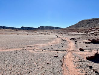
The route mapped here is drawn as an out-and-back along the slickrock face, from the parking area to the end and back. While you can choose to ride this route as mapped, if you want to get playful, keep your eyes open for creative and entertaining lines. It’s all fair game!
It’s fair game, that is, as long as you stay on the slickrock. Don’t venture off the rock in this area, as you’ll damage the cryptobiotic soil. But there’s plenty of rock ripping to be had, so enjoy!
Sources: https://www.utahmountainbiking.com/trails/bartlett.htm https://rimtours.com/tours/bartlett-wash/ https://www.youtube.com/watch?v=Rm9GEM4nAhw
Difficult
Mostly stable trail tread with some variability featuring larger and more unavoidable obstacles that may include, but not be limited to: bigger stones, roots, steps, and narrow curves. Compared to lower intermediate, technical difficulty is more advanced and grades of slopes are steeper. Ideal for upper intermediate riders.

Some trail sections have exposed ledges or steep ascents/descents where falling could cause serious injury.

Away from help but easily accessed.
4.7 km away
A scenic, non-technical introduction to riding Moab's slickrock.
Moderate Mountain Biking
8.9 km away
Navajo Rocks embodies new school Moab mountain biking at its finest!
Difficult Mountain Biking
8.9 km away
A superb XC loop at Klondike Bluffs.
Moderate Mountain Biking
8.9 km away
This expansive trail system features miles and miles of slickrock and singletrack spreading out in every direction. The options are seemingly endless!
Difficult Mountain Biking
20 routes · Mountain Biking
8 routes · Mountain Biking

25 routes · Mountain Biking
6 routes · Mountain Biking