4.7 km away
Bartlett Wash
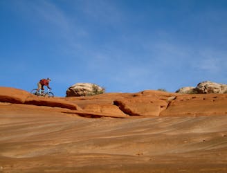
Prepare to have a blast playing on Bartlett's undulating slickrock terrain.
Difficult Mountain Biking
- Distance
- 9.2 km
- Ascent
- 207 m
- Descent
- 207 m
A scenic, non-technical introduction to riding Moab's slickrock.
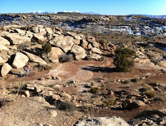
Mountain Biking Moderate

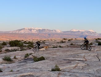
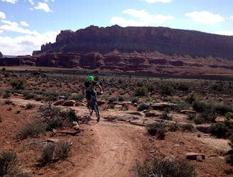
There are a LOT of riding options in the Moab area—after all, Moab is internationally known as a premier mountain biking destination. Famously, Moab riding is known for slickrock... lots and lots of slickrock! The Monitor-Merrimac route is perfect for a non-technical introduction to riding it.
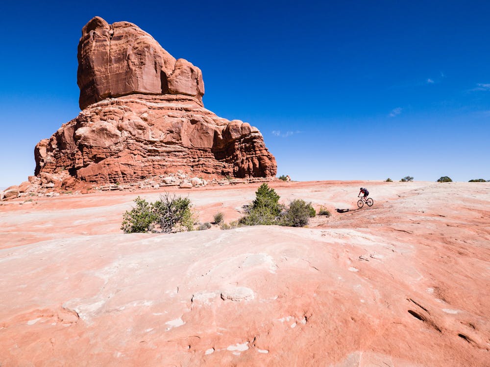
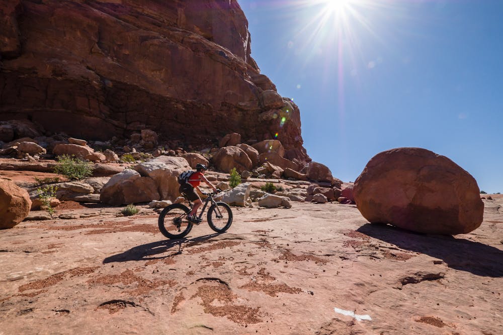
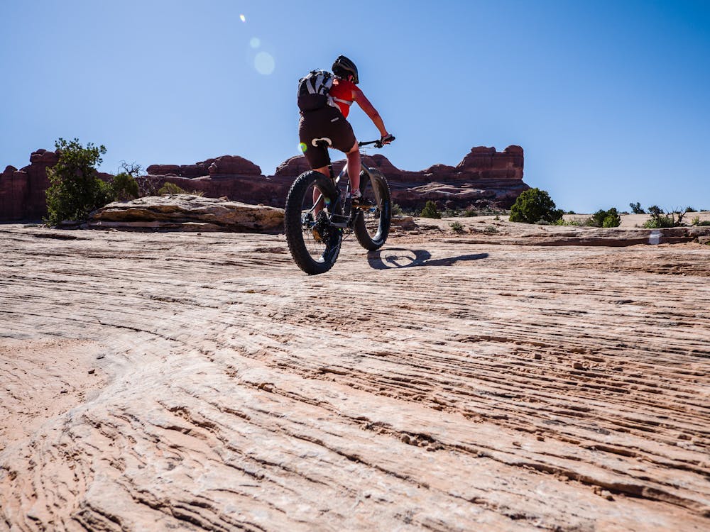
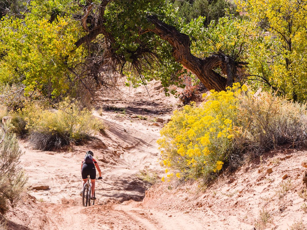
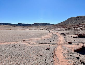
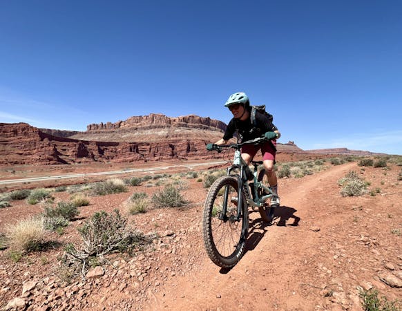
This ride starts about 15 miles from Moab, with ample parking on Mill Canyon Road. The classic 7-mile ride is a loop that is most commonly ridden clockwise, but is also quite excellent counter-clockwise. The main choice is whether to ride the sandy Mill Canyon first (as an ascent) or last (as a descent). Either way, mountain bikers may have to do some hike-a-bike to negotiate the deep sand, while fat bikers can cruise right on top.
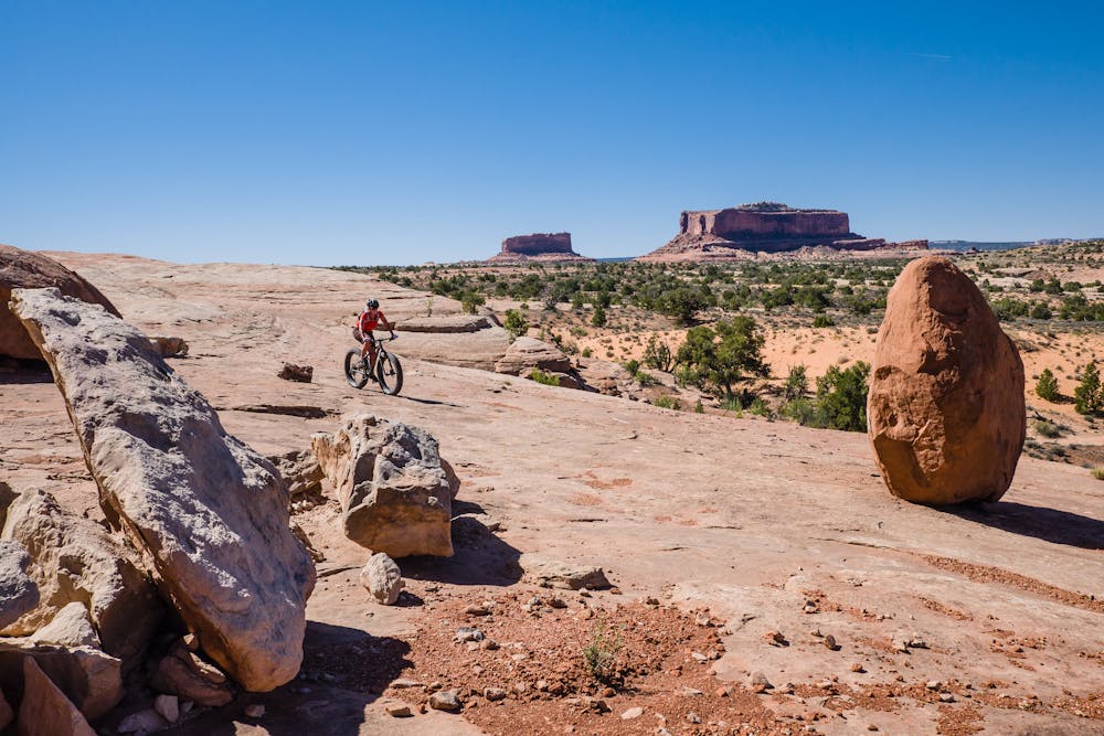
The highlight of the loop is an amazing intro-level, non-technical, slickrock playground with stunning views of the eponymous Monitor and Merrimac Buttes. The impressive rock formations are named for their resemblance to the historic Civil War “ironclads” the USS Monitor, and the larger CSS Merrimack.
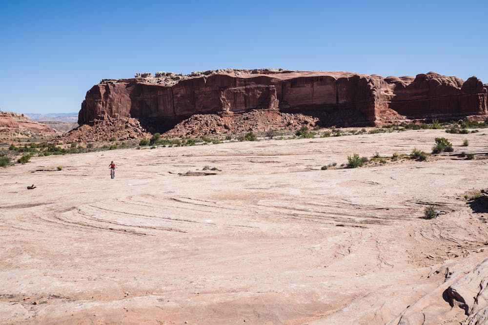
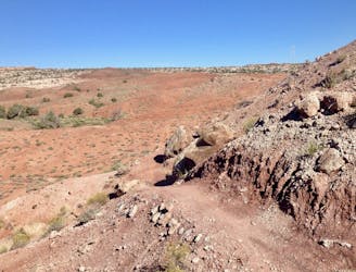
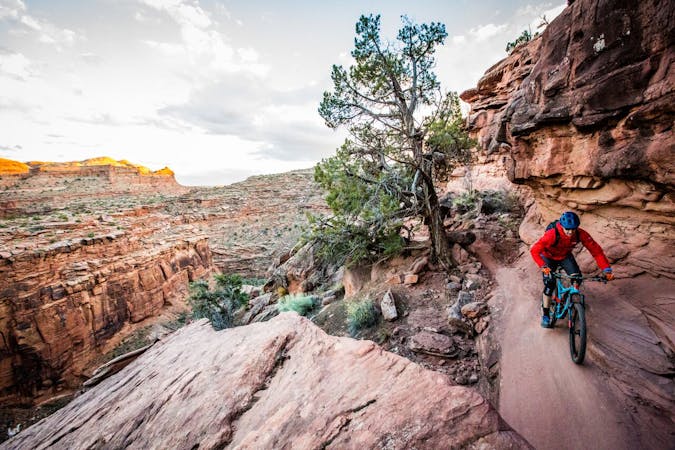
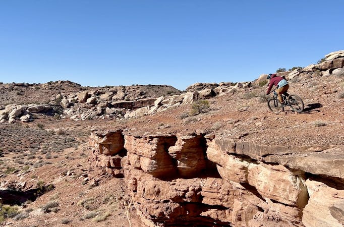
The glory of this route is the ample slickrock riding that circumnavigates a huge rock formation. One of the first things to know about slickrock riding is that routes are marked by painted white dots. Following the dots is easy for the most part, but it is necessary to keep one's eyes peeled! The massive expanse of slickrock provides plenty of opportunity to practice step-ups and ledge drops that are not too risky. In fact, the Monitor-Merrimac loop is widely known as the “easiest” slickrock riding in the Moab area.
For view-junky riders, the riding is easy enough and the mileage is short enough to afford plenty of scenic appreciation. There are “Wow” places aplenty, like the huge rock sitting all by itself, a kind of otherworldly outlier that appears to have been dropped out of the sky.
The route is mostly easy to follow, with carsonite posts marked with a bike icon and arrow. In the washes before and after the slickrock, there is a place here-and-there that can cause a head-scratching moment, so one should pay attention.
After riding Monitor-Merrimac, riders will feel ready to take on some of the more technical routes in the massive Moab mountain bike trail system!
Moderate
Mostly stable trail tread with some variability, with unavoidable obstacles 8in/20cm tall or less. Other obstacles such as rock gullies and steep sections may exist. Ideal for lower intermediate riders.

The trail contains some obstacles such as outcroppings and rock which could cause injury.
Away from help but easily accessed.
4.7 km away
Prepare to have a blast playing on Bartlett's undulating slickrock terrain.
Difficult Mountain Biking
5.7 km away
This expansive trail system features miles and miles of slickrock and singletrack spreading out in every direction. The options are seemingly endless!
Difficult Mountain Biking
5.7 km away
A superb XC loop at Klondike Bluffs.
Moderate Mountain Biking
6.6 km away
Rock gardens and rock slabs interspersed with sandy stretches make for an ever-changing ride.
Severe Mountain Biking
7.5 km away
While easier than most trails in the region, Klonzo is still full-on Moab.
Moderate Mountain Biking
9.9 km away
A fantastic intro to riding on Moab's slickrock slabs.
Difficult Mountain Biking
9.9 km away
The Lazy EZ beginner loop isn’t actually lazy and it’s not all that easy, but compared to other trails in Moab this is a great beginner option that’s also entertaining and scenic.
Easy Mountain Biking
9.9 km away

A flowier side to the Moab Brand Trails
Difficult Mountain Biking
9.9 km away

New school chunky Moab singletrack leads to a ripping fast drop down a steep slickrock slab.
Severe Mountain Biking
9.9 km away

Rock slab upon rock slab and rock garden upon rock garden combine to create high-quality new school Moab singletrack.
Severe Mountain Biking
20 routes · Mountain Biking

8 routes · Mountain Biking

25 routes · Mountain Biking
7 routes · Mountain Biking
6 routes · Mountain Biking