706 m away
God's Lawnmower

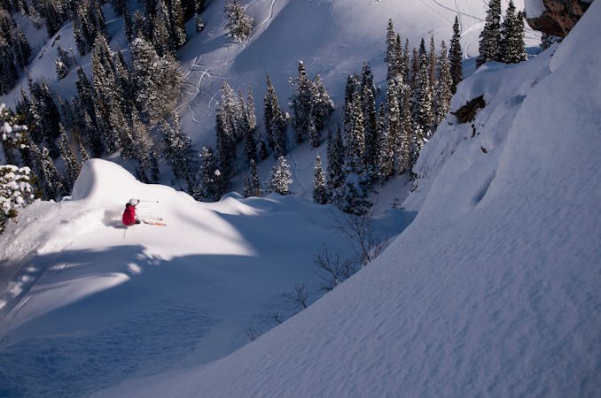
This is the huge avalanche path that's visible from the road on the N slope of Kessler Peak.
Difficult Ski Touring
- Distance
- 2 km
- Ascent
- 2 m
- Descent
- 946 m
This is the easiest and most direct way to skin to the top of Kessler Peak and enjoy one of it's many great runs.
Ski Touring Difficult

Park 7.1 miles up Big Cottonwood road on your right, at the base of the Argenta slide path. Head up the slide path using kick turns to gain the steep slope. Continue 2,000 feet up the slide path, staying near the sides if there are any avalanche concerns. Trend to the right, and once you gain the upper basin keep to the right and head into the thick spruce forest. You will gain the ridge through these trees. Once on the ridge head left, SW and stay on the ridge as much as possible as you skin up. The summit is off a bit to the right as you climb, and will become easy to locate. Once on top, there are many great runs on several good aspects to descend!
Difficult
Serious gradient of 30-38 degrees where a real risk of slipping exists.

Exposure is limited to that of the slope itself. Getting hurt is still likely if the slope is steep and/or the snow is hard.

In the high mountains or remote conditions, all individuals must be completely autonomous in every situation.
706 m away
This is the huge avalanche path that's visible from the road on the N slope of Kessler Peak.
Difficult Ski Touring
937 m away

A big fun run off of Kessler Peak with some great chute and trees skiing involved.
Difficult Ski Touring
2.7 km away

Virginia Slims is the fun dogleg chute next to the more popular Old Growth chute in the lower reaches of Cardiff Fork.
Difficult Ski Touring
3 km away

Old Growth chute is a mini classic that provides great rock wall lined ambience and easy access.
Difficult Ski Touring
5.9 km away

Stairs Gulch is 4,000 feet long, serious with a combination of a steep, technical chute and a flat, more mellow finish.
Difficult Ski Touring
6.8 km away

Major Tom is a steep and sporty couloir in a remote corner of the Wasatch that can have a few rappels to navigate!
Extreme Ski Touring
7.9 km away

Scotty's is a classic north facing roadside attraction in upper Little Cottonwood Canyon.
Difficult Ski Touring
8.2 km away

Access from Brighton to backcountry zones like Patsy Marley and Wolverine Cirque.
Moderate Ski Touring
8.6 km away

Memorial #1 is a very long and clean chute that runs off the ridge of the S summit of Mount Olympus.
Difficult Ski Touring
8.8 km away

Tolcat Canyon is the large and prominent chute that splits the N and S summits of Mount Olympus.
Difficult Ski Touring

18 routes · Resort Ski Touring · Ski Touring
9 routes · Resort Ski Touring · Ski Touring