4.1 km away
God's Lawnmower

This is the huge avalanche path that's visible from the road on the N slope of Kessler Peak.
Difficult Ski Touring
- Distance
- 2 km
- Ascent
- 2 m
- Descent
- 946 m
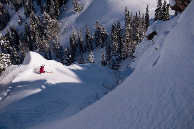
The East Face of Reynonlds Peak is a classic intermediate run in Big Cottonwood.
Ski Touring Difficult

The approach to Reynolds Peak is best accessed by parking at the Spruces Campground 9.7 miles up Big Cottonwood Canyon. Cross the highway to the N side of the road and follow the Mill D North trail through the cabins and up the drainage. Branch to the left/W at the junction, you may or may not find a trail sign here. Work up the gully to the base of the peak, but don't go straight up the face, head to the N and work up through the trees, then traverse along the ridge to reach the summit.
From the top of Reynolds peak you'll enter the East Face for some great turns on a wide open face in the upper thirty degrees. Be very careful about wind loading on this slope and make sure avalanche danger is low. The face is five to six hundred feet long before it benches out and rolls over again for a nice treed run until you hit the gully. Follow this down and out to the trail, and back down to the road.
Difficult
Serious gradient of 30-38 degrees where a real risk of slipping exists.

Exposure is limited to that of the slope itself. Getting hurt is still likely if the slope is steep and/or the snow is hard.

In the high mountains or remote conditions, all individuals must be completely autonomous in every situation.
4.1 km away
This is the huge avalanche path that's visible from the road on the N slope of Kessler Peak.
Difficult Ski Touring
4.6 km away

A big fun run off of Kessler Peak with some great chute and trees skiing involved.
Difficult Ski Touring
4.9 km away

Virginia Slims is the fun dogleg chute next to the more popular Old Growth chute in the lower reaches of Cardiff Fork.
Difficult Ski Touring
5.2 km away

Old Growth chute is a mini classic that provides great rock wall lined ambience and easy access.
Difficult Ski Touring
8.3 km away

Access from Brighton to backcountry zones like Patsy Marley and Wolverine Cirque.
Moderate Ski Touring
8.7 km away

Major Tom is a steep and sporty couloir in a remote corner of the Wasatch that can have a few rappels to navigate!
Extreme Ski Touring
9.8 km away

Stairs Gulch is 4,000 feet long, serious with a combination of a steep, technical chute and a flat, more mellow finish.
Difficult Ski Touring
9 routes · Resort Ski Touring · Ski Touring