1.4 km away
Stairs Gulch

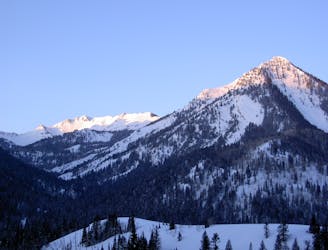
Stairs Gulch is 4,000 feet long, serious with a combination of a steep, technical chute and a flat, more mellow finish.
Difficult Ski Touring
- Distance
- 3.1 km
- Ascent
- 0 m
- Descent
- 1.5 km

The Spindrift Couloir runs off of Storm Mountain and is one of the longest, steepest, and tightest lines in the Wasatch Mountains. It averages around 45 degrees and involves 2-4 rappels depending on conditions.
Ski Touring Extreme

Storm Mountain is a very rugged and rocky peak in the lower reaches of Big Cottonwood Canyon. It takes the right year with enough snowfall for the few lines that exist on it to fill in. The Spindrift Couloir starts from near the summit of Storm Mountain and drops down 3,000 feet averaging around 45 degrees before it empties into Stairs Gulch.
Recommended gear: Two 60m dynamic ropes, enough gear to build 2-3 rappel anchors, steel crampons and two ice tools for down climbing short ice sections.
To access, park at the Ferguson trailhead and follow the trail up into the canyon. This is a very steep and narrow canyon. Stay on the trail which heads right up the bottom, and then switches back and forth on the N side of the canyon until it branches off to the E through some thick brush. Battle your way up the canyon, staying in the upper gully until it opens up into a mellow treed basin. Stay to the left side of the canyon and you'll be able to see the summit of Storm Mountain. Head past it a little bit and find a prominent W facing couloir to climb up. Once you hit the ridge climb up and to the left until you gain the summit. Drop in here!
The upper section drops fall line down through the trees with a slope angle in the upper 40's. The line narrows into a tight pinch that may, or may not have a short ice bulge. It then opens up into a little pocket with a large live tree off to the skiers right. This is the first rappel where two 60m ropes are recommended. Rappel over the rocks and near the end of the lines you'll find a little cave to climbers left where you can place protection for the second rappel (dynamic ropes are recommended, the added stretch may be needed to reach the lower snowfield). This will dump you onto the steepest section of the line. From here drop down a few hundred feet in the open pocket. Below you the run narrows into a stunning and proper wall lined couloir. Depending on snow levels you may need to set up a short rappel, or down climb this little icy/rocky bulge. There is a good rock crack above and to the skiers right that will take pitons and pins. Enjoy the tight turns in the heart of this beautiful line for several hundred feet. The chute ends in a cliff.
Skirt out to skiers left to another chute that will drop you into the large open gully. Some down climbing over ice may be necessary here, or there are some small trees to sling for a quick rappel. The open gully will tighten down into another fun chute, until it opens up to the exit apron. The apron spills out into the lower portion of Stairs Gulch where you'll continue down, keeping to the right of the drainage until you hit a faint trail that will spit you out onto the Big Cottonwood Canyon road.
Extreme
Extreme skiing terrain above 45 degrees. These routes are reserved for experienced experts.
1.4 km away

Stairs Gulch is 4,000 feet long, serious with a combination of a steep, technical chute and a flat, more mellow finish.
Difficult Ski Touring
5 km away

Major Tom is a steep and sporty couloir in a remote corner of the Wasatch that can have a few rappels to navigate!
Extreme Ski Touring
5.8 km away

Probably the longest, most consistent rock-lined chute in the Wasatch if you're into that sort of thing.
Severe Ski Touring
5.9 km away

Memorial #1 is a very long and clean chute that runs off the ridge of the S summit of Mount Olympus.
Difficult Ski Touring
6 km away

Tolcat Canyon is the large and prominent chute that splits the N and S summits of Mount Olympus.
Difficult Ski Touring
6.1 km away

Memorial #3 is one of the classic steep lines on the backside of Mount Olympus with large dramatic rock lined walls.
Difficult Ski Touring
6.2 km away

This is the steepest and longest of the Memorials with excellent pitch and beautiful rock lined walls.
Severe Ski Touring
6.4 km away

A big fun run off of Kessler Peak with some great chute and trees skiing involved.
Difficult Ski Touring
6.5 km away

Medusa's Face is the most gawked over and coveted, but rarely skied lines in the Wasatch Mountains.
Extreme Ski Touring
6.5 km away

The Apollo Couloir is the shorter, mellower sister chute to the Zeus Couloir on the magnificent northwest face of Mount Olympus.
Extreme Ski Touring