2 km away
Stairs Gulch

Stairs Gulch is 4,000 feet long, serious with a combination of a steep, technical chute and a flat, more mellow finish.
Difficult Ski Touring
- Distance
- 3.1 km
- Ascent
- 0 m
- Descent
- 1.5 km
A tight chute into a wide bowl that turns into some nice tree skiing
Ski Touring Severe

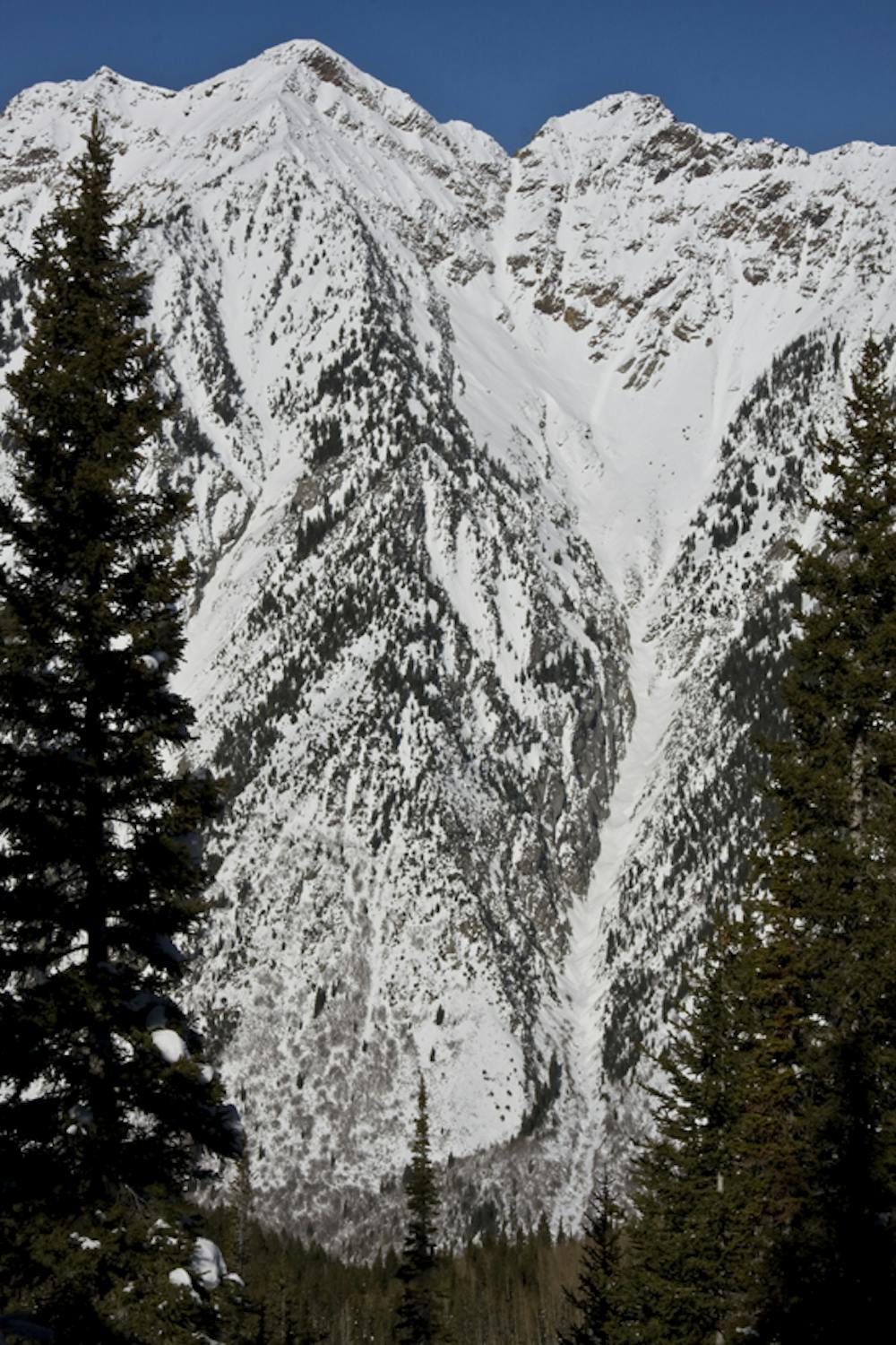
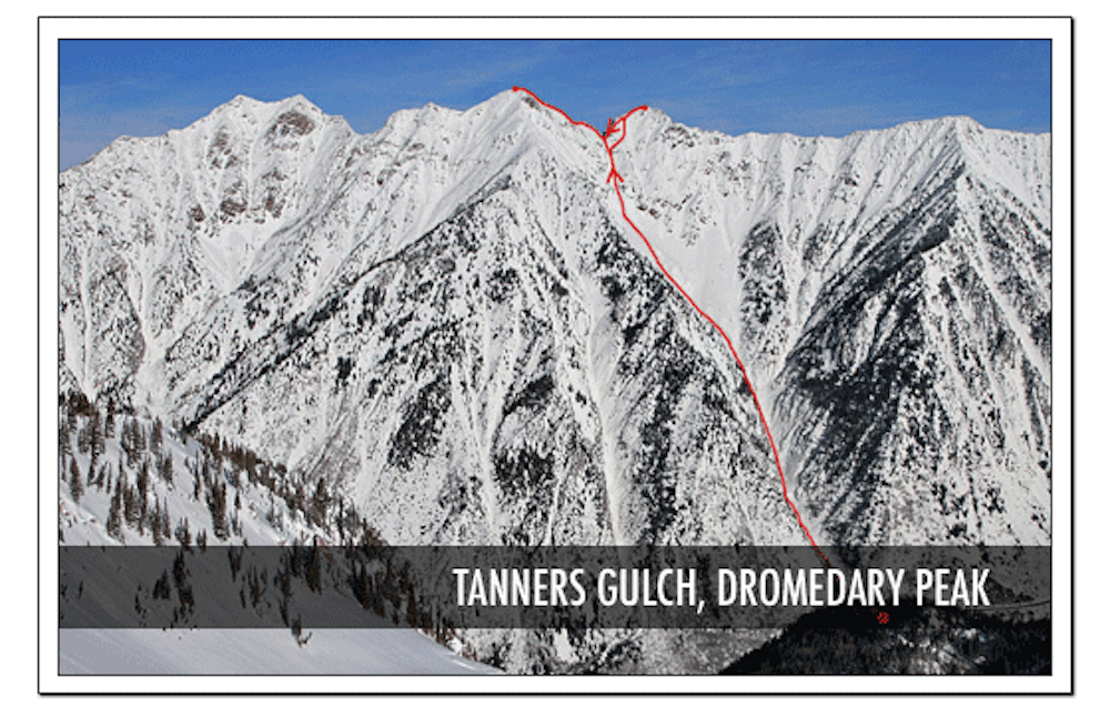
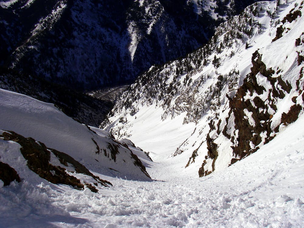
Tanner Gulch is considered a “classic couloir” that begins with a headwall chute, opens up to a large apron and open bowl with fun rolling terrain all the way to the bottom. You would go up the upper western chute, with the reward of a wide, steep, sustained 40 degree descent. It is also a an avalanche terrain trap, as it is a long sustained funnel, with the lower fifth serving as a depository for any debris that rips from above. To the saddle its a 4.3 mile hike, beginning at 7,400 ft elevation, and topping out 3,400 vertical ft higher (By comparison, the highest you can obtain at a Utah ski resort is 3,243 vertical feet at Snowbird).
Severe
Steep skiing at 38-45 degrees. This requires very good technique and the risk of falling has serious consequences.

In case of a fall, death is highly likely.
Little chance of being seen or helped in case of an accident.
2 km away
Stairs Gulch is 4,000 feet long, serious with a combination of a steep, technical chute and a flat, more mellow finish.
Difficult Ski Touring
4.1 km away

Probably the longest, most consistent rock-lined chute in the Wasatch if you're into that sort of thing.
Severe Ski Touring
4.5 km away

Scotty's is a classic north facing roadside attraction in upper Little Cottonwood Canyon.
Difficult Ski Touring
4.9 km away

A big fun run off of Kessler Peak with some great chute and trees skiing involved.
Difficult Ski Touring
5.3 km away

This is the huge avalanche path that's visible from the road on the N slope of Kessler Peak.
Difficult Ski Touring
5.7 km away

The Dresden is one of the longest and most continually steep faces in the Wasatch.
Severe Ski Touring
5.8 km away

Old Growth chute is a mini classic that provides great rock wall lined ambience and easy access.
Difficult Ski Touring
5.9 km away

Virginia Slims is the fun dogleg chute next to the more popular Old Growth chute in the lower reaches of Cardiff Fork.
Difficult Ski Touring
7.6 km away

Major Tom is a steep and sporty couloir in a remote corner of the Wasatch that can have a few rappels to navigate!
Extreme Ski Touring
8.9 km away

Memorial #1 is a very long and clean chute that runs off the ridge of the S summit of Mount Olympus.
Difficult Ski Touring

18 routes · Resort Ski Touring · Ski Touring