1 km away
Stairs Gulch

Stairs Gulch is 4,000 feet long, serious with a combination of a steep, technical chute and a flat, more mellow finish.
Difficult Ski Touring
- Distance
- 3.1 km
- Ascent
- 0 m
- Descent
- 1.5 km
This is a short but very steep line off of one of the tallest and most iconic Wasatch peaks.
Ski Touring Extreme
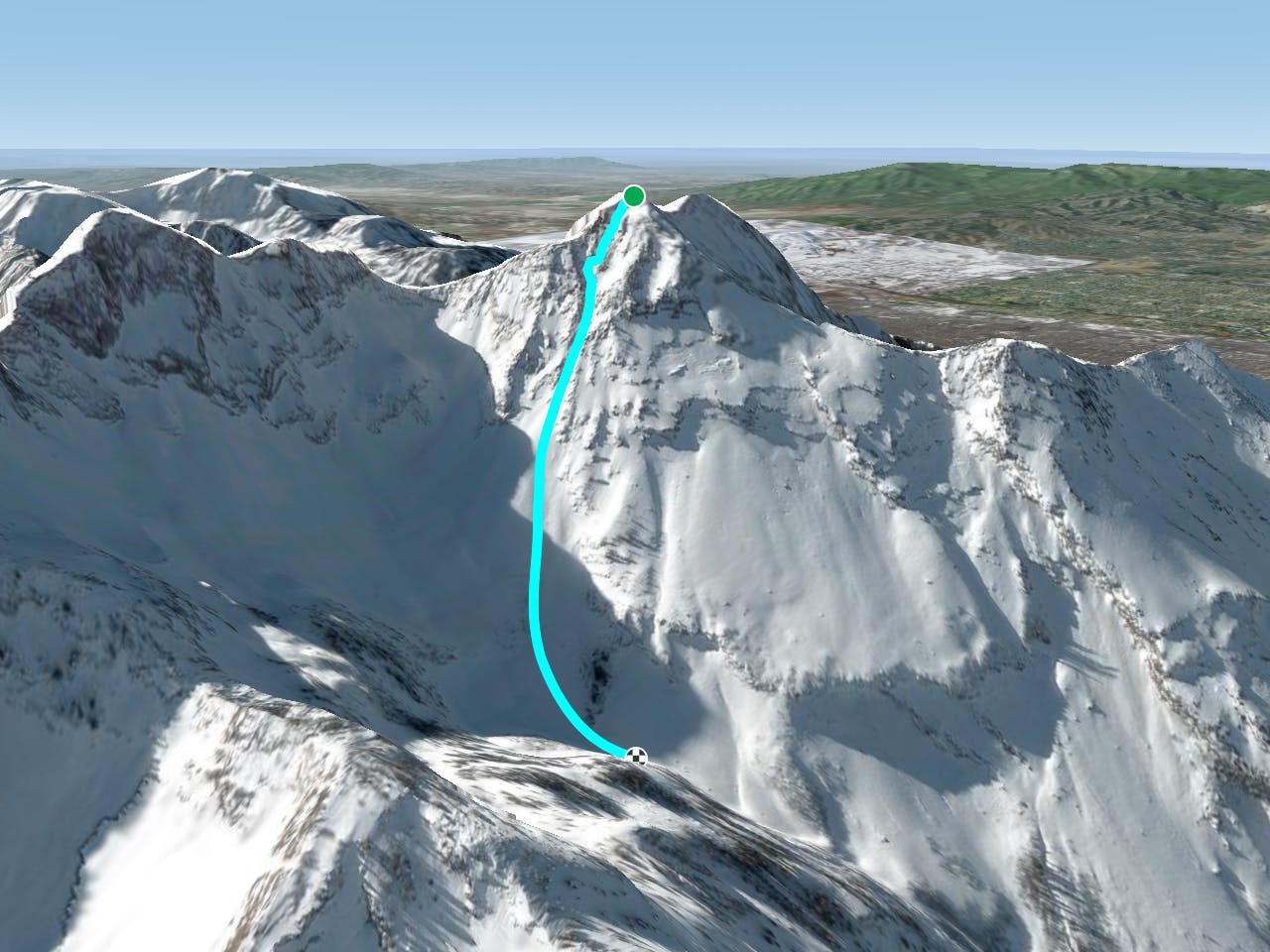
The E Face of Twin Peaks is not one of the longest lines, but it's consistently steep and can be very fun in the right conditions. This line is easily scouted on the approach which is nice. Start at the Broads Fork trailhead in Big Cottonwood Canyon, head up the main drainage to the saddle to the S of Twin Peaks and then traverse the ridge to the summit.
This line starts off of the E summit of Broads Fork Twin Peaks. The upper section is littered with very sharp rocks and often holds loose and rotten snow. When coverage is good you can drop right in from the summit. If coverage isn't great you can work down to the skiers left or right and skirt in to avoid some of the rocky upper section. The top few turns off the summit are the steepest nearing 50 degrees, but only for a few turns. The slope then mellows out to a nice 40 degrees. Trend to skiers right and you'll line yourself up for the nice chute in the middle section. This narrows into a choke that is a few hundred centimeters wide and then opens up into a great apron to finish it off.
Extreme
Extreme skiing terrain above 45 degrees. These routes are reserved for experienced experts.

In case of a fall, death is highly likely.

In the high mountains or remote conditions, all individuals must be completely autonomous in every situation.
1 km away
Stairs Gulch is 4,000 feet long, serious with a combination of a steep, technical chute and a flat, more mellow finish.
Difficult Ski Touring
4 km away

Probably the longest, most consistent rock-lined chute in the Wasatch if you're into that sort of thing.
Severe Ski Touring
5.4 km away

Scotty's is a classic north facing roadside attraction in upper Little Cottonwood Canyon.
Difficult Ski Touring
5.6 km away

A big fun run off of Kessler Peak with some great chute and trees skiing involved.
Difficult Ski Touring
5.6 km away

The Dresden is one of the longest and most continually steep faces in the Wasatch.
Severe Ski Touring
6 km away

This is the huge avalanche path that's visible from the road on the N slope of Kessler Peak.
Difficult Ski Touring
6.7 km away

Virginia Slims is the fun dogleg chute next to the more popular Old Growth chute in the lower reaches of Cardiff Fork.
Difficult Ski Touring
6.8 km away

Old Growth chute is a mini classic that provides great rock wall lined ambience and easy access.
Difficult Ski Touring
7 km away

Major Tom is a steep and sporty couloir in a remote corner of the Wasatch that can have a few rappels to navigate!
Extreme Ski Touring
8.2 km away

Memorial #1 is a very long and clean chute that runs off the ridge of the S summit of Mount Olympus.
Difficult Ski Touring

18 routes · Resort Ski Touring · Ski Touring