209 m away
Taint

A tight evergreen glade for expert skiers.
Moderate Freeride Skiing
- Distance
- 334 m
- Ascent
- 0 m
- Descent
- 136 m
One of the hardest unmarked glades on the mountain.
Freeride Skiing Severe

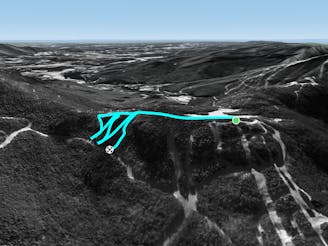
About half way down Freefall, there is a traverse into the woods to skiers right. This leads out to F.I.S. About half way across this traverse, there is a steep drop into the woods. This can sometimes be roped off and anyone who’s skied it knows why. Freefall Glades are extremely tight and rocky, even on the biggest snow years it can be hard to negotiate these woods. After the first half of the glade, you have the option of taking a left or a right. To skiers right there is a mandatory drop, to skiers left there’s a bunch of stumps and rocks. In the early season there is a rope that can be used to help negotiate this section, but later in the year this can be burried. The bottom half of the glade is a little wider with small evergreens that let in sunlight. Freefall glades end on F.I.S.
Severe
Steep skiing at 38-45 degrees. This requires very good technique and the risk of falling has serious consequences.

As well as the slope itself, there are some obstacles (such as rock outcrops) which could aggravate injury.
Away from help but easily accessed.
209 m away
A tight evergreen glade for expert skiers.
Moderate Freeride Skiing
322 m away

A short but steep face that terminates into tight trees.
Severe Freeride Skiing
534 m away

Short little stash off Lower Chilcoot.
Moderate Freeride Skiing
884 m away

The inbounds continuation of Hershey Highway.
Moderate Freeride Skiing
1.1 km away

A tight glade skiers right of Smugglers Alley.
Moderate Freeride Skiing
1.2 km away

A handful of turns through unmarked woods.
Moderate Freeride Skiing
1.4 km away
A short hike/sidestep some wide side country glades.
Difficult Freeride Skiing
1.8 km away

A massive backcountry glade with a number of drop ins
Difficult Freeride Skiing
2.2 km away

A low angle trail used to cross from Spruce Peak to Sterling Peak and to access the Back Bowls.
Easy Freeride Skiing
2.5 km away

A short little stash off Cross Cut #2
Moderate Freeride Skiing