322 m away
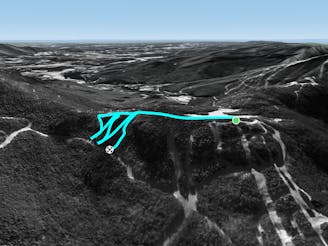
Freefall Glades

One of the hardest unmarked glades on the mountain.
Severe Freeride Skiing
- Distance
- 207 m
- Ascent
- 0 m
- Descent
- 80 m
A short but steep face that terminates into tight trees.
Freeride Skiing Severe

When skiing Upper F.I.S., about half way down you may notice the trail hangs a left, but the open face continues down into the woods. This open face is known as Sally’s Alley. The first few turns are fairly steep, then the open face blends into tight woods. Sally’s Alley ends on catwalk.
Severe
Steep skiing at 38-45 degrees. This requires very good technique and the risk of falling has serious consequences.

As well as the slope itself, there are some obstacles (such as rock outcrops) which could aggravate injury.

Close to help in case of emergency.
322 m away
One of the hardest unmarked glades on the mountain.
Severe Freeride Skiing
379 m away

A tight evergreen glade for expert skiers.
Moderate Freeride Skiing
818 m away

Short little stash off Lower Chilcoot.
Moderate Freeride Skiing
878 m away

The inbounds continuation of Hershey Highway.
Moderate Freeride Skiing
1.1 km away

A tight glade skiers right of Smugglers Alley.
Moderate Freeride Skiing
1.2 km away

A handful of turns through unmarked woods.
Moderate Freeride Skiing
1.4 km away
A short hike/sidestep some wide side country glades.
Difficult Freeride Skiing
1.8 km away

A massive backcountry glade with a number of drop ins
Difficult Freeride Skiing
2.2 km away

A low angle trail used to cross from Spruce Peak to Sterling Peak and to access the Back Bowls.
Easy Freeride Skiing
2.4 km away

A short little stash off Cross Cut #2
Moderate Freeride Skiing