305 m away
Hellbrook

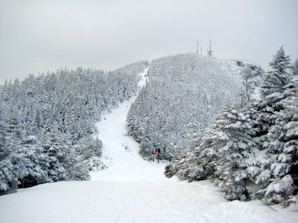
The crown jewel of Smugglers Notch.
Difficult Freeride Skiing
- Distance
- 3.6 km
- Ascent
- 13 m
- Descent
- 775 m
It'll take you to the real Smugglers Notch.
Freeride Skiing Difficult

This is a popular freeride skiing route which is generally considered to be difficult. It's extremely remote, it features medium exposure (e2) and is typically done between December and February. From a low point of 1 km to the maximum altitude of 1.2 km, the route covers 1.5 km, 43 vertical metres of ascent and 189 vertical metres of descent. It's graded 2.3 and Labande grade 4. You'll need rope to complete it safely.
It's really beautiful, but skiing high up on the Notch could (has before) been a death sentence.
Difficult
Serious gradient of 30-38 degrees where a real risk of slipping exists.

As well as the slope itself, there are some obstacles (such as rock outcrops) which could aggravate injury.

In the high mountains or remote conditions, all individuals must be completely autonomous in every situation.
305 m away
The crown jewel of Smugglers Notch.
Difficult Freeride Skiing
548 m away

Technical ridge skiing that is not easy to access.
Severe Freeride Skiing
557 m away

An hourglass shaped chute for expert skiers only.
Difficult Freeride Skiing
686 m away

The most popular descent on Mount Mansfield.
Difficult Freeride Skiing
1.1 km away

A very straight forward chute, directly above the Gondola.
Difficult Freeride Skiing
1.1 km away

A complex mess of boulders, trees and chutes that makes perfect freerider terrain.
Severe Freeride Skiing
1.1 km away

Long, steep glade runs, involving cliffs and chutes.
Severe Freeride Skiing
1.1 km away

Climbing Gully serves as the approach for Mount Mansfield, but it also makes a great ski line.
Difficult Freeride Skiing
1.3 km away

One of the most popular hardwood glades in The Notch
Moderate Freeride Skiing
1.3 km away

A frozen riverbed that’s almost as wide as a ski trail.
Moderate Freeride Skiing
12 routes · Freeride Skiing