20 m away
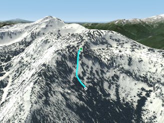
BX Exit Chute

A steep, splitting couloir for experts
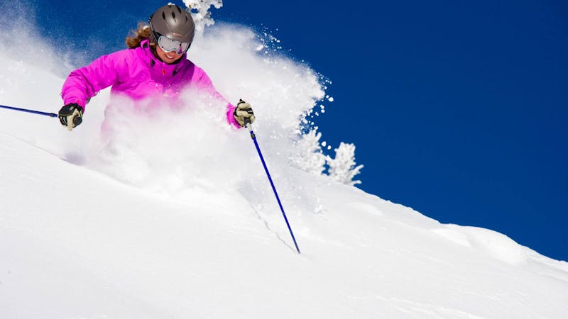
Severe Freeride Skiing
- Distance
- 251 m
- Ascent
- 0 m
- Descent
- 156 m
A steep couloir for experts
Freeride Skiing Severe

This steep couloir is one of the last straightforward routes through the cliffs that continue along the diminishing ridge to the north. This chute is true backcountry and is not part of the ski patrol's avalanche control. Furthermore, this large chute avalanches regularly, hence the name The White Dragon. The mouth at the top of this long chute is fairly wide, with a cornice that builds on the ridge rib. This rib is often wind-loaded and can avalanche regularly. This rib also offers a fun entrance into this slope. Once past this upper section, the slope steepens slightly across a few light rock bands. It steepens even more towards the bottom where it squeezes through the cliff band. This is the real danger spot here, as the cliffs on either side are tall and a fall here could be catastrophic. Below this funnel, watch for avalanche debris. You will have to veer right across a creek bed to return to the bottom of Northway Chair. Alternately ski to bottom of old Lower Northway to the parking lot where you hopefully left a shuttle vehicle. This is true backcountry. Ski/ride with a partner and carry the proper avalanche equipment.
Severe
Steep skiing at 38-45 degrees. This requires very good technique and the risk of falling has serious consequences.

In case of a fall, death is highly likely.
Little chance of being seen or helped in case of an accident.
20 m away
A steep, splitting couloir for experts
Severe Freeride Skiing
183 m away

A narrow gully surrounded by thick timber.
Difficult Freeride Skiing
186 m away

A steep face that ends in mandatory air to small ledge and another cliff.
Severe Freeride Skiing
187 m away

A nice, steep glade that holds snow after a storm.
Difficult Freeride Skiing
428 m away
A very narrow chute for experienced experts that requires a straight-line.
Severe Freeride Skiing
557 m away

Two small chutes that open to a steep face.
Severe Freeride Skiing
600 m away

A very steep gully guarded on either side by cliffs.
Severe Freeride Skiing
612 m away

A steep section below the chair crosshatched with rock bands.
Difficult Freeride Skiing
692 m away

Two narrow, curving couloirs that meet together at the bottom.
Severe Freeride Skiing
692 m away

A steep open backcountry glade for experts.
Severe Freeride Skiing
13 routes · Freeride Skiing · Ski Touring