2.6 km away
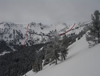
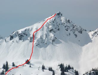
Pickhandle Peak and Crown Point
Linking together two great lines in Pickhandle Basin
Moderate Ski Touring
- Distance
- 6.4 km
- Ascent
- 908 m
- Descent
- 909 m
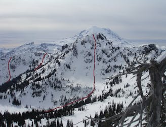
This wide backcountry chute offers consistent snow and pitch
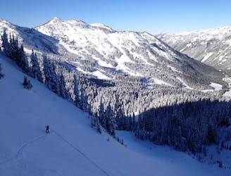
Ski Touring Difficult

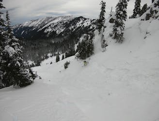
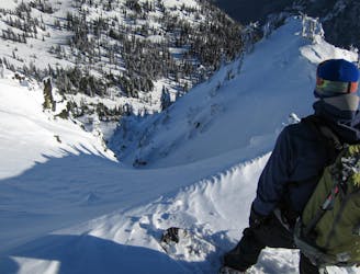
Sitting above Upper Henskin Lake, Gunbarrel makes for a fun, steep pitch. Approach by skinning up from the top of Quicksilver lift or by traversing from Three Way Exit Chute. Wide enough to bank turns off the sides, this chute is less intimidating than Dogleg and opens up to the bottom without cliffs. The entrance is the steepest part but watch for loaded snow; avalanches are common. This is true backcountry. Carry proper equipment and always ski or ride with a partner.
Difficult
Serious gradient of 30-38 degrees where a real risk of slipping exists.

As well as the slope itself, there are some obstacles (such as rock outcrops) which could aggravate injury.

Little chance of being seen or helped in case of an accident.
2.6 km away
Linking together two great lines in Pickhandle Basin
Moderate Ski Touring
2.7 km away
A Long Day route tagging 4 Separate lines South of Crystal Mountain
Difficult Ski Touring
2.7 km away
A steep and potential dangerous line just beyond the ski resort
Difficult Ski Touring
2.7 km away
Heading South of Crystal Mountain making a scenic loop
Difficult Ski Touring
2.7 km away
A great and scenic ski tour just South of Crystal Mountain
Moderate Ski Touring
2.7 km away
Heading out to Chinook Pass during the Winter
Difficult Ski Touring
2.7 km away
A full day of ski touring around Crystal Peak with an exit down 410
Difficult Ski Touring
2.7 km away
Making the most of of some great North Facing Chutes
Moderate Ski Touring
2.7 km away
Hitting all the main peaks in the Backcountry of Crystal Mountain
Difficult Ski Touring
2.7 km away
Making the most out of the slopes around Dogleg Peak
Moderate Ski Touring