2 km away
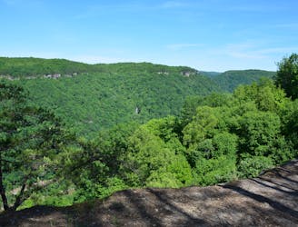
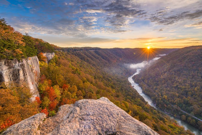
Endless Wall Trail
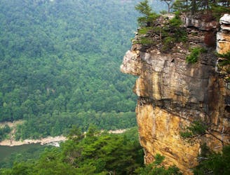
A classic New River hike loaded with "endless" views from a bluff staring across the river to Fayetteville and the New River Gorge Bridge.
Moderate Hiking
- Distance
- 4.7 km
- Ascent
- 131 m
- Descent
- 131 m
A short and steep hike to explore the historic Nuttall coal mine.
Hiking Difficult

The Conveyor Trail is a short but quad-busting trail with great views of the Nuttall coal mine and the conveyor "used to transport coal from the mine to the processing area at river level," according to the NPS. The hike begins at the bottom of the conveyor then quickly switchbacks uphill as it climbs towards the mine entrance. One of the best things about this hike is that you can venture as far - or as little - as you'd like!
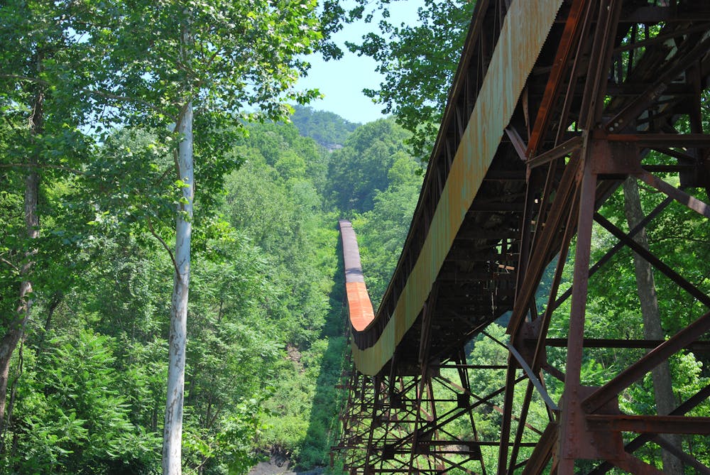
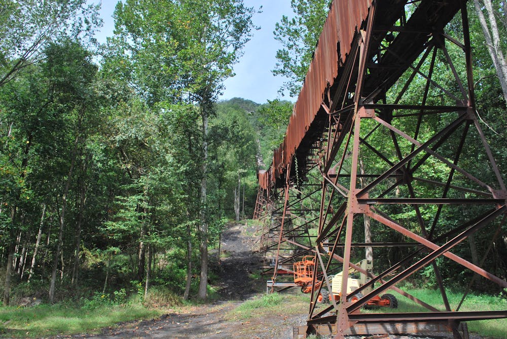
What it lacks in distance, the Conveyor Trail makes up for in difficulty. There are plenty of views along the way, "but be sure to watch your footing, for the trail surface is loose and slaggy (old coal debris from the conveyor) in many places," the park warns. The mining remnants are present at every turn, but remember "to leave historic artifacts as you find them, where they help tell the story of the past," the park continues.
The main parking area for this hike is on Keeney's Creek Road, though it is quite small. The road is also narrow and winding, and the park urges extreme caution to drivers. At times, you may have to find a pull-off to allow others to pass. Should you find yourself head-to-head with another vehicle, remember that the closest pull-out may be behind you, not in front.
Should you want to explore the mine on an easier outing, consider parking at the upper trailhead on Lansing-Edmond Road instead. If you have the time, the Endless Wall is just a short drive away and one of New River's must-visit spots for both hikers and rock climbers.
Difficult
Hiking trails where obstacles such as rocks or roots are prevalent. Some obstacles can require care to step over or around. At times, the trail can be worn and eroded. The grade of the trail is generally quite steep, and can often lead to strenuous hiking.

The trail contains some obstacles such as outcroppings and rock which could cause injury.
Away from help but easily accessed.
2 km away
A classic New River hike loaded with "endless" views from a bluff staring across the river to Fayetteville and the New River Gorge Bridge.
Moderate Hiking
2.5 km away
A steep, mostly-downhill hike near Fayetteville to a historic coal mine.
Difficult Hiking
3.5 km away
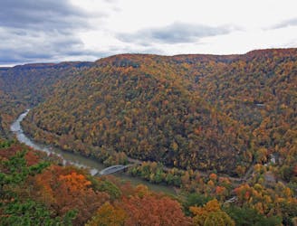
A rock outcropping with impressive views of the New River Gorge Bridge.
Moderate Hiking
3.9 km away
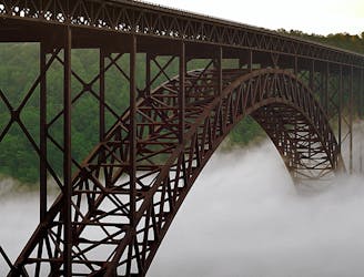
The easiest and most popular way to view the impressive New River Gorge Bridge.
Easy Hiking
5.4 km away
A short hike near Fayetteville with unique views from below the New River Gorge Bridge.
Moderate Hiking
10 routes · Hiking

63 routes · Alpine Climbing · Hiking