3.9 km away
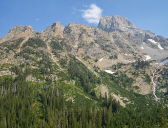
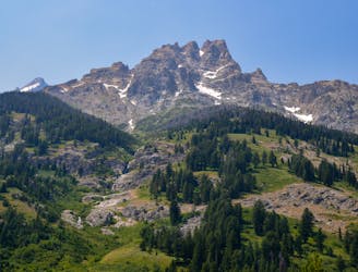
Teton Crest Trail: Alaska Basin to North Fork Cascade Canyon
One of the most beautiful sections of trail in the Tetons.
Difficult Hiking
- Distance
- 16 km
- Ascent
- 621 m
- Descent
- 904 m
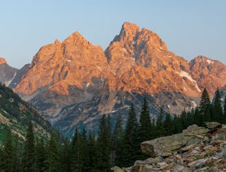
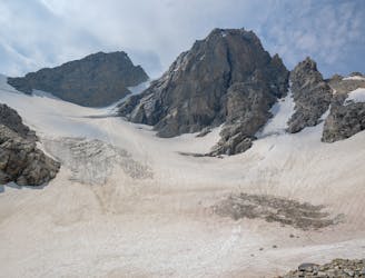
Incredible vistas combined with the highest lake in the Teton Range!
Hiking Moderate

This route is a must-do if you are on the Teton Crest Trail. This route features two magnificent spots: Avalanche Divide and Icefloe Lake.
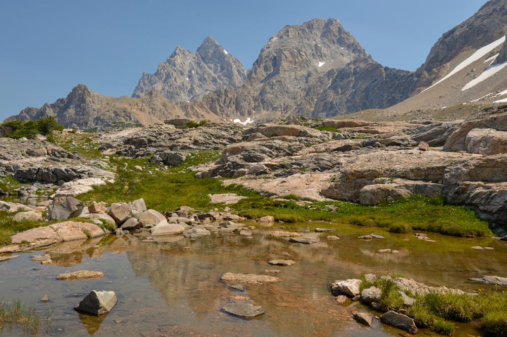
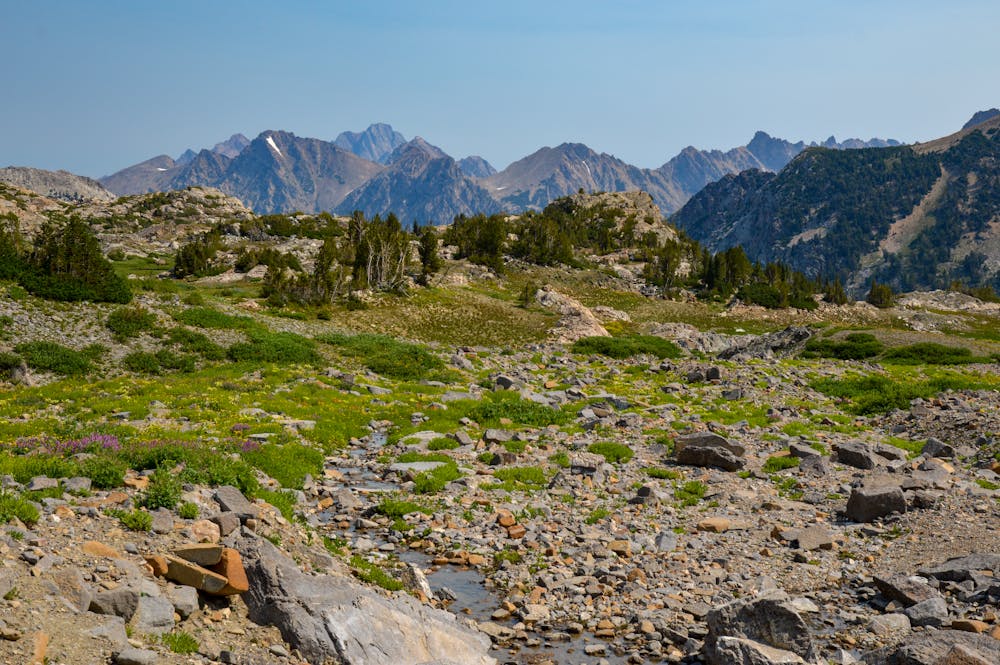
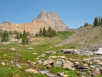
The views are incredible since the entire route is wide-open. You start at a junction, which is located near Hurricane Pass. Given that Hurricane Pass could be the prettiest spot along the Teton Crest Trail, this side-trip is right in the thick of gorgeous scenery.
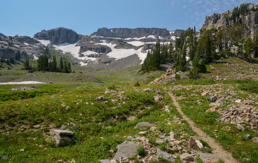
The trail climbs uphill most of the way, but it is pretty gradual. You are treated to views immediately, and the wonder of what lies ahead at Avalanche Divide is a great motivator.
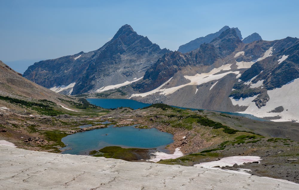
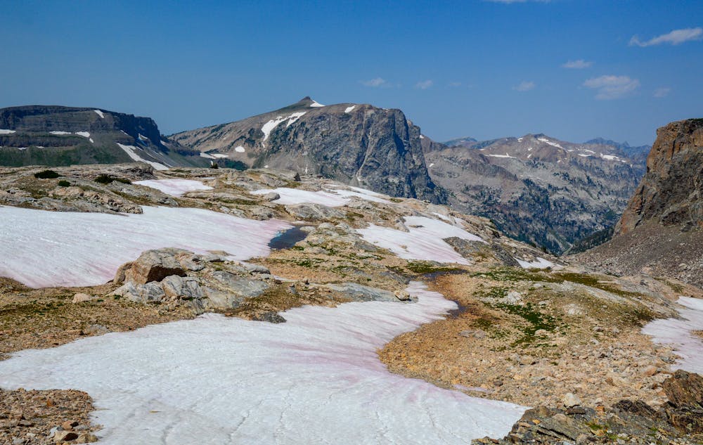
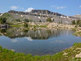
Once you arrive at Avalanche Divide, take your time, as this incredible spot should not be rushed. This is one of the best viewpoints in the Tetons, as you get a glimpse of the Grand and Snowdrift Lake. The adventurous can scramble down to Snowdrift Lake to extend the route. The Divide is nice and flat, presenting a nice spot for a break.
Once at the Divide, it isn't too far to Icefloe Lake. The trail comes and goes at times and is faint for most of the way. Despite this, it isn't too difficult to navigate to the lake. Depending on the time of year, snowfields may be present along this section.
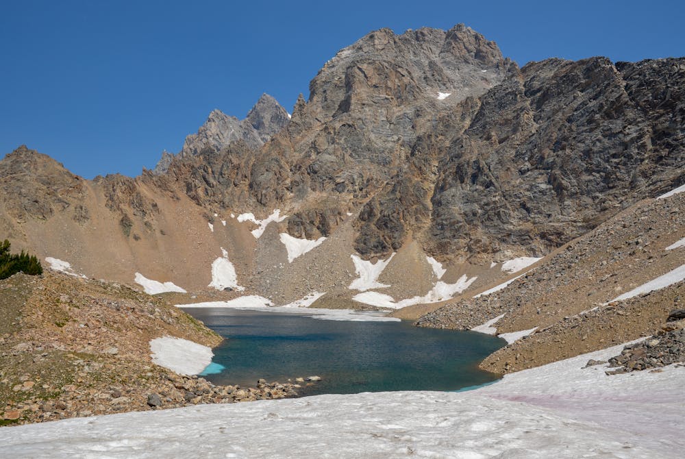
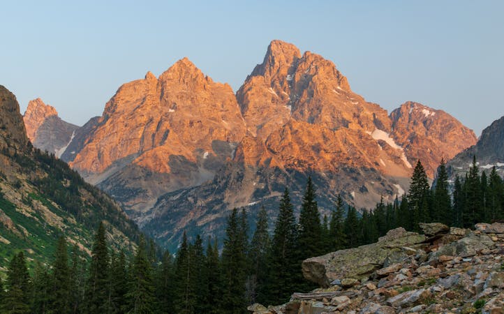
Icefloe Lake should be on everyone's list given it is the highest lake in the entire Teton Range! Sitting at over 10,500 feet, it is a jewel. The sparkling blue water will blow you away. The Grand Teton looms right above, putting the icing on the cake.
Once ready, descend back down to the Avalanche Divide trail junction and then to the Teton Crest Trail.
Overall, this side trip isn't too far despite packing in incredible views. Featuring superb views and the highest lake in the Tetons, this route delivers on all cylinders!
Moderate
Hiking along trails with some uneven terrain and small hills. Small rocks and roots may be present.

The trail contains some obstacles such as outcroppings and rock which could cause injury.

Little chance of being seen or helped in case of an accident.
3.9 km away
One of the most beautiful sections of trail in the Tetons.
Difficult Hiking
3.9 km away
A must-do side trip off the Teton Crest Trail.
Extreme Hiking
6.1 km away
One final stretch through beautiful Cascade Canyon
Moderate Hiking
6.1 km away
An epic final day on the Teton Crest Trail.
Difficult Hiking
6.7 km away
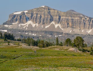
An incredibly steep approach to Table Mountain rewarded with stunning views of the Tetons.
Extreme Hiking
7.9 km away
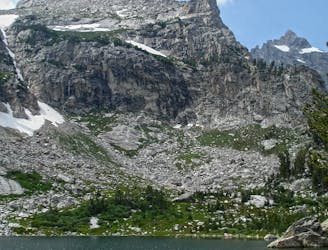
A difficult day hike to stunning sub-alpine lakes shouldered by the highest peaks in the Tetons.
Difficult Hiking
7.9 km away
A day hike to one of the prettiest lakes in the Tetons!
Difficult Hiking
7.9 km away
Epic trek to the saddle in between the Middle and Grand Teton.
Extreme Hiking
8.7 km away
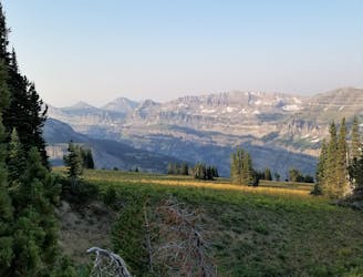
A splendid day along the Teton Crest in which you reach peaceful Alaska Basin
Easy Hiking
9.1 km away
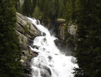
A shorter, family-friendly hike to the only year-round waterfall in Grand Teton National Park.
Moderate Hiking
7 routes · Hiking

25 routes · Alpine Climbing · Hiking
5 routes · Alpine Climbing · Hiking
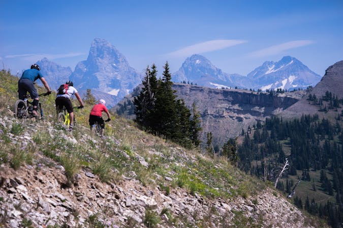
4 routes · Mountain Biking · Hiking · Trail Running
11 routes · Hiking · Trail Running

63 routes · Alpine Climbing · Hiking