4 m away
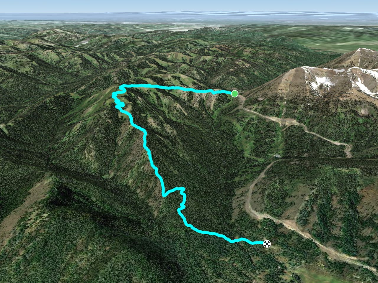
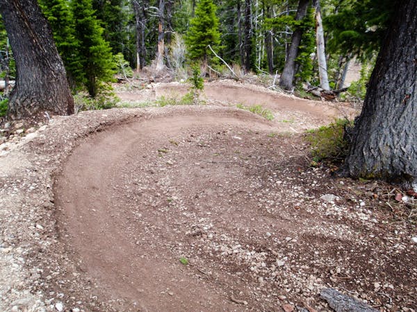
Black Canyon Shuttle
A backcountry enduro shuttle that's been a longtime Jackson Hole classic.
Difficult Mountain Biking
- Distance
- 10 km
- Ascent
- 249 m
- Descent
- 836 m
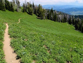
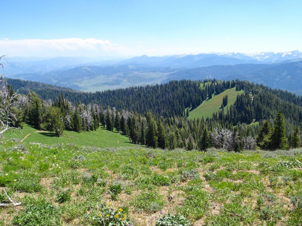
One of the longest runs in the Teton Pass area.
Mountain Biking Extreme
Teton Pass is "already on the map as a paradise of easy access for backcountry skiing, but the same goes for downhill biking,” writes Brigid Mander on TetonGravity.com. The Teton Pass trail network began life as a collection of illegal underground trails, but eventually the builders organized and went legit. Thanks to "local trail advocates and progressive land managers from the Bridger-Teton National Forest,” the local trail builders were able to construct "the nation’s first (legal) downhill-bike only trail network on public land and minimize user conflict.”
"Teton Pass is unique in that there are a lot of multi-use and DH trails crammed into a small space – but the trails are well-signed, so pay attention, respect the community order and be courteous, so that everyone in this highly trafficked spot stays happy,” continues Mander.
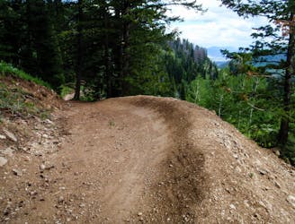
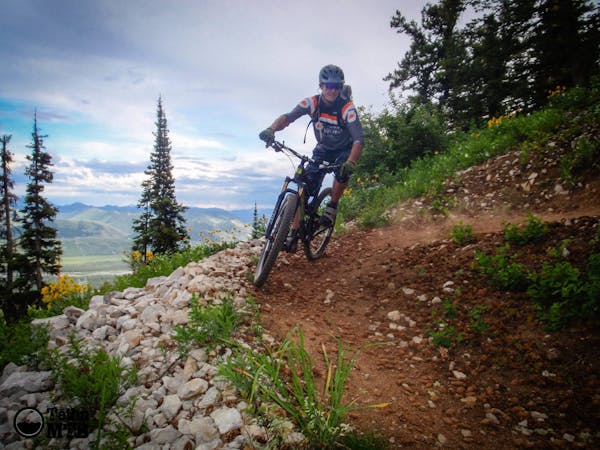
From the top of Teton pass, riders must either hike-a-bike for 30-40 minutes or endure a grunt of a pedal to get back to Black Canyon and the Lithium trail. While one of the furthest out trails in the Teton Pass network, it offers one of the most sustained descents in the area.
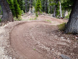
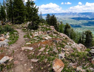
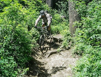
The work invested to access Lithium is well-worth it, though. "Lithium is a steep, DH only trail with natural terrain features, technical rock gardens, and gap jumps,” according to Mountain Bike the Tetons. "All jumps have go-arounds. One of the original, classic DH trails built as part of the Teton Pass DH trail network. The longest ride of all the DH trails in the network, it's definitely worth the trip out to Mt. Ely for the views alone. An expert-only trail."
Sources: https://www.tetongravity.com/story/bike/5-of-the-best-downhill-biking-shuttle-zones-in-north-america https://mountainbiketetons.org/region/trails/jackson-hole/teton-pass/lithium/
Extreme
Very steep, difficult, narrow singletrack with widely variable and unpredictable trail conditions. Unavoidable obstacles could be 15in/38cm tall or greater, and unavoidable obstacles with serious consequences are likely to be present. Obstacles could include big rocks, difficult root sections, drops, jumps, sharp switchbacks, and more. Ideal for expert-level riders.

Some trail sections are extremely exposed where falling will almost certainly result in serious injury or death.

Away from help but easily accessed.
4 m away
A backcountry enduro shuttle that's been a longtime Jackson Hole classic.
Difficult Mountain Biking
11 m away
This combination of trails forms one of the most renowned freeride downhill runs in the Teton Pass area.
Extreme Mountain Biking
2.5 km away
An expert-only downhill run filled with big jumps—including significant gaps.
Extreme Mountain Biking
2.5 km away
An instant classic ridgeline trail ride.
Severe Mountain Biking
2.5 km away
One of the most technical, old school descents in the region.
Severe Mountain Biking
8 routes · Mountain Biking
3 routes · Mountain Biking