False Summit of the Throne

A steep open glade.
Difficult Freeride Skiing
- Distance
- 322 m
- Ascent
- 0 m
- Descent
- 195 m
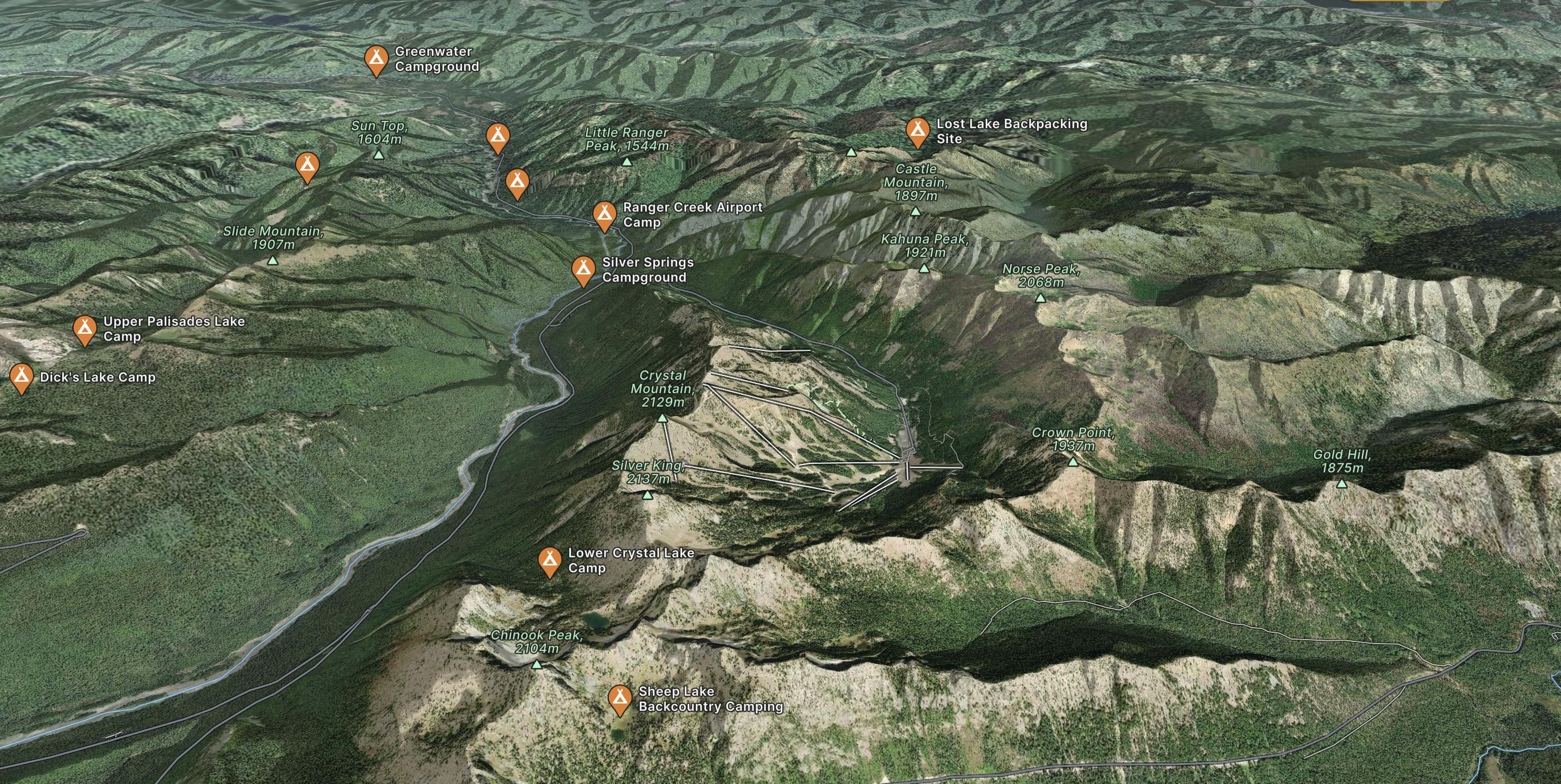
Located on the Northeast corner of Mt. Rainier National Park less than two hours from Seattle or Bellevue.
Explore Crystal Mountain with curated guides of the best ski routes, and more. With over 180 3D trail maps in FATMAP, you can easily discover and navigate the best trails in Crystal Mountain.
No matter what your next adventure has in store, you can find a guide on FATMAP to help you plan your next epic trip.
Get a top trail recommendation in Crystal Mountain from one of our 5 guidebooks, or get inspired by the 180 local adventures uploaded by the FATMAP community. Start exploring now!
A steep open glade.
Difficult Freeride Skiing

A short steep glade
Difficult Freeride Skiing

A short couloir through an otherwise impassable cliff.
Difficult Freeride Skiing

An open face that falls over a large cliff
Severe Freeride Skiing

A broad, steep face to the left of Exterminator
Difficult Freeride Skiing

A broad open face that often holds deep snow
Difficult Freeride Skiing

An open glade that often holds deep snow
Difficult Freeride Skiing

A broad, relatively easy face
Moderate Freeride Skiing

A steep, extremely narrow chute with high exposure
Extreme Freeride Skiing

A short, hidden chute that holds good snow.
Severe Freeride Skiing

A very narrow chute for experienced experts only.
Severe Freeride Skiing

A steep, wide couloir for experts
Severe Freeride Skiing

An undulating start to a classic sub-alpine run.
Difficult Freeride Skiing

An open face along the SE side of Silver King ("The King") that leads into glades, chutes and cliffs.
Difficult Freeride Skiing

A broad face that ends in four short chutes between Boxcar Cornice and Powder 8s
Difficult Freeride Skiing

A steep, rocky face reserved for experienced experts
Extreme Freeride Skiing