Teilabschnitt Walser Ultra

Trainingslauf Trailrunning
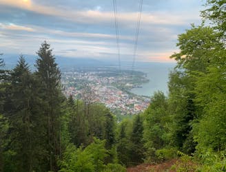
Severe Trail Running
- Distance
- 18 km
- Ascent
- 1.1 km
- Descent
- 1.1 km
Go trail running in Vorarlberg with curated guides of the best trail runs across the region. With over 69 3D trail maps in FATMAP, you can easily discover and navigate the best trails in Vorarlberg.
No matter what your next adventure has in store, you can find a guide on FATMAP to help you plan your next epic trip.
Get a top trail running recommendation in Vorarlberg from one of our 3 guidebooks, or get inspired by the 69 local adventures uploaded by the FATMAP community. Start exploring now!
Trainingslauf Trailrunning
Severe Trail Running

Alpenhütten-Gratweg-Bergpanorama
Difficult Trail Running

Obere Eggstr-Auweg-Obere Walmendinger Alpe-Walmendinger Horn-Höhenweg-Schöntalweg-Schwarzwasserbach-Auweg-Karolienweg-Mahdtalweg-Obere Eggstr
Severe Trail Running

Riezlern-Walmingeralpe-Ochsenhoferscharte-Schwasserwasserhütte-Riezlern
Moderate Trail Running

Wildenthal-Kuhgehren-Walser Hammerspitze-Hochgehrenspitze-Wannaalp-Fluchtalpe-Wildenthal
Moderate Trail Running
Traumhaftes Panorama und gut zu laufen.
Moderate Trail Running

Trail Marathon from Switzerland across Liechtenstein into Austria. Mostly on single trails and on ridges with spectacular views.
Severe Trail Running
Flowy single trails, alps with cows and the smallest cable car in the Canton!
Difficult Trail Running

Flowy single trails flanked by impressive calc stone walls
Difficult Trail Running
Challenging trails through varied terrain and stunning ridges along the Swiss / Austrian border
Severe Trail Running
Great trail run through beautiful forest -- medium gradient but slippery in some places
Moderate Trail Running