1 km away
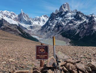
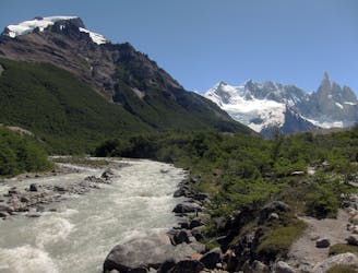
Laguna Torre
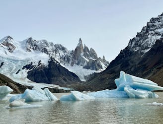
While quite long, the popular hike to Laguna Torre is very achievable, making it a true crowd-pleaser.
Difficult Hiking
- Distance
- 18 km
- Ascent
- 442 m
- Descent
- 441 m
A short but steep hike to a spectacular view above El Chalten.
Hiking Difficult

This short but steep hike won't appear on most lists of the best hikes in El Chalten, but since it flies so far under the radar, you might have the trail all to yourself! This trail isn't signposted, but it's still easy to navigate using this map on FATMAP.
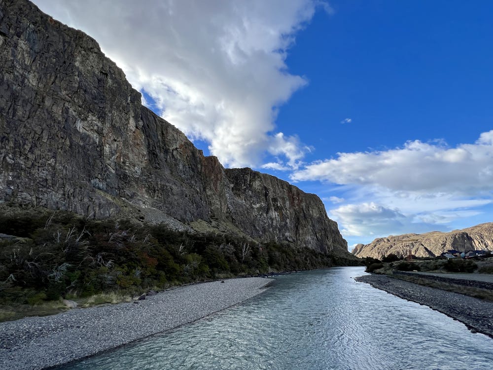
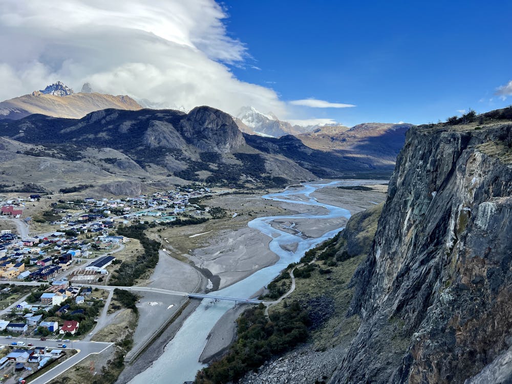
Begin your hike from El Chalten by crossing a bridge above the Rio de Los Vueltas and taking a right on the opposite bank. The trail soon narrows down to singletrack and follows the river bank, providing beautiful views of the glacier-fed river and the town beyond.
Soon, the trail bears left, following the curve of the cliffside, and then breaks hard to the left and steeply up the hill. After the easy walking you've just enjoyed along the river, the steep hoof to the top of the cliffside will be a bit of a shock to the system! This short climb gains a stiff 143m of vertical in just 0.7km. Unlike the other better-maintained trails in El Chalten, you won't find any stairs here and hardly any switchbacks. Instead, you'll have to grind straight up a narrow dirt track to reach the viewpoint. When the dirt is dry, it can be loose and slippery in places. However, due to the lack of trail traffic, the singletrack hasn't suffered too much erosion at the time of this writing in 2023.
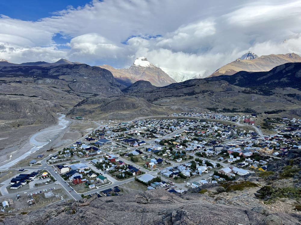
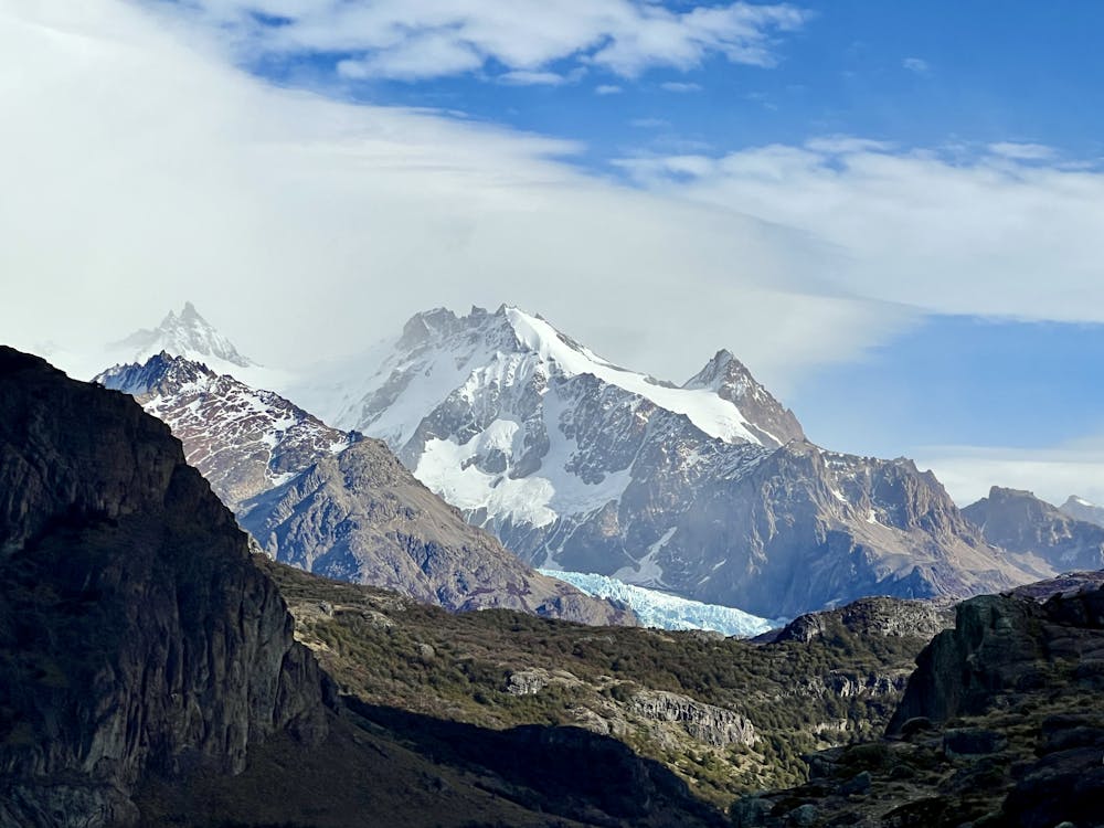
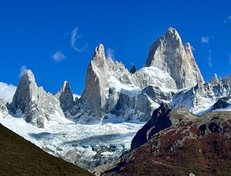
This viewpoint is located just across from the Mirador de Los Condores, but if anything, the vista from this elevated cliff face is dramatically more impressive than the better-known tourist hike on the other side of the river. Here, you'll find yourself sitting on top of a vertical wall of rock with Rio de Los Vueltas directly below you and El Chalten spreading out on the other side of the river. Behind El Chalten, the Andes form the jagged skyline, and you'll enjoy views of all the famous peaks, like Monte Fitz Roy and the Cerro Torre. You can even spot a few of the glaciers from this vantage point. The longer you look, the more details you'll notice. For such a short hike, the reward is absolutely spectacular!
It is possible to bear right at the top of the cliff face and follow a faint social trail that continues to climb along the ridgeline. There are no markings along this social trail, and the exposure is dramatic if you approach the cliff edge. If you decide to explore further, exercise caution, but have fun!
Difficult
Hiking trails where obstacles such as rocks or roots are prevalent. Some obstacles can require care to step over or around. At times, the trail can be worn and eroded. The grade of the trail is generally quite steep, and can often lead to strenuous hiking.

Some trail sections have exposed ledges or steep ascents/descents where falling could cause serious injury.

Away from help but easily accessed.
1 km away
While quite long, the popular hike to Laguna Torre is very achievable, making it a true crowd-pleaser.
Difficult Hiking
1.1 km away
Despite being one of the most underrated treks in El Chalten, this hike offers absolutely stupendous views!
Difficult Hiking
1.1 km away
A great warm up hike in El Chalten, which also offers great bird spotting.
Moderate Hiking
1.1 km away
One of Patagonia's most stunning treks provides unique views of the Southern Patagonia Icefield and much more!
Difficult Hiking
1.2 km away
Multi-day trek linking the most classic views of Fitz Roy and Cerro Torre in Los Glaciares National Park.
Severe Hiking
1.2 km away
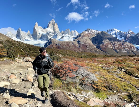
The ultra-famous hike leading to an elevated view point of the Monte Fitz Roy.
Severe Hiking
1.2 km away
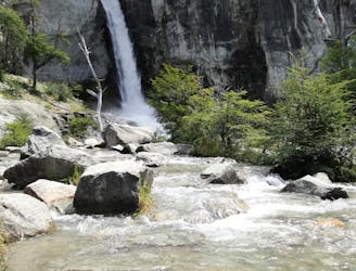
An easy hike from El Chalten to a gorgeous waterfall!
Easy Hiking
8 routes · Hiking