48 m away
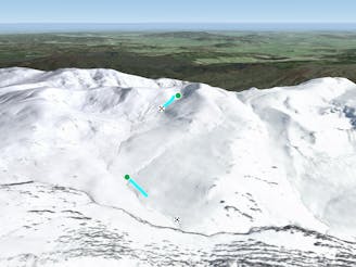
Club Lake - Route 3

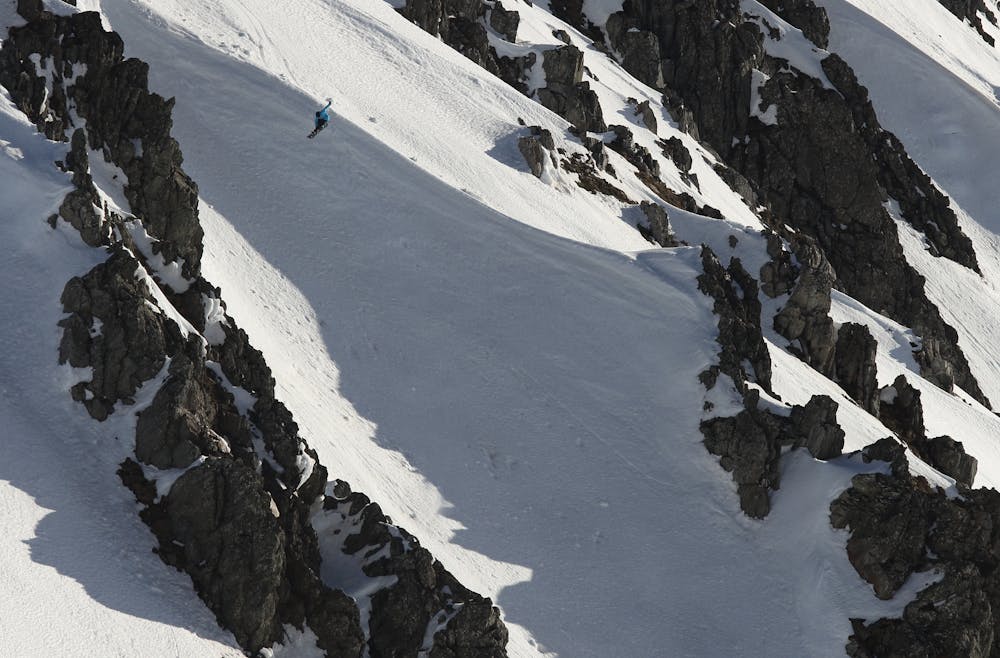
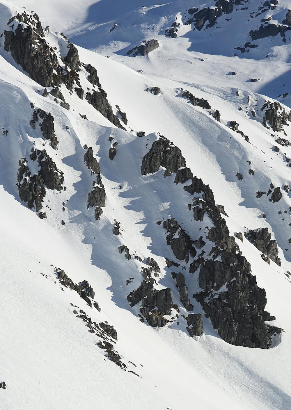
Route 3, or "The Elevator" is aptly named. Steep and intimidating, this is the most obvious line from Carruthers Peak.
Difficult Freeride Skiing
- Distance
- 270 m
- Ascent
- 0 m
- Descent
- 124 m
Our favourite burly line down the guts of Carruthers with optional cliff drops.
Freeride Skiing Severe

36.40994ºS, 148.2904ºE
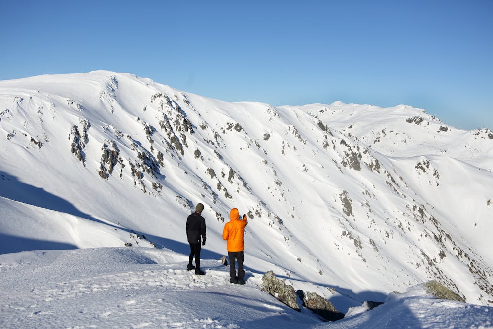
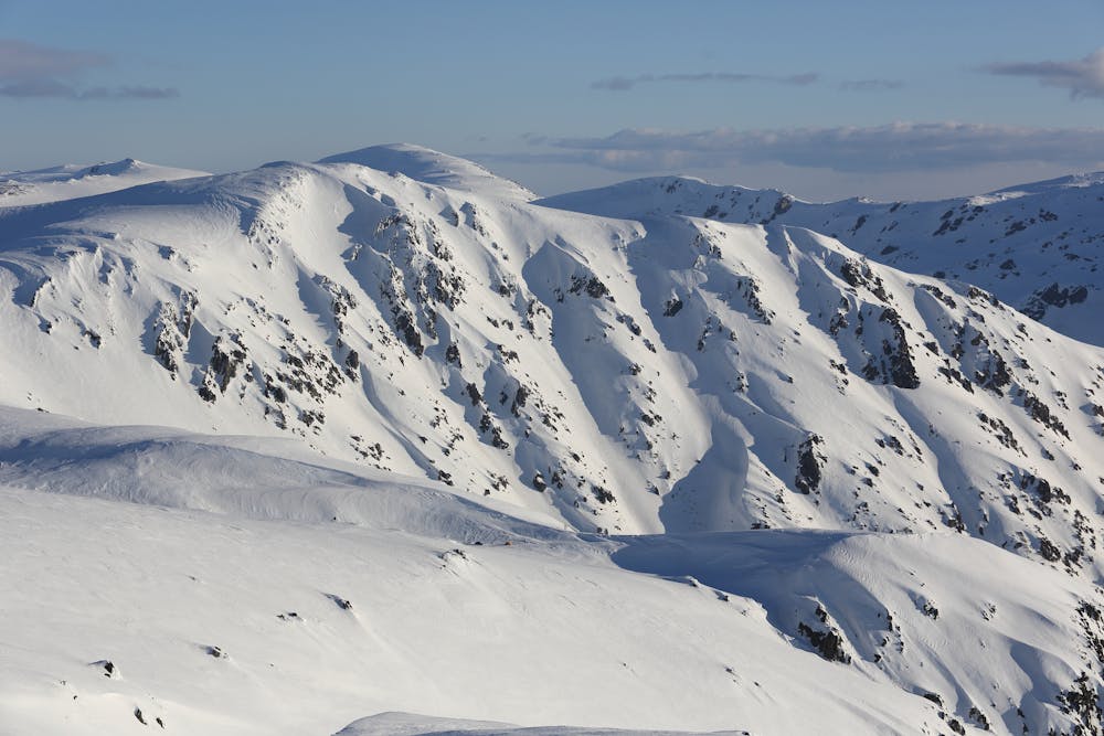
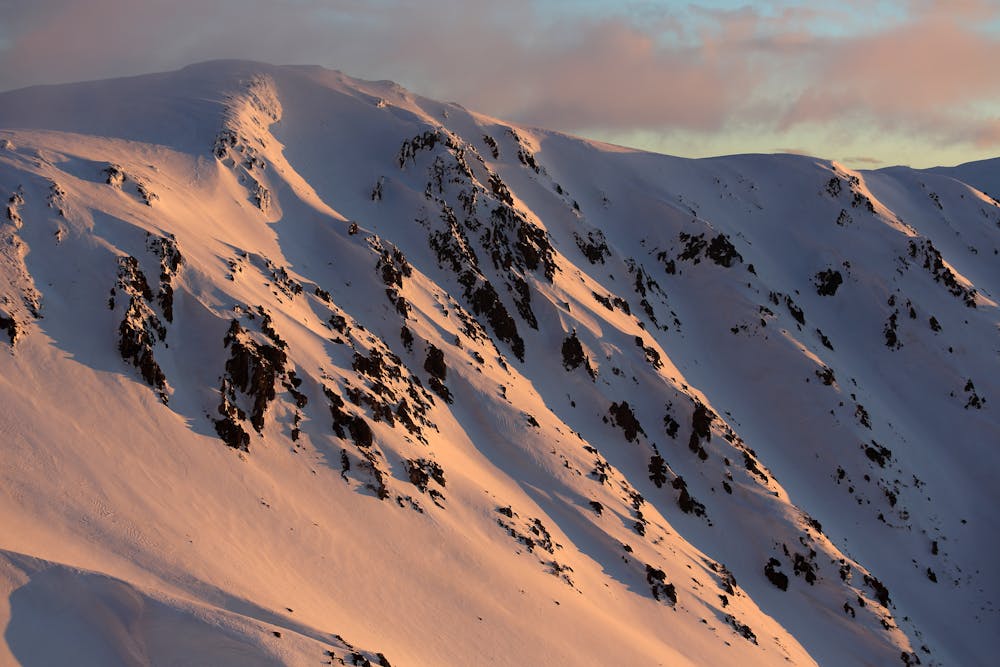
A few hours touring from some of Australia’s largest ski resorts in Perisher and Thredbo, lies a string of peaks and valleys known as the Main Range. At around 2145m sits Carruthers, a favourite peak of ours lurking above these Western Faces, and one that offers a myriad of lines down to James Macarthur Creek at the valley floor.
Depending on snow conditions, there are tight chutes and cliff drops to be had. We rate this line best in early spring, or just after a storm given its north-facing aspect. Beware of snow sharks as it can take a while for some lines to fill in.
Severe
Steep skiing at 38-45 degrees. This requires very good technique and the risk of falling has serious consequences.

As well as the slope itself, there are some obstacles (such as rock outcrops) which could aggravate injury.

Little chance of being seen or helped in case of an accident.
48 m away
Route 3, or "The Elevator" is aptly named. Steep and intimidating, this is the most obvious line from Carruthers Peak.
Difficult Freeride Skiing
49 m away

Only skiable in above average years, providing similar characteristics to Route 3, just add a very very steep drop.
Difficult Freeride Skiing
49 m away

Consistently steep, cross graded at times and challenging. With a cliff on the side to show off to your mates.
Difficult Freeride Skiing
49 m away

The "easiest" descent into Club Lake from Carruther's Peak
Difficult Freeride Skiing
49 m away

One of the easier routes down from Carruthers Peak to Club Lake.
Difficult Freeride Skiing
49 m away

At a couple of kilometres long, these runs offer long consistent slopes for intermediates, that hold around 300 metres of vertical.
Moderate Freeride Skiing
50 m away

A steep series of chutes, with over 400 metres of vertical on offer.
Difficult Freeride Skiing
134 m away

West and slightly to the south, Little Austria provides some incredible skiing, and is a locals' favourite.
Moderate Freeride Skiing
144 m away

Providing around 400 metres of continuous vertical, this run gives more margin for error compared to the rocky chutes to the west.
Difficult Freeride Skiing
396 m away
A great way from Club Lake to milk a few more sweet turns before heading back home to Charlotte's Pass.
Moderate Freeride Skiing