1.1 km away
X1
Officially marked freeride run
Easy Freeride Skiing
- Distance
- 914 m
- Ascent
- 0 m
- Descent
- 153 m
Short but hidden backside run down to Pinzgauer hütte
Freeride Skiing Easy

A small distance of transport and hike to get to the open field. You can walk past the open field and to hike up a bit more to find a nice snow cornice to drop from.
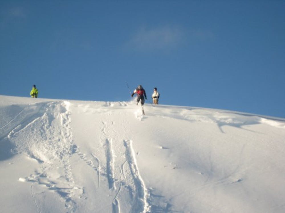
After the open field follow skiers right but look out for barb wire fence. Usually you'll see the fence poles but if not there's enough snow to get you over without issues.
Last section quite thick forest with some open sections down to transport run or directly down to Pinzgauer hütte.
Easy
Wide gentle slopes at around 20 degrees or less.

Exposure is limited to that of the slope itself. Getting hurt is still likely if the slope is steep and/or the snow is hard.
Close to help in case of emergency.
1.1 km away
Officially marked freeride run
Easy Freeride Skiing
1.2 km away
A popular freeride line in Zell am See
Moderate Freeride Skiing
2.1 km away
Short but sweet freeride run
Easy Freeride Skiing
3.1 km away
A long-ish descent through open terrain and forrest
Easy Freeride Skiing
3.2 km away
Quick and easy freeride line
Easy Freeride Skiing
3.2 km away
Valley freeride descent
Moderate Freeride Skiing
3.8 km away
Nice run past the trees
Easy Freeride Skiing
4.9 km away
Shortcut freeride line between slopes
Moderate Freeride Skiing
7 km away

Long and steep-ish descent until Saalbach
Difficult Freeride Skiing
7.1 km away

Long descent until bus stop
Moderate Freeride Skiing
8 routes · Freeride Skiing