5.3 km away
Seejoch

A unfrequented hike made for everyone who wants to get started with easy ridge hiking.
Difficult Hiking
- Distance
- 8.8 km
- Ascent
- 1.2 km
- Descent
- 1.2 km
A picturesque, mid-length hike in Austria’s highest ski resort, taking in 3 alpine lakes, including the impressive Finstertaler reservoir.
Hiking Moderate

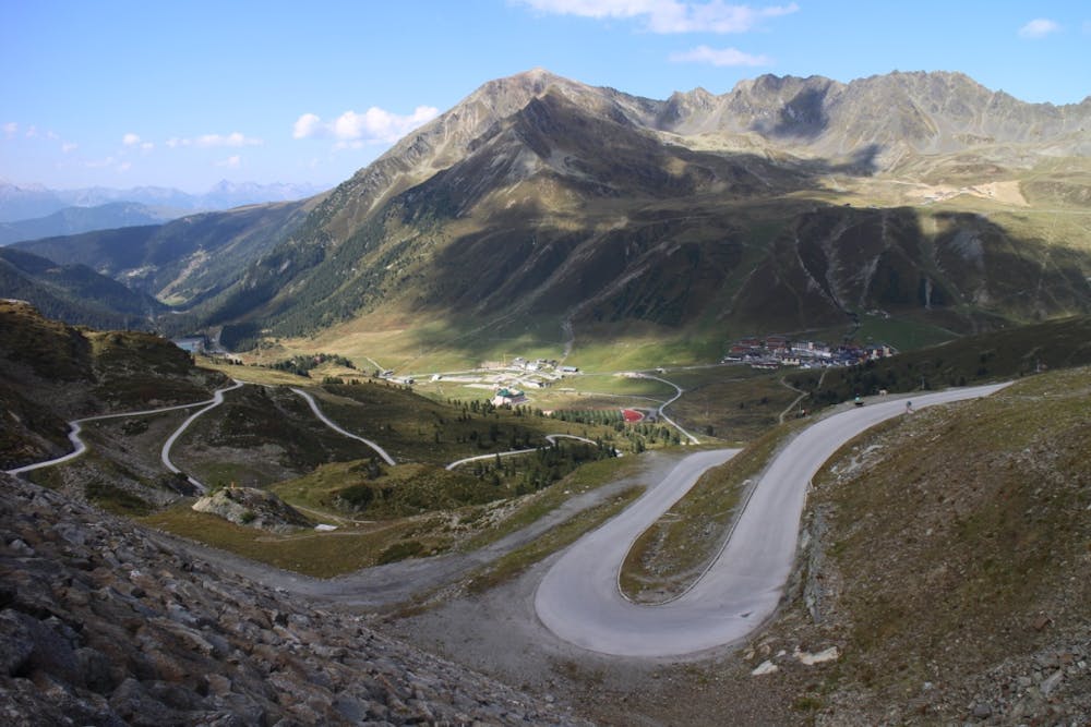
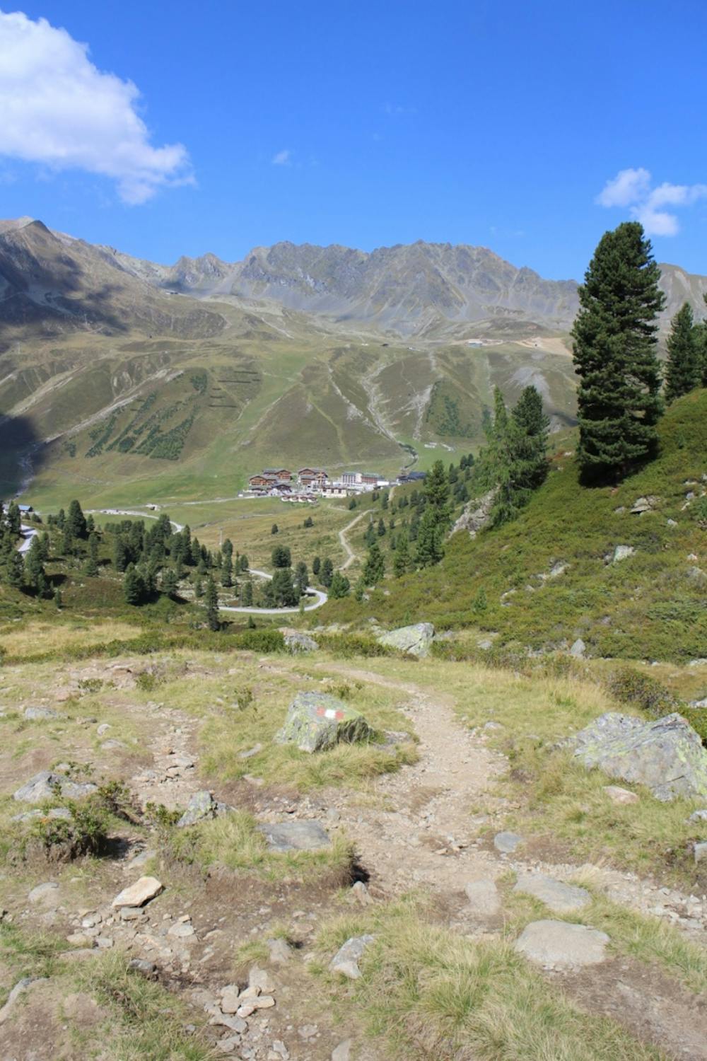
The hike starts at the Alpenrose Hotel, just below Kühtai village it-self. Follow the track running parallel to the chair lift, bending round to the right until you reach a left-hand turn on to the hiking trail, signposted ‘Dreiseenhütte’.
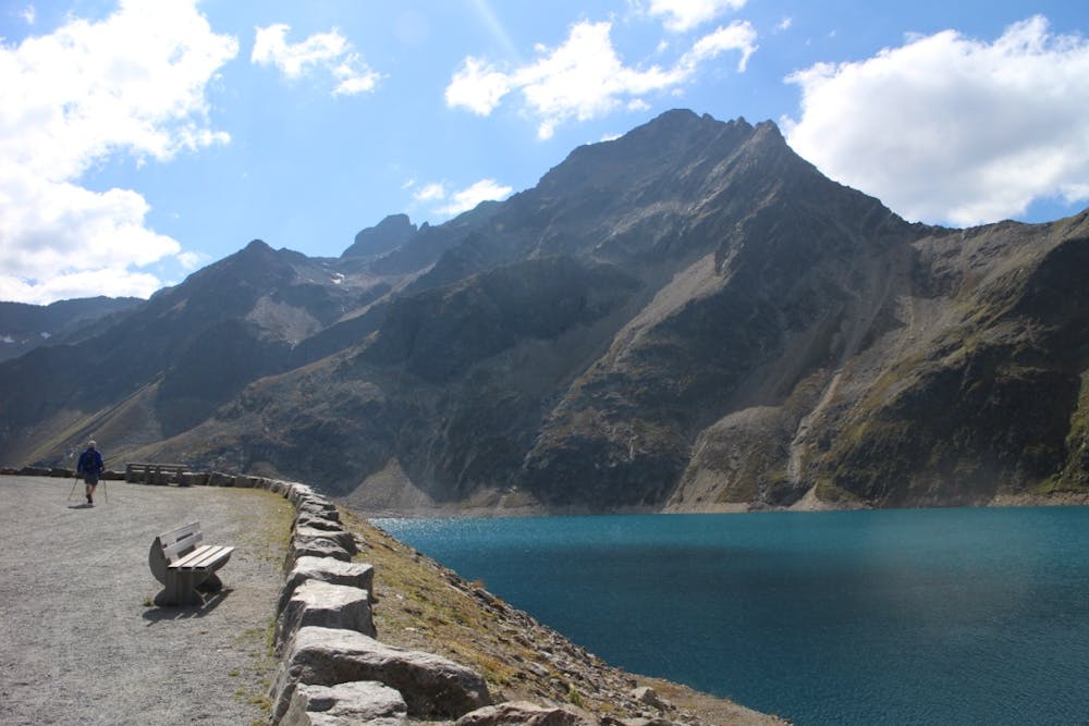
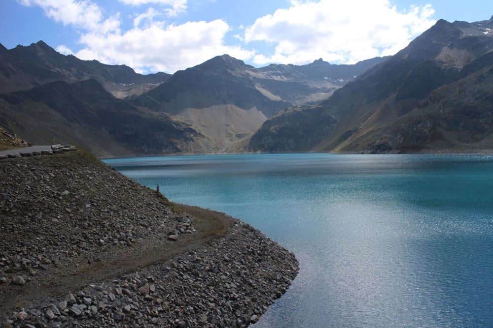
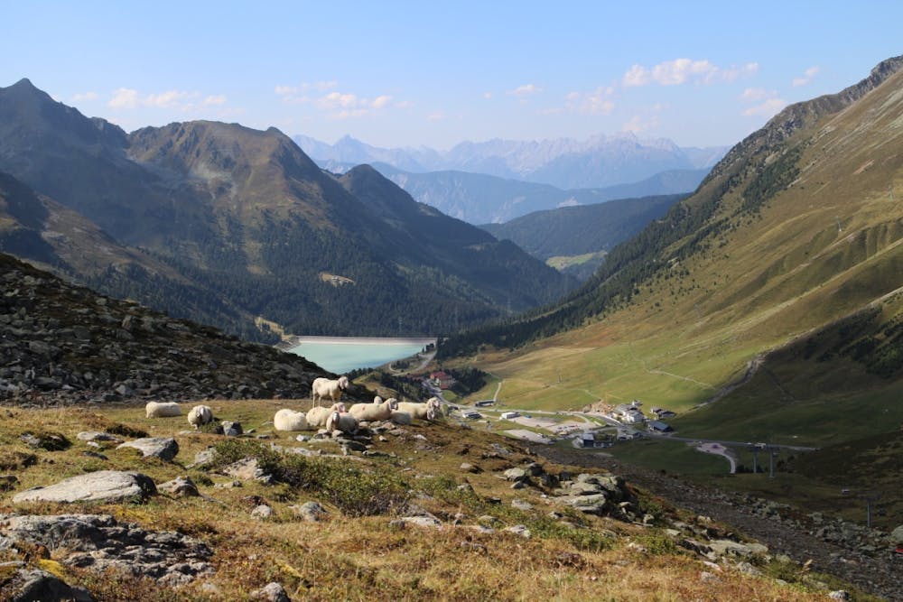
The initial climb is gentle, following red and white paint markers and crossing several streams. After 30 minutes at the junction continue straight ahead in the direction of ‘Neunerkogel’ and ‘Steintalsattel-Pockkogel’, to shortly reach the foot of the dam wall of the Finster-taler reservoir. Turn left briefly on to a road, then rejoin the hiking path just before the road tunnel. Continue following the red and white paint markers to reach the reservoir itself in around 15 minutes.
Continue on along the gravel track leading upwards and away from the reservoir. There is a very short climb which then turns into a traversing descent. After around 20 minutes the Dreiseenhütte will appear, which is an excellent alpine hut. Fantastic views and hearty food makes this an ideal lunch spot. From the hut, follow the 4x4 track downhill initially, but shortly after passing under the chairlift cables, rejoin the hiking trail on the righthand side.
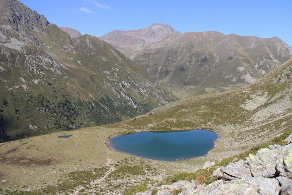
This is a lovely, quiet section of the route, where you are likely to see very few, if any other hikers. The gentle path crosses the hillside to pass a beautiful alpine lake, and after around 1/2 hour a split in the path offers two options. Take the lefthand fork heading downhill back towards Kühtai. En route back to the village you will pass the final alpine lake, a beautiful, peaceful place, ideal for an-other break. From here the path winds gently back down through Kühtai village from where you can continue on to the Alpenrose ho-tel.
Moderate
Hiking along trails with some uneven terrain and small hills. Small rocks and roots may be present.

The path is on completely flat land and potential injury is limited to falling over.

Away from help but easily accessed.
5.3 km away
A unfrequented hike made for everyone who wants to get started with easy ridge hiking.
Difficult Hiking
9.9 km away

A long day out in the Ötztaler alps through a remote valley and a swim with a view.
Difficult Hiking
9.9 km away

Easy hike combining two unfrequented peaks with a great view onto the higher mountains of the Ötz valley.
Moderate Hiking

3 routes · Hiking

25 routes · Hiking