17 m away
Poschachkogel

Easy hike combining two unfrequented peaks with a great view onto the higher mountains of the Ötz valley.
Moderate Hiking
- Distance
- 9 km
- Ascent
- 1 km
- Descent
- 1 km
A long day out in the Ötztaler alps through a remote valley and a swim with a view.
Hiking Difficult

Start of this route is at the parking lot next to the bus station Niederthai Informationsbüro at Sennhof, where you can get by car or with public transportation.
From the parking lot, start northeastwards onto the gravel road alongside the Horlachbach stream which will lead you into the valley in pleasant terrain.
After you’ve passed the Larstigalm hut the trail slightly increases in steepness and crosses the stream until you reach the Klein-Horlachalm hut.
Turn left (north) and walk alongside the Finstertalbach stream in direction of Gruejoch/Peistakogel onto a short and steep path to the Finstertalm hut.
Now follow the signs to the Peistakogel and walk past the hut into the narrow valley on the left (south-west).
The green plateau with its small streams and diverse fauna really contributes to the beauty up here. Enjoy the remoteness for a moment and then continue hiking towards the ridge until you leave the route up the Hohe Wasserfalle and turn left (south) onto another smaller plateau with a saisonal lake.
Aiming for the ridge, the trail now increases in steepness and leads the way up over big debris fields. As you reached the ridge, turn right (west) for the last meters up to the Peistakogel. This grassy summit offers the opportunity for a well deserved nap with a stunning view down into the valley.
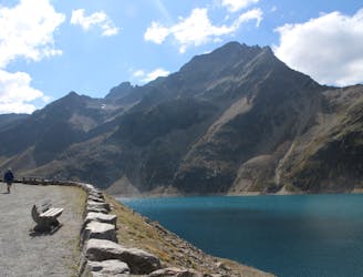
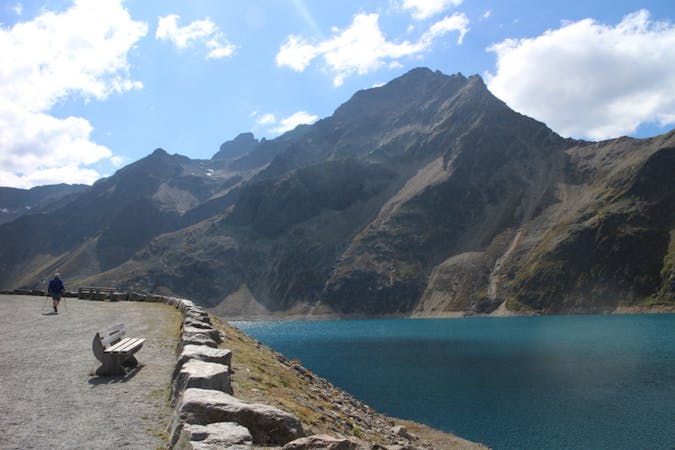
Continue walking onto the ridge down to the Gruejoch col. Turn left (south) until you reach the Gruesee lake, which is a nice opportunity to extend the break and cool down with a stunning view at the higher mountains of the Ötzvalley.
From here on the trail continues south in direction of the Poschachkogel. As the trail branches off to the left (east) start the very steep descent down into into the valley. After you zigzagged your way down, turn right (south) onto the Bergmähder trail to reach the parking lot and Niederthai again.
Difficult
Hiking trails where obstacles such as rocks or roots are prevalent. Some obstacles can require care to step over or around. At times, the trail can be worn and eroded. The grade of the trail is generally quite steep, and can often lead to strenuous hiking.

The trail contains some obstacles such as outcroppings and rock which could cause injury.

Little chance of being seen or helped in case of an accident.
17 m away
Easy hike combining two unfrequented peaks with a great view onto the higher mountains of the Ötz valley.
Moderate Hiking
9.9 km away
A picturesque, mid-length hike in Austria’s highest ski resort, taking in 3 alpine lakes, including the impressive Finstertaler reservoir.
Moderate Hiking
3 routes · Hiking

25 routes · Hiking