17 m away
Peistakogel

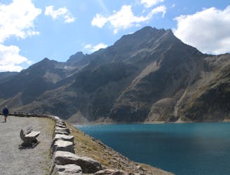
A long day out in the Ötztaler alps through a remote valley and a swim with a view.
Difficult Hiking
- Distance
- 14 km
- Ascent
- 1.2 km
- Descent
- 1.2 km
Easy hike combining two unfrequented peaks with a great view onto the higher mountains of the Ötz valley.
Hiking Moderate

Start of this route is at the parking lot next to the bus station Niederthai Informationsbüro at Sennhof.
For the first meters follow the street (north-west) until the last house of the Sennhof. Then turn right (north) onto a gravel road that leads to the Bergmäder trail.
Follow this road for a short time until a narrow trail shows up on the left (north). This easy but steep trail guides you up through a forest and quickly gains altitude. As this trail leaves the tree line behind, you’ll reach the first peak. The Narrenkogel offers a nice view onto the first part of the route and the ridge to the Poschachkogel. Now follow the easy ridge north-east, which guides you directly to the peak of the Poschachkogel. For the last meters up to the summit, the trail gets a bit steeper again. As the Poschachkogel sits high above the valley, it offers a great view onto the Köfels mountain creep, the landform down in the valley between Umhausen and Winklen. You might also spot the Wildspitze, Tyrol highest summit, while resting here for a bit.
The trail now descents via the east ridge, until you turn left (north) at the first crossover. Follow this trail and, if you still have some energy left, you may walk some extra meters up to the Gruesee lake.
Otherwise turn right (south-east) for the very steep trail down into the valley. After you zigzagged you way down to the bottom, turn right (west) and follow the Bergmähder trail until you reach the parking lot again.
Moderate
Hiking along trails with some uneven terrain and small hills. Small rocks and roots may be present.

The trail contains some obstacles such as outcroppings and rock which could cause injury.
Away from help but easily accessed.
17 m away
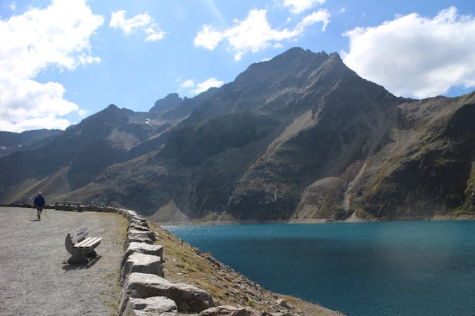
A long day out in the Ötztaler alps through a remote valley and a swim with a view.
Difficult Hiking
9.9 km away
A picturesque, mid-length hike in Austria’s highest ski resort, taking in 3 alpine lakes, including the impressive Finstertaler reservoir.
Moderate Hiking
3 routes · Hiking

25 routes · Hiking