266 m away
The Dohlen Nords

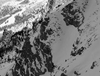
3 cracking couloirs which lead straight to a pub!
Difficult Ski Touring
- Distance
- 1.3 km
- Ascent
- 100 m
- Descent
- 273 m
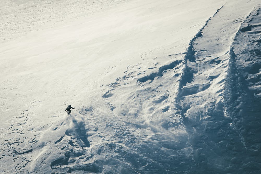
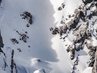
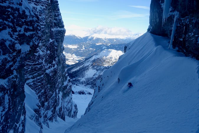
A narrow and exciting gully.
Ski Touring Difficult

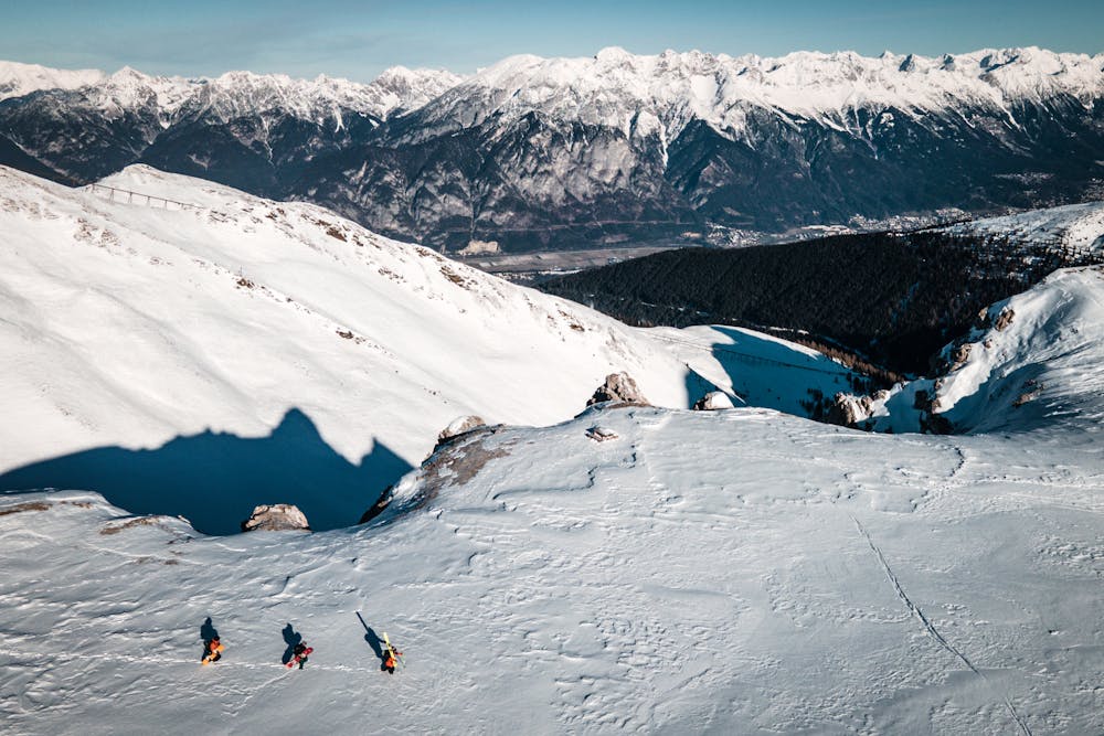
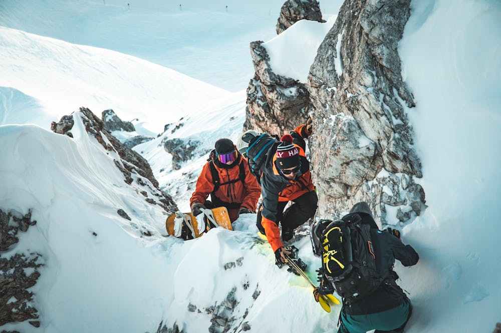
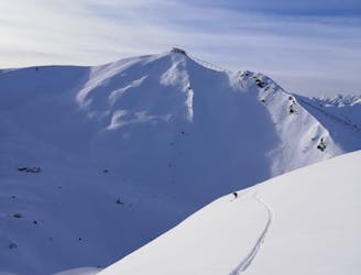
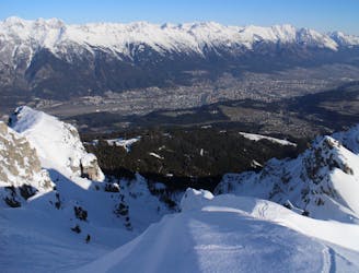
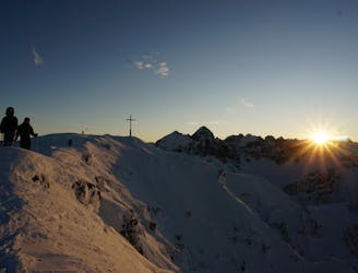
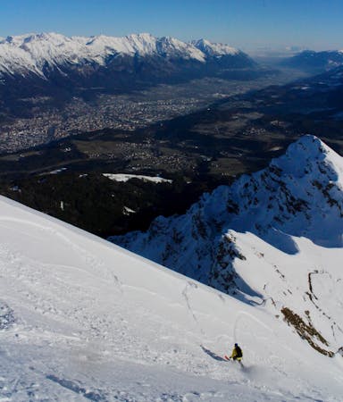
From the Hoadlhaus restaurant (2340 metres), ski south down the Olympia Abfahrt Damen piste for 1 minute to reach the HoadlSattel col (2264 metres), where the piste bends sharply to the left. At the Hoadlsattel, take your skis off, put them on your rucksack (there's a short and easy rocky scramble on the bootpack so carrying skis on your shoulder isn't advised - you'll need your hands free) and start hiking southwards along the snowy ridge that is straight ahead. Hike for 10 minutes on the low angled ridge crest and then, when you reach a steeper, rockier section, drift right and climb up through a 10 metre rock band via a short little gully. This is easy enough but can feel a bit exposed in icy conditions and you'll be glad of having strapped your skis to your rucksack so that you have your hands free. If the rock step looks too icy and difficult, it's also possible to traverse around it to the right (west) and then climb back up onto the ridge crest on the far side of it. Whether you go through or around the rock band, both options lead to a 10 metre wide col. Rinne 2 drops in from here. For this line, carry on hiking south up a 20 metre slope to reach a large, flat plateau with stunning views of the Kalkogel peaks. Once on the plateau put your skis on and make a descending traverse leftwards for 300 horizontal metres until you are at the foot of this line. The angle of the traverse is dictated by the presence of some rocky shoulders on your left which prevent you from holding maximum height - you will have to sacrifice some height in order to remain under these shoulders. Once at the end of the traverse and the foot of this line, put your skins on and start heading up. It is not always obvious from below but you need to climb (and ski down) on the right of the line as you up (skier's left) because the other side of the line has a small rocky cliff. Depending on conditions (the snow cover at the top of the line is often thin) it might be necessary to bootpack the last 50 - 100 metres. If snow cover is really bad, skip out the final section of the line and ski from wherever looks good. Wherever you ski from, expect an exciting and atmospheric ski line, with rock walls on either side and some lovely steep-ish (35 - 40 degree turns). Once out of the line proper and back at where you put skins on, enjoy the beautiful 30 degree slope which leads down to the valley floor and the Kemater Alm (1673 metres). The Alm serves a selection of hearty Tirolian food and a good selection of beverages. From the hut, ski down the jeep track for 9 kilometres to reach the village of Grinzens, from where you can catch a bus to Axams, then back up to Axamer Lizum. Hiking up to the hut dragging a sledge and then sledging down is popular with the locals so control your speed on the jeep track and be prepared to stop at all times. Bear in mind that the buses from Axams to Axamer Lizum stop at 4.30pm (ish) so if you're planning on doing this run at the end of the day, the best way to do it is drive to Axams at the start of the day then catch the bus from there to Axamer Lizum. When you've skied this route, get the bus from Grinzens back to your car in Axams.
Difficult
Serious gradient of 30-38 degrees where a real risk of slipping exists.

As well as the slope itself, there are some obstacles (such as rock outcrops) which could aggravate injury.

Little chance of being seen or helped in case of an accident.
266 m away
3 cracking couloirs which lead straight to a pub!
Difficult Ski Touring
449 m away

A wide and beautiful couloir.
Difficult Ski Touring
508 m away
An awe inspiring journey around the Kalkogel range, home to some of Tirol's most dramatic peaks.
Difficult Ski Touring
593 m away

An amazing peak that manages to feel wild despite its proximity to the ski area.
Moderate Ski Touring
1 km away
A very "out there" feeling line which is undeniably serious and takes you through some extraordinary mountain terrain.
Severe Ski Touring
1.1 km away
An exposed traverse leads to a lovely hanging face.
Difficult Ski Touring
1.7 km away

A great little lift assisted ski tour which begins at the top of the Olympiabahn lift and finishes at the bottom of it.
Moderate Ski Touring
2.4 km away
The most famous couloir in Kalkkögel!
Difficult Ski Touring
3.1 km away
An exciting ski line which is visible from virtually all of Innsbruck city centre.
Severe Ski Touring
3.1 km away
One of the most classic views over Innsbruck and a great ski descent
Moderate Ski Touring
5 routes · Ski Touring

50 routes · Freeride Skiing · Ski Touring
6 routes · Ski Touring

25 routes · Ski Touring