508 m away
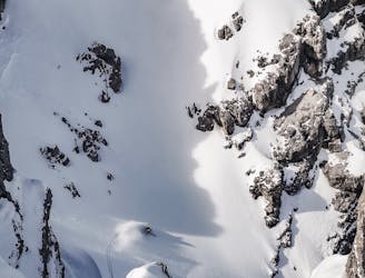
Hochtennspitze Nord-West 1
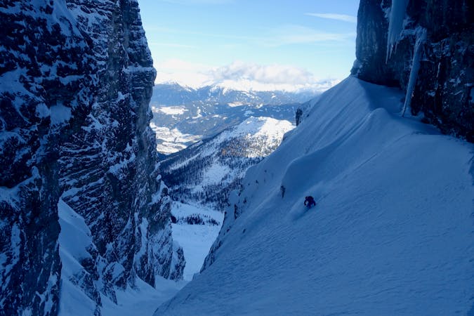
A narrow and exciting gully.
Difficult Ski Touring
- Distance
- 2.1 km
- Ascent
- 1 m
- Descent
- 699 m
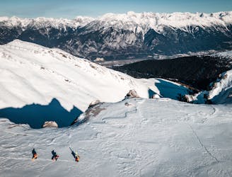
An awe inspiring journey around the Kalkogel range, home to some of Tirol's most dramatic peaks.
Ski Touring Difficult

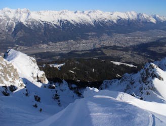
A long and incredibly varied journey through exceptional scenery, this is one of the best tours in the Tirol. Bear in mind that 600 vertical metres of the height gain specified here are gained using a chairlift in Schlick 2000 so this route is easier than the headline numbers might suggest.
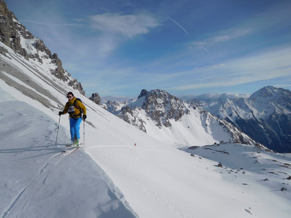
Start at the top of the Olympiabahn lift in Axamer Lizum and ski down the Damen Abfahrt piste for a couple of minutes to the Hoadlsattel Col, where the piste bends to the left.
Instead of following the piste left, take your skis off, put them on your pack and hike up the ridge straight ahead of you for 15 minutes to gain the large plateau from where many of Axamer Lizum's best known freeride lines begin.
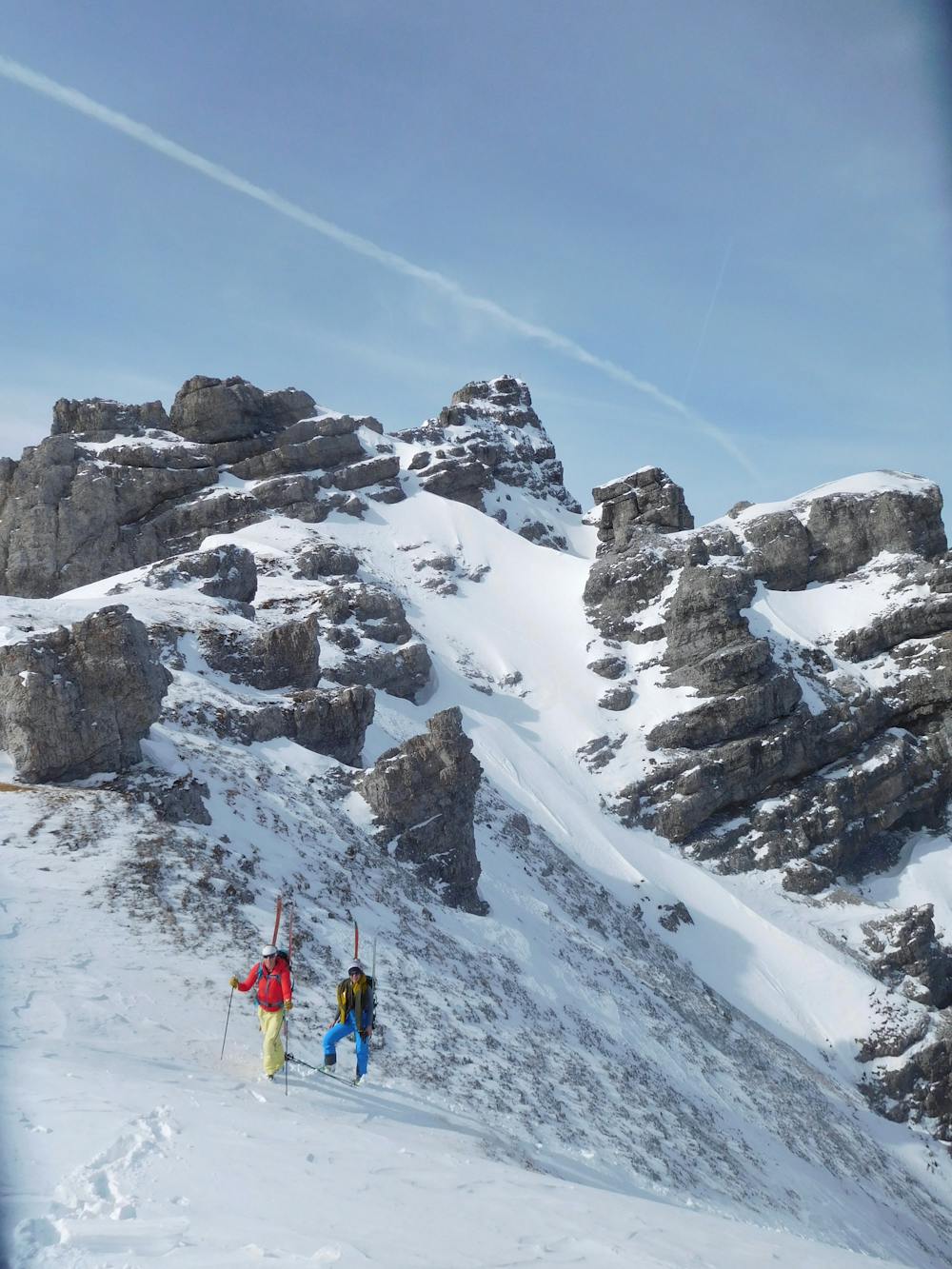
Ski east off this, keeping as far right as you can so as to sacrifice the bare minimum amount of height. Once underneath the series of cols separating the Malgrubenspitze and Hochtennspitze, put your skins on and being climbing towards the furthest right of the cols. Eventually you'll need to give up skinning and resort to bootpacking but save this for as long as possible because the bootpacking is pretty hard going!
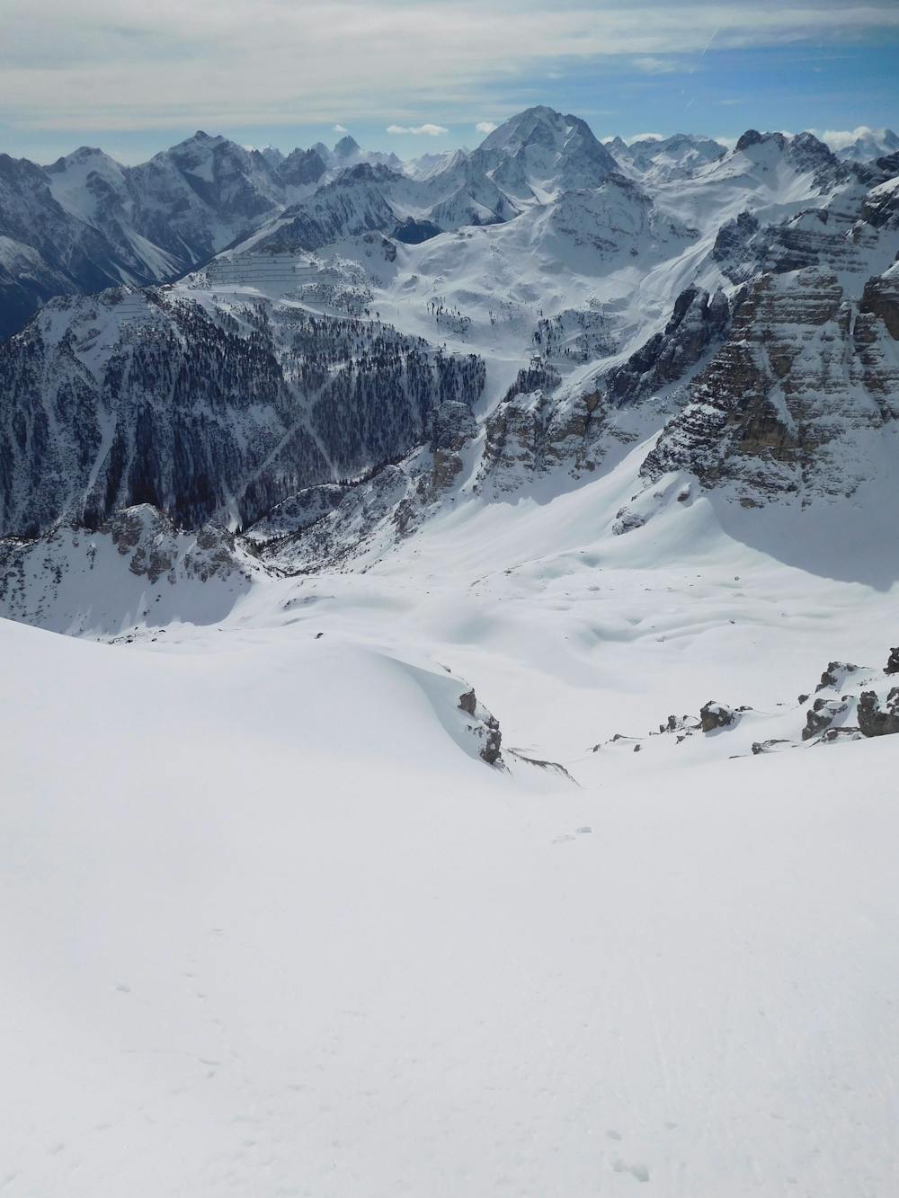
Once at the col, edge your way into the curving gully below. The gully faces plum south and gets a lot of sun so only drop into it if you are sure it is not going to avalanche - there's a lot of big terrain below it and getting caught in a slide would be disastrous.
Provided the gully is safe it's a brilliant ski and then opens up onto a wide slope below, which is at that perfect angle to egg you on to ski ever faster! Follow the slope as it takes you into a valley which quickly becomes full of trees. Ski through these down to the Schlicker Alm mountain hut, which is the perfect place to stop for lunch.
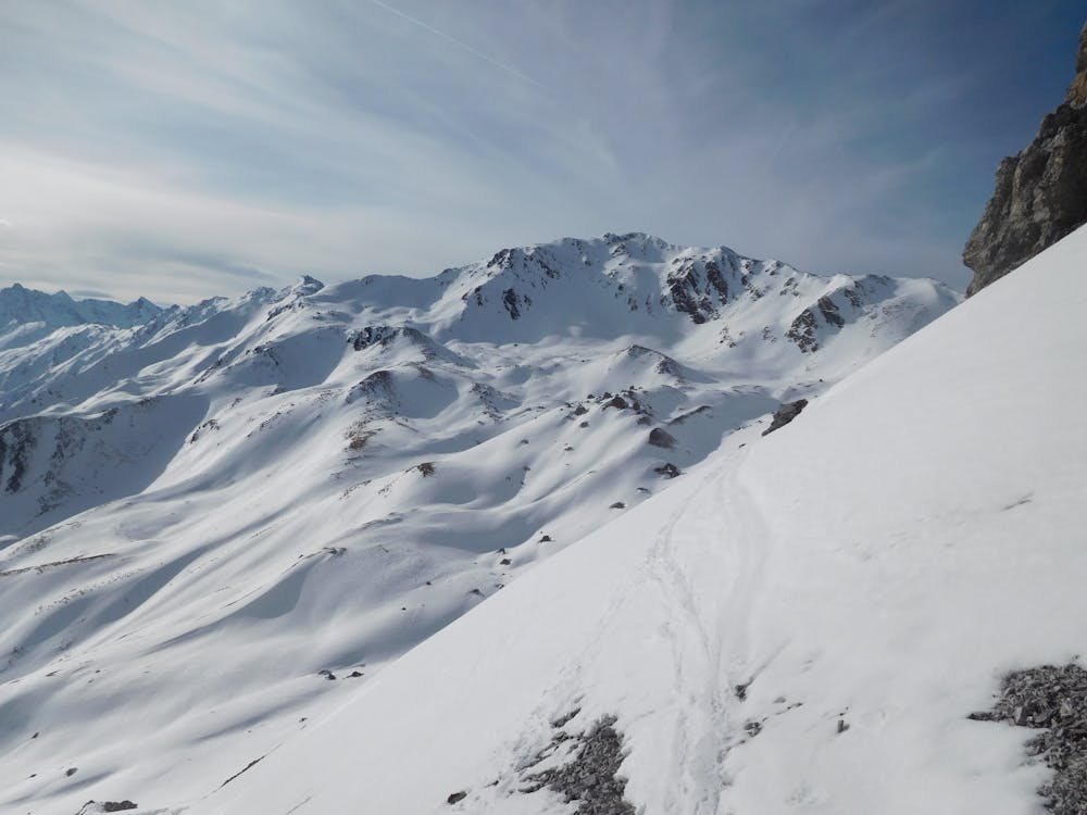
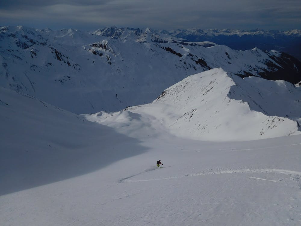
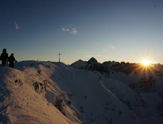
From the Schlicker Alm ride the Sennjochbahn chairlift and then at the top make a long traverse west to the foot of a large bowl. Put skins back on and climb the bowl, which steepens at the top, to the Schlicker Schartl col. The route suddenly feels very wild here, and that feeling is only exacerbated when you ski down into the basin west of the col. Once in the middle of this basin put skins on for the final time and skin north for 15 minutes to gain the Seejöchl col. The tour really is in the bag now so soak in your achievement and then ski north before turning north-west and skiing an utterly brilliant open face which eventually narrows and channels you into the foot of the Höhenwald valley.
Follow a good track out of this to the Kemater Alm hut and then on for a further 6 kilometres down a snow covered jeep to the village of Grinzens.
Difficult
Serious gradient of 30-38 degrees where a real risk of slipping exists.

As well as the slope itself, there are some obstacles (such as rock outcrops) which could aggravate injury.

Little chance of being seen or helped in case of an accident.
508 m away
A narrow and exciting gully.
Difficult Ski Touring
584 m away

An amazing peak that manages to feel wild despite its proximity to the ski area.
Moderate Ski Touring
764 m away

3 cracking couloirs which lead straight to a pub!
Difficult Ski Touring
845 m away

A wide and beautiful couloir.
Difficult Ski Touring
1.2 km away
A very "out there" feeling line which is undeniably serious and takes you through some extraordinary mountain terrain.
Severe Ski Touring
1.3 km away
An exposed traverse leads to a lovely hanging face.
Difficult Ski Touring
2 km away

A great little lift assisted ski tour which begins at the top of the Olympiabahn lift and finishes at the bottom of it.
Moderate Ski Touring
2.4 km away
The most famous couloir in Kalkkögel!
Difficult Ski Touring
3.2 km away
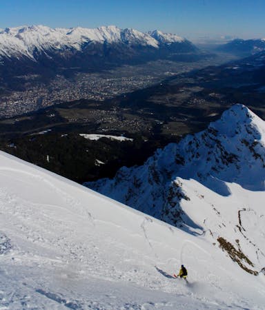
An exciting ski line which is visible from virtually all of Innsbruck city centre.
Severe Ski Touring
3.2 km away
One of the most classic views over Innsbruck and a great ski descent
Moderate Ski Touring
5 routes · Ski Touring

50 routes · Freeride Skiing · Ski Touring
6 routes · Ski Touring

25 routes · Ski Touring