266 m away
Hochtennspitze Nord-West 1
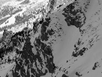
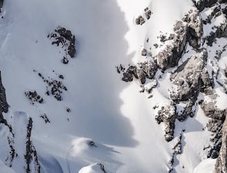
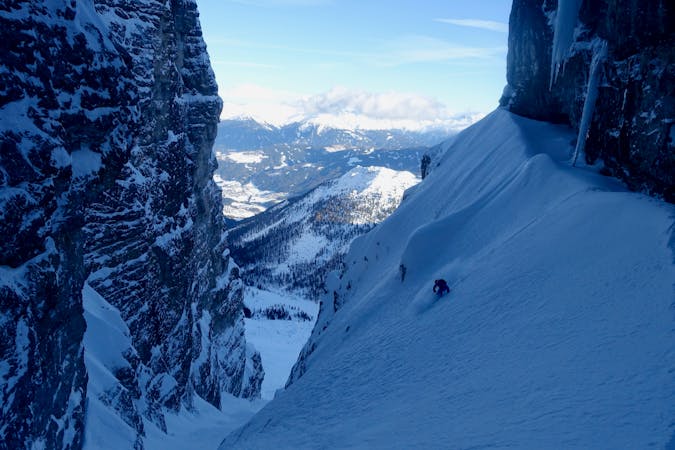
A narrow and exciting gully.
Difficult Ski Touring
- Distance
- 2.1 km
- Ascent
- 1 m
- Descent
- 699 m
3 cracking couloirs which lead straight to a pub!
Ski Touring Difficult

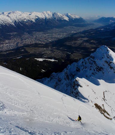
From the Hoadlhaus restaurant (2340 metres), ski south down the Olympia Abfahrt Damen piste for 1 minute to reach the HoadlSattel col (2264 metres), where the piste bends sharply to the left. At the Hoadlsattel, take your skis off, put them on your rucksack (there's a short and easy rocky scramble on the bootpack so carrying skis on your shoulder isn't advised - you'll need your hands free) and start hiking southwards along the snowy ridge that is straight ahead. Hike for 10 minutes on the low angled ridge crest and then, when you reach a steeper, rockier section, drift right and climb up through a 10 metre rock band via a short little gully. This is easy enough but can feel a bit exposed in icy conditions and you'll be glad of having strapped your skis to your rucksack so that you have your hands free. If the rock step looks too icy and difficult, it's also possible to traverse around it to the right (west) and then climb back up onto the ridge crest on the far side of it. Whether you go through or around the rock band, both options lead to a 10 metre wide col. Rinne 2 drops in from here. For these lines, carry on hiking south up a 20 metre slope to reach a large, flat plateau with stunning views of the Kalkogel peaks. Hike to the centre of the plateau then go due west to reach the top of a nice, open face. The face is about 100 metres wide and can be skied just about anywhere but is usually best if you drop in on the left and continually drift down and right all the way down. The slope is the perfect steepness for avalanches so be prepared to bail if it looks dangerous (it's only a 5 minute walk back to the Rinne 2 line). Having skied this face, stay as high and and right as possible until you are under the westernmost (looker's right) of these 3 lines. Put skins on and climb this line, which should take 30 - 45 minutes. The angle is around 30 degrees but it steepens slightly and narrows for the final 100 vertical metres and it's often necessary to bootpack this section. The ascent leads to a nicely exposed col. From here, either ski down the way you came up, or scramble easily along the ridge to the east to access one of the other 2 lines. The middle line is the widest and simplest but none are especially difficult and all are wonderfully atmospheric and between 30 and 35 degrees. They face plum north so hold good snow for days after the last storm. Once you've skied your chosen line, ski past the lake that feeds the Axamer Lizum snow cannons and down to the Dohlennest bar.
Difficult
Serious gradient of 30-38 degrees where a real risk of slipping exists.

Exposure is limited to that of the slope itself. Getting hurt is still likely if the slope is steep and/or the snow is hard.

Away from help but easily accessed.
266 m away
A narrow and exciting gully.
Difficult Ski Touring
458 m away

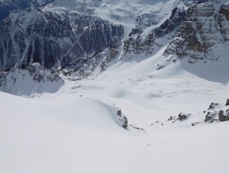
A wide and beautiful couloir.
Difficult Ski Touring
681 m away

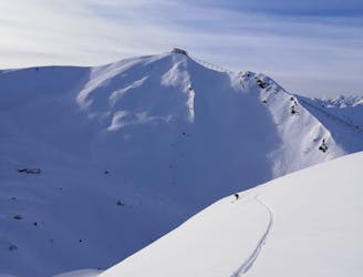
An amazing peak that manages to feel wild despite its proximity to the ski area.
Moderate Ski Touring
764 m away
An awe inspiring journey around the Kalkogel range, home to some of Tirol's most dramatic peaks.
Difficult Ski Touring
906 m away
A very "out there" feeling line which is undeniably serious and takes you through some extraordinary mountain terrain.
Severe Ski Touring
991 m away
An exposed traverse leads to a lovely hanging face.
Difficult Ski Touring
1.5 km away

A great little lift assisted ski tour which begins at the top of the Olympiabahn lift and finishes at the bottom of it.
Moderate Ski Touring
2.4 km away
The most famous couloir in Kalkkögel!
Difficult Ski Touring
3.1 km away
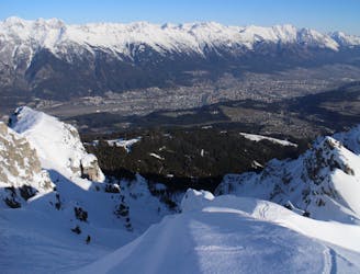
An exciting ski line which is visible from virtually all of Innsbruck city centre.
Severe Ski Touring
3.1 km away
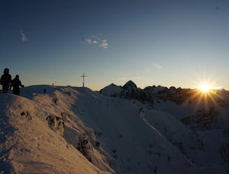
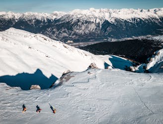
One of the most classic views over Innsbruck and a great ski descent
Moderate Ski Touring
5 routes · Ski Touring

50 routes · Freeride Skiing · Ski Touring
6 routes · Ski Touring

25 routes · Ski Touring