6.5 km away
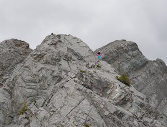
East End of Rundle (EEOR)
Quick and close to town, but challenges your fitness.
Difficult Hiking
- Distance
- 4.9 km
- Ascent
- 829 m
- Descent
- 829 m
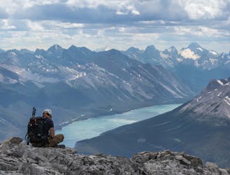
Steep and sweet views
Hiking Difficult

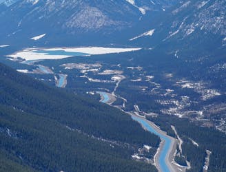
This is a popular hiking route which is generally considered to be difficult. It's not remote, it features medium exposure and is typically done between June and December. From a low point of 1.4 km to the maximum altitude of 2.1 km, the route covers 9.4 km, 808 vertical metres of ascent and 808 vertical metres of descent.
Very steep but non technical
Difficult
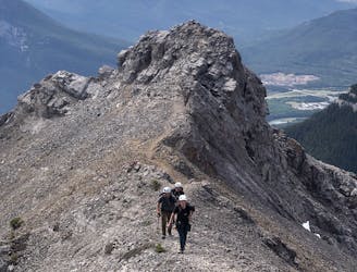
Hiking trails where obstacles such as rocks or roots are prevalent. Some obstacles can require care to step over or around. At times, the trail can be worn and eroded. The grade of the trail is generally quite steep, and can often lead to strenuous hiking.

The trail contains some obstacles such as outcroppings and rock which could cause injury.

Close to help in case of emergency.
6.5 km away
Quick and close to town, but challenges your fitness.
Difficult Hiking
6.7 km away
A steep scramble to a mythical summit in the Canadian Rockies
Extreme Hiking
7.8 km away
Scramble to the Summit of Lady Mac
Extreme Hiking
8.7 km away
A stenuous scrambling to breathtaking views
Difficult Hiking
8.7 km away
A very difficult and technical route.
Extreme Hiking
8.7 km away
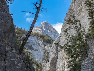
Grotto Canyon, hiking on a frozen river in Kananaskis Country
Easy Hiking