602 m away
Middle Needle Peak
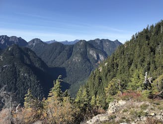
Follow a heavily forested ridge to one of Vancouver's lesser known peaks
Moderate Hiking
- Distance
- 20 km
- Ascent
- 1.5 km
- Descent
- 1.5 km
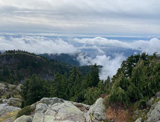
Gradual trail that leads from lynn headwaters to Coliseum mountain and back
Hiking Difficult

This is a popular hiking route which is generally considered to be difficult. It's remote, it features medium exposure and is typically done between June and October. From a low point of 190 m to the maximum altitude of 1.4 km, the route covers 22 km, 1313 vertical metres of ascent and 1313 vertical metres of descent.
This is a lightly trafficked trail, the starting seeing the most use as Norvan falls can be popular.
Difficult
Hiking trails where obstacles such as rocks or roots are prevalent. Some obstacles can require care to step over or around. At times, the trail can be worn and eroded. The grade of the trail is generally quite steep, and can often lead to strenuous hiking.

The trail contains some obstacles such as outcroppings and rock which could cause injury.
Away from help but easily accessed.
602 m away
Follow a heavily forested ridge to one of Vancouver's lesser known peaks
Moderate Hiking
5.8 km away
A scrambly hike to the summit of Mt. Seymour
Difficult Hiking
9.2 km away
Short distance, low elevation, great views
Easy Hiking

7 routes · Hiking · Trail Running

6 routes · Hiking

3 routes · Hiking