3.7 km away
Marble Canyon
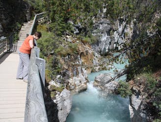
Walk along a remarkably narrow gorge flowing with water.
Easy Hiking
- Distance
- 1.5 km
- Ascent
- 39 m
- Descent
- 40 m
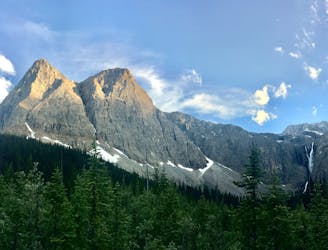
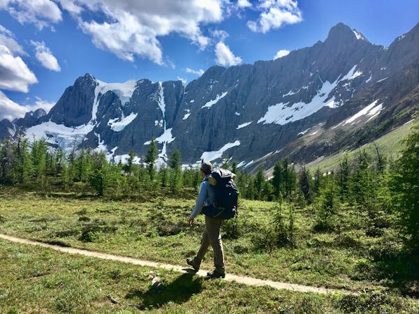
A relatively easy hike to get up close with a glacier
Hiking Moderate

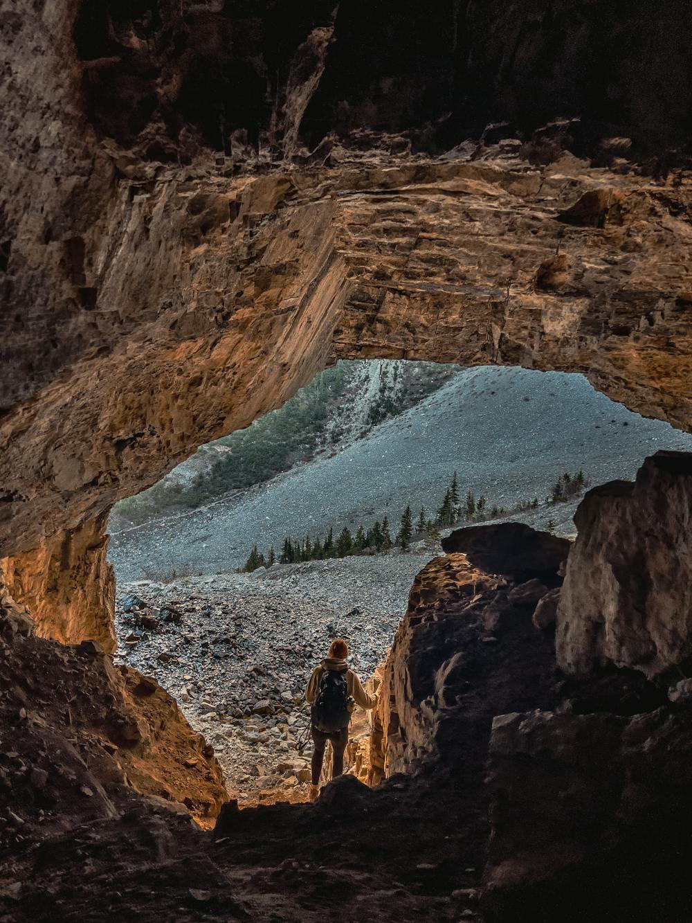
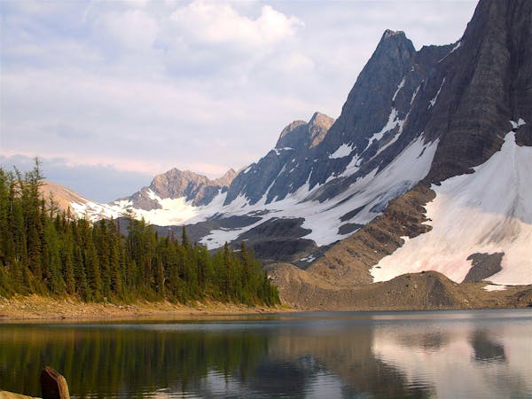
Located near Lake Louise, this 10.9km out-and-back trail takes you through new-growth forest with some solid vertical gain (600m) up to the base of the Stanley Glacier with an optional push to the summit via the “unofficial” trail. The trail starts off from the parking lot off the highway with a creek crossing, and takes you through Lower Falls which can be slightly muddy until you break into the alpine. Once you get to the base of the glacier, you may see some caves on your right which you can explore at your own risk. Keep an eye out for loose rock and be sure not to get in the way of any rock climbers projecting routes in / around these caves.
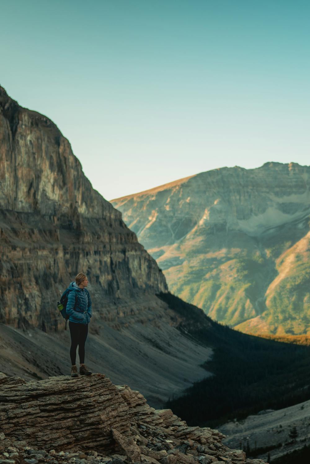
If pushing higher than the base of the glacier, follow the obvious loop counter-clockwise. Doing it this way is the easiest to both ascend and descend the final portion of the trail.
You can also check out the Lower Falls waterfall on your way down or up. Although not massive by Rockies Standards, they're still pretty cool because you can get pretty up close to them and are a majestic sight, especially on a nice day where the water sparkles in the sun.
DOGS: Dogs are permitted on this trail. Getting to the base of the glacier is easy for them, however scrambling and boulders are involved if pushing for the summit which means you will have to assist your dog in getting up the steeper sections. The descent down scree may be hard on their paws as the rock is fairly sharp, booties can help with this.
NOTE: Bears are common in this area. A Parks Canada pass is required if recreating in this area.
RECOMMENDED GEAR: Poles, Long Socks or Gaiters, Bear Spray
Moderate
Hiking along trails with some uneven terrain and small hills. Small rocks and roots may be present.

The trail contains some obstacles such as outcroppings and rock which could cause injury.
Away from help but easily accessed.
3.7 km away
Walk along a remarkably narrow gorge flowing with water.
Easy Hiking
6.1 km away
An easy overnight backpacking trip, or one end of the difficult Rockwall trek.
Moderate Hiking
9.4 km away
Hike to a backcountry campground near a huge, double-forked waterfall along The Rockwall trek.
Moderate Hiking
6 routes · Hiking
5 routes · Hiking
4 routes · Hiking