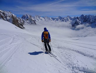
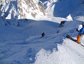
Vallee Blanche
Perhaps the most famous ski descent in the world? Technically moderate but very serious skiing in an absolutely breathtaking setting.
Moderate Freeride Skiing
- Distance
- 14 km
- Ascent
- 11 m
- Descent
- 2 km
A traversing section that links the Envers du Plan to the Grand Envers and Requin Hut Couloirs exit.
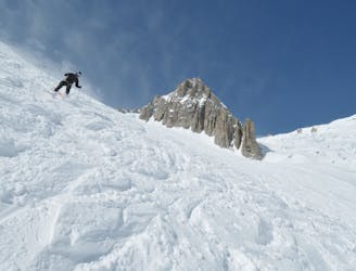
Freeride Skiing Difficult

This is a popular freeride skiing route which is generally considered to be difficult. It's extremely remote, it features medium exposure (e2) and is typically done between January and May. From a low point of 1.5 km to the maximum altitude of 3.7 km, the route covers 12 km, 199 vertical metres of ascent and 2216 vertical metres of descent. It's graded 3.2 and Labande grade 3. You'll need rope and crampons to complete it safely.
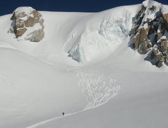
From above the Petit Rognon traverse down and left across open slopes to meet the Grand Envers line. A fun wide open line but with ever present crevasse hazard to watch out for.
Difficult
Serious gradient of 30-38 degrees where a real risk of slipping exists.

As well as the slope itself, there are some obstacles (such as rock outcrops) which could aggravate injury.

In the high mountains or remote conditions, all individuals must be completely autonomous in every situation.
Perhaps the most famous ski descent in the world? Technically moderate but very serious skiing in an absolutely breathtaking setting.
Moderate Freeride Skiing
Highly crevassed but good skiing, this is a step up from the Vallée Blanche both technically and in the seriousness of the glacier.
Difficult Freeride Skiing
Great skiing links sections of steeper technical terrain with wide open stretches. Perfect for taking in the view.
Severe Freeride Skiing

A steep south facing slope is a great finishing option to the Petit Envers or Envers du Plan.
Difficult Freeride Skiing

A highly crevassed variation of the Vallée Blanche which is not often possible due to the state of the glacier.
Difficult Freeride Skiing

A variant finish to the Petit Envers to rejoin the Vallee Blanche above the seracs
Difficult Freeride Skiing
3 m away
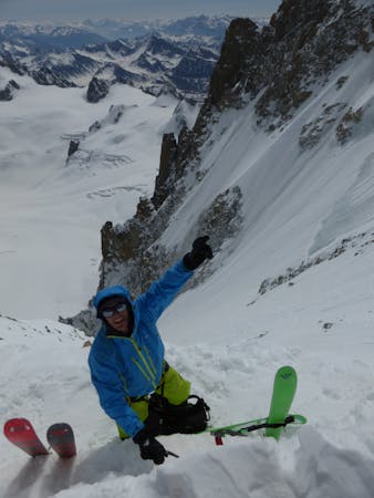
This is a classic extreme skiing line, not only in Chamonix, but across the Alps. 900 meters of sustained and serious terrain between 40-50 degrees; enough to get anyones heart pumping.
Extreme Freeride Skiing
71 m away
A mega classic that links steep sustained pitches before finishing in the requin hut exits couloirs. Incredidble but very serious skiing.
Severe Freeride Skiing
77 m away
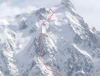
This highly sought after mountaineering line is perhaps the most aesthetic ski line on the North Face of the Midi.
Extreme Freeride Skiing
104 m away

Maybe the most coveted line in the Chamonix valley representing the pinnacle in steep and committing skiing, all with a perfect view of the town of Chamonix.
Extreme Freeride Skiing
5 routes · Freeride Skiing · Ski Touring

10 routes · Freeride Skiing

10 routes · Freeride Skiing · Ski Touring

50 routes · Freeride Skiing · Ski Touring

15 routes · Freeride Skiing · Ski Touring
10 routes · Freeride Skiing