216 m away
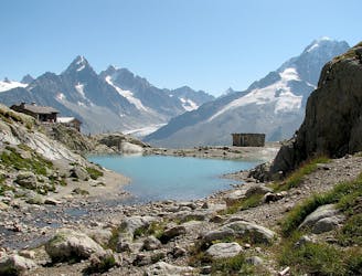
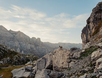
Lac de la Vogealle
Visit an alpine lake before discovering one of France's 17 "Grand Sites de France," the glacial cirque of Fer à Cheval.
Difficult Hiking
- Distance
- 17 km
- Ascent
- 1.2 km
- Descent
- 1.2 km
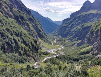
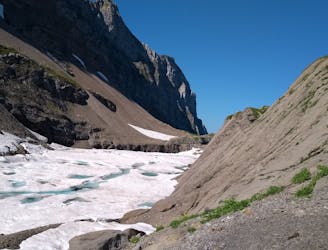
Route up to Refuge de La Vogealle from Cirque du Fer-à-Cheval via Chalet du Boret
Hiking Difficult

This is a popular hiking route which is generally considered to be difficult. It's remote, it features high exposure and is typically done between June and September. From a low point of 938 m to the maximum altitude of 1.9 km, the route covers 6.7 km, 1018 vertical metres of ascent and 54 vertical metres of descent.
Route up to Refuge de La Vogealle from Cirque du Fer-à-Cheval via Chalet du Boret
Difficult
Hiking trails where obstacles such as rocks or roots are prevalent. Some obstacles can require care to step over or around. At times, the trail can be worn and eroded. The grade of the trail is generally quite steep, and can often lead to strenuous hiking.

Some trail sections have exposed ledges or steep ascents/descents where falling could cause serious injury.

Away from help but easily accessed.
216 m away
Visit an alpine lake before discovering one of France's 17 "Grand Sites de France," the glacial cirque of Fer à Cheval.
Difficult Hiking
7.9 km away
A hike beginning with easy trails and ending by scrambling to a summit.
Extreme Hiking
8.6 km away
A 3-day hike along part of the Via Alpina in the stunning Haute-Savoie region of France.
Moderate Hiking
9.1 km away
Challenging alpine hike that summits Mont Buet along with other nearby peaks.
Extreme Hiking
9.5 km away
A steep and exposed hike. Beatifull panaromas
Severe Hiking

5 routes · Hiking

3 routes · Hiking