0 m away
Cucumelle West Face 1

A steep, dynamic face, full of chutes and rocky ridges, that changes dramatically depending on snow levels.
Severe Freeride Skiing
- Distance
- 652 m
- Ascent
- 0 m
- Descent
- 335 m

A steep, dynamic face, full of chutes and rocky ridges, that changes dramatically depending on snow levels.
Freeride Skiing Severe

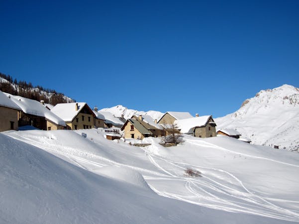
The west facing slopes of the Cucumelle and Rocher du Grand Pré can be straightforward, if steep, in big snow years or rocky technical nightmares best avoided in low snow years. The access is fairly straightforward although it does require a careful scoping from below (Eychauda piste or chairlift) or opposite (Catex freeride run). There are numerous options depending on how filled in the slope is and all are shorter than nearly every other option from the top of the Cucumelle. So you need to weigh up how long you expect the pay off to be following the 20-30 minute hike up the Cucumelle. One of these runs, skied fast, can last less than a minute. That said they are exciting, technical and rarely ridden. The access is to the left from the ridge that continues due north from the summit of the Cucumelle. The further you get, the sketchier, rockier and more exposed the lines become. Be careful not to get caught out by one in particular that looks straightforward from above but has a large icefall in the middle half way down. Again, a careful scoping out from below will pay off.
Severe
Steep skiing at 38-45 degrees. This requires very good technique and the risk of falling has serious consequences.
0 m away

A steep, dynamic face, full of chutes and rocky ridges, that changes dramatically depending on snow levels.
Severe Freeride Skiing
2 m away

A steep, dynamic face, full of chutes and rocky ridges, that changes dramatically depending on snow levels.
Severe Freeride Skiing
3 m away

A narrow, steep couloir that isn’t always easy to access. A dream in the right conditions.
Severe Freeride Skiing
14 m away

Epic, wild terrain with tricky route finding. If in doubt, go with a local instructor or guide.
Difficult Freeride Skiing
614 m away

A beautiful north facing open bowl followed by perfectly spaced larch trees.
Difficult Freeride Skiing
629 m away

A largely open, undulating descent in a huge southeast facing bowl – ideal for entry level off piste.
Moderate Freeride Skiing
714 m away

The other La Balme couloir – less well known, less skied and shorter than its illustrious neighbour but epic all the same.
Difficult Freeride Skiing
939 m away

An epic off piste run, mostly in well spaced larch trees. The route finding is very tricky though so going with an instructor or guide who knows the area well is preferable.
Moderate Freeride Skiing
978 m away

Classic steep couloir, enclosed on both sides by huge cliffs.
Severe Freeride Skiing
1.2 km away

Steep and often deep at the start then cruisy open glades lower down. The route finding is very tricky though so going with an instructor or guide who knows the area well is preferable.
Difficult Freeride Skiing

10 routes · Freeride Skiing

15 routes · Freeride Skiing · Ski Touring