222 m away
Roches Corneille Couloir

Classic steep couloir, enclosed on both sides by huge cliffs.
Severe Freeride Skiing
- Distance
- 1.1 km
- Ascent
- 8 m
- Descent
- 411 m
Steep and often deep at the start then cruisy open glades lower down. The route finding is very tricky though so going with an instructor or guide who knows the area well is preferable.
Freeride Skiing Difficult

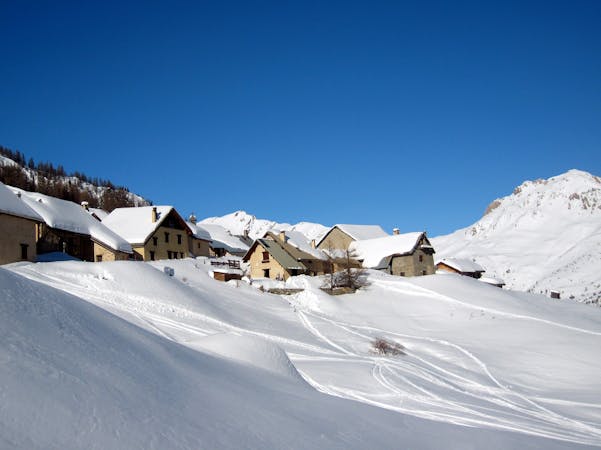
The Tête du Grand Pré is the collective name for a series of off piste descents on the mountain that is commonly (but wrongly) known as the Tête du Grand Pré. Confusingly the actual Tête du Grand Pré is the name of the peak to the west of the peak we’re interested in here and the one below which you traverse to get to the start of these descents. In the same way as the Les Guibertes area, the Tête du Grand Pré has a huge number of potential lines, each with their own particular character. However, it is also a tricky place to navigate and it is easy to get lost in its vastness, which can mean unwelcome encounters with cliffs and avalanche couloirs. The complicated route finding, together with the long hike and traversing, keep the hordes away from these lines and it is not uncommon to find untracked snow a week or more after the last snowfall. All in all the area offers wild and wonderful tree skiing that can rival anywhere in the world on its day. The access is initially the same as for the Guibertes couloirs, namely a 20-30 minute hike up the Cucumelle followed by a ski and traverse high on the south face of the Tête du Grand Pré. A short side step or climb leads to another traverse, this time on the southeast face of the same mountain. At the small col that leads to Les Guibertes, you need to hike up the ridge straight ahead for another 10 minutes. Be careful at and around the summit as a large and sometimes overhanging cornice often forms over the cliffs on the north side. There is a lot of traversing involved to get to the Tete du Grand Pré. If you are on a snowboard it is much easier if you are goofy or happy riding switch. Heel edge traversing can be a slow, frustrating process. From the summit, follow the wide often windblown ridge down to the northeast. To find the small col that marks the entrance to the northern line you need to stay just left (north) of the rocky peak across the dip straight ahead of you. Stay high and traverse around to the col. The initial part of the descent from here is a wide open face that just asks to be skied hard and fast in powder conditions. Take care though as avalanches have been known to go all the way to the valley floor from this point. You’ll need to pick your way through a number of steep chutes before you reach the open and much gentler glades on the lower slopes. Gradually head right here, traversing each time you reach an obvious end to an open area. This will bring you to the same point as for the end of the gulley line where you have the same two exit options. At about 1600 metres altitude it gets significantly steeper. You can continue straight on down but there needs to be very good snow cover as the ground is rocky. Continue down to what is a footpath in the summer. Turn right on the footpath and follow it down to the last bend of the Route de Fréjus green piste. An alternative exit, if the snow cover is patchy, is to turn right just before the end of the glade and traverse above a cliff and across an obvious avalanche corridor (often it has old avalanche debris in it) before heading down to join the walking path and then the Route de Fréjus piste.
Difficult
Serious gradient of 30-38 degrees where a real risk of slipping exists.

As well as the slope itself, there are some obstacles (such as rock outcrops) which could aggravate injury.

Little chance of being seen or helped in case of an accident.
222 m away
Classic steep couloir, enclosed on both sides by huge cliffs.
Severe Freeride Skiing
249 m away

An epic off piste run, mostly in well spaced larch trees. The route finding is very tricky though so going with an instructor or guide who knows the area well is preferable.
Moderate Freeride Skiing
1.2 km away

Epic, wild terrain with tricky route finding. If in doubt, go with a local instructor or guide.
Difficult Freeride Skiing
1.2 km away

A narrow, steep couloir that isn’t always easy to access. A dream in the right conditions.
Severe Freeride Skiing
1.2 km away

A steep, dynamic face, full of chutes and rocky ridges, that changes dramatically depending on snow levels.
Severe Freeride Skiing
1.2 km away

A steep, dynamic face, full of chutes and rocky ridges, that changes dramatically depending on snow levels.
Severe Freeride Skiing
1.2 km away

A steep, dynamic face, full of chutes and rocky ridges, that changes dramatically depending on snow levels.
Severe Freeride Skiing
1.5 km away

A beautiful north facing open bowl followed by perfectly spaced larch trees.
Difficult Freeride Skiing
1.5 km away

A largely open, undulating descent in a huge southeast facing bowl – ideal for entry level off piste.
Moderate Freeride Skiing
1.6 km away

The other La Balme couloir – less well known, less skied and shorter than its illustrious neighbour but epic all the same.
Difficult Freeride Skiing
10 routes · Freeride Skiing

15 routes · Freeride Skiing · Ski Touring